Yosemite Ten Lakes Loop 2021

In the late September of 2021, my plans to backpack in the Trinity Alps in Northern California became impossible due to extensive wildfires, and ultimate forest closures, in that area. As a last-minute plan, I did some quick research and was able to get a wilderness permit for the Ten Lakes Trailhead. I designed a route that would allow a low-mileage, multi-day route, with plenty of time to explore the lakes and take photographs. This was a very pleasant, easy trip, with opportunities to visit several pristine lakes, minimal crowds, and a tiny bit of practice for off-trail route-finding. To make the most of the trip, I hiked to Elizabeth Lake upon my arrival, and stayed overnight in the Tuolumne Meadows backpackers camp, before starting my Ten Lakes trip the next morning. This was my last backpacking trip of 2021 and I thoroughly enjoyed it.

Location (Red icon) of Ten Lakes Trailhead in Tuolumne Meadows, Yosemite National Park, California
Elizabeth Lake Day Hike


GPS route (left) and elevation plot (top) of the day- hike to Elizabeth Lake
Elizabeth Lake offered a gentle and pleasant day hike after several hours of driving to the park. The September weather was perfect, and I had time to relax at the lake before returning to set up my campsite at the Tuolumne Meadows backpackers camp.
Elizabeth Lake Slideshow


Ten Lakes Backpacking Trip


GPS track Left, red) and elevation plot (top) of track to Ten Lakes and Grant Lakes.
Total distance: 24.6 mi (39.6 km)
Total ascent: 4481 feet
I wasn't able to find the names of all the lakes on a map, so I labeled them as shown to describe the hikes and photos. I didn't hike to the easternmost lake.

Day 1: Ten Lakes Trailhead to Ten Lakes campsite 7.8 mi / 12.6 km
It was quite cold overnight at Tuolumne Meadows! After packing up my campsite and loading up on water, I drove to the Ten Lakes Trailhead on Tioga Road, and set off up the trail. The beginning of the trail had suffered a recent fire, and it was sad to see the damage and scars to the pines. After a short while, I passed the intersection of the trail from White Wolf or Lukens Lake; this trail heading south was closed off due to the recent fire in the White Wolf / Lukens area. I hopped over several very dry creeks, more signs of the effects of the dangerous drought in the state.

Approaching 9000 feet in elevation, there were a few opportunities for views of the surrounding range. The sky was slightly hazy, likely from far away wildfires to the north. The weather was perfect - shirtsleeve hiking! Eventually I reached Half Moon Meadow, and stopped for a short break, knowing I was facing a steeper climb ahead.


After Half Moon Meadow, the trail became more steep, with numerous switchbacks and steps beautifully created from stone, and well maintained. On the way up, I passed a trail crew hard at work in the warm sun, chiseling and sculpting the trail. I thanked them for their hard work, and continued sweating upward. Ascending on such a beautifully maintained trail made the climb much easier.
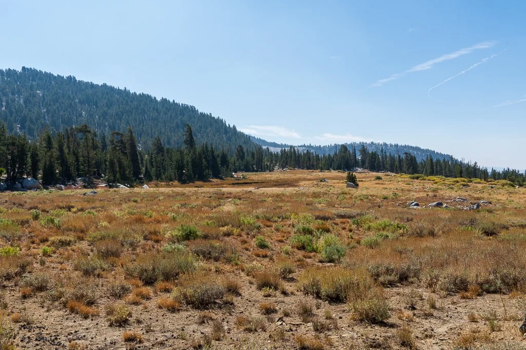
Eventually, I neared the top where the trail began to level out more, and at Ten Lakes Pass the terrain became much more dry, with less trees.


After passing the trail to Grant Lakes, I continued northeast in an easy hike over to the precipice of the Ten Lakes Basin. There I stopped for a few photos of the lakes from the top, but I didn't see the side trail that offered better views. I began what seemed would be a long, steep descent, but turned out to be not as long or tiring as I expected. My pack felt a bit heavy, and I was looking forward to relaxing in some shade near one of the lakes.
Views of Ten Lakes from the Top of the Cliff


Because I didn't have an early start that morning, I reached the first lake north of the trail (Lake A, above) around 4:30 in the afternoon, and quickly found a nice private campsite on a ledge on the east side of the lake. After setting up camp and getting re-hydrated after the climb, I took a relaxing walk to the northeast side of the lake to capture some photos before the alpenglow disappeared. A beautiful lake, and I was happy to see it wasn't very busy - there were perhaps 6 other people, in twos, in the entire lake area. The trail crew was encamped at a large site at the first lake to the south of the trail (Lake C), as I was to discover the next day. In the evening, they came in for some well-deserved dives into the cold lake, which they seemed to thoroughly enjoy. Too cold for me, by then I had cooled off! It was a full moon that evening, so I made an attempt to capture some photos of the trees in the moonlight - I still need practice at these night-time photos...


Day 2: Day Hike to neighboring Lakes 6 mi / 9.6 km
I always enjoy having a base camp where I can explore without a fully loaded backpack! I had a leisurely morning and packed some lunch for a day of exploring the lakes. I started out by heading north, walking around the little lakelets at the northwest corner of Lake A.


I hiked around the north end of Lake A, thinking I might find a well-used trail to the northernmost lake. If it was there, it wasn't obvious, so I inspected the topo map and backtracked to take the most straightforward route uphill (mostly on granite), and then downhill to Lake B. This was a small lake, but blissfully empty of campers.
Lake B


I chose not to hike all the way around this lake, as I wanted to allow plenty of time to visit the lakes to the south. I returned to the north end of Lake A and completed my circumnavigation along the east side. Crossing the main trail, I hiked south to Lake C. At the north end I could see the sole encampment at this lake - a large spread with big tarps and many tents, dedicated to the trail workers.

Lake C
There was a clear trail on the east side of Lake C, but beyond that required some extra-sharp trail-sniffing, or route-finding. I missed the sharp ~280 degree turn back northeast on my way to the lakes, so ended up doing some rock-hopping and bouldering up the slope instead. I crossed the creek, then crossed it again when I realized the best route was on the north side of the deep ravine of the creek, before I reached the top of the hill and had views of Lake D. There was still a fair bit of haze in the air from the wildfire to the north.
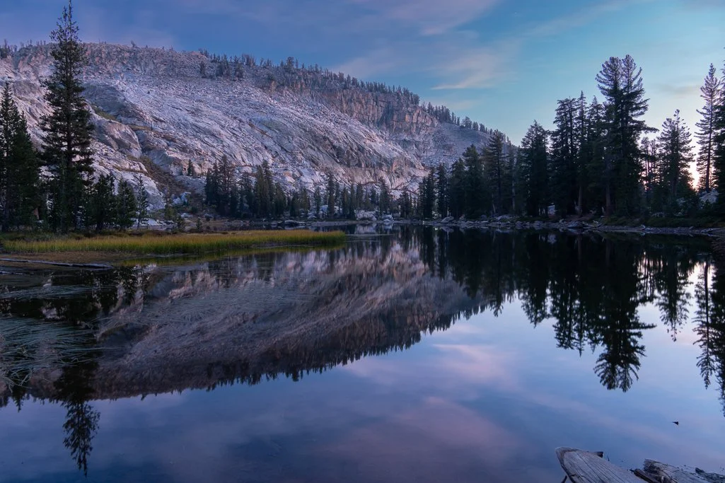
Lake D


There were potential campsites, but none clearly obvious, on the hill on the east side of Lake D, sufficiently far from the water (see below).
From Lake D, there was a gentle hike up an incline and over the boulders to Lake E, another serene little lake nestled among the trees.
Lake E

The shore on the north side of the lake was rocky and not suitable for camping.

Heading back, I studied the topo to find a slightly easier route west, then returned along the northern edge of Lake D. Keeping a sharp eye for the trail, I spied the more obvious route this time, which stayed on the north side of the creek, and circled back to meet the main trail alongside Lake C in a sharp switchback. That explains why I missed it the first time; I captured this waypoint below to aid other hikers. I got back to my campsite with plenty of time to catch the alpenglow over the lake and granite.

Back home at Lake A
Day 3: Ten Lakes Basin to Grant Lakes 5.4 mi / 8.7 km
I packed up and hit the trail out of Ten Lakes basin before 9 a.m., wanting to do most of the steep climb in the cooler hours. Surprisingly, the climb back up to the cliff-top wasn't as taxing as I had feared, and this time I stopped to look for the overlook trail that veers north off the main trail. Dropping my pack, I hiked to the high point (see waypoint below) to take some photos, before climbing up the remaining switchbacks.

After cooling off and taking a photo break at the viewpoint, I continued south over Ten Lakes pass again, and then began the gentle descent on the Grant Lakes trail. This was a pretty trail, with brown meadows and a gentle grade. Along the way I came across a couple of these interesting sooty grouses, which I had never before seen in the wilderness -- they are considered uncommon.

As I entered the Grant Lakes camping area, I saw several campsites above the Lower Grant Lake. Two fellows were departing to head west to Upper Grant Lake and points beyond, and I saw a large encampment of many brightly colored tents near the western lake outlet. I found a beautiful little campsite on the north side of the lake, and set up my site enough to keep my tent anchored and lighten my load a bit. I then set off to see if I could find a trail to Upper Grant Lake. As before, an obvious trail petered out, but I made my way up a fairly steep slope, zig-zagging to find the best route. Eventually, I came out at a clearing with a view of the lake, and made my way down. By the lake I found the campers with the bright tents -- a dozen or so school-age children with adult guides. The kids were incredibly polite and clearly having a great time relaxing in the wilderness. I gave them some space and sat down to enjoy my lunch by the lake.
Upper Grant Lake


After lunch and relaxation, I made my way across the small lake outlet and up the slope to the northwest side of the lake. There were a couple of mostly granite campsites on the ledges on the northwest side, but no one camped there. Plenty of opportunity for solitude for someone camping at this lake! Looking at the topo, I could see that it would be easier to descend to Lower Grant Lake on the north side of the creek, compared to the south. Indeed, this was a simple matter of making my way across boulders and ledges, before descending to the creek gully and making my way back west to my campsite. This was the route the guides and kids took some time later, and they commented that they enjoyed finding their way without a designated trail.
Back at camp, I finished setting up my tent, and hiked around to the south side of Lower Grant Lake. There were a couple nice campsites on the south side of the lake as well. While the east side of the lake was passable, it was a bit boggy and didn't seem to offer better views, so I returned the way I came.


As I was preparing my dinner, I saw that the sunset was imminent, and I wanted to capture some photos of the amazing pink clouds from the north side of the lake as the light changed. I ended up racing back and forth, setting up my tripod and hopping back to prevent my food from getting stolen by the ravens. Eventually I was able to bring my chow over to feast while I took some longer-exposure photos. Another great day in the wilderness!
Day 4 : Grant Lakes to Trailhead 6.7 mi / 10.8 km I had a long drive back home from Yosemite, so I hit the trail around 8:30, after a leisurely breakfast. The school kids were gone before I was, so they must have been up early and well-organized. Kudos to the guides for taking that many kids out into the wilderness. I had a relaxing hike up the gentle grade back to Ten Lakes Pass, and then back southwest along Ten Lakes Trail, enjoying Mother Nature along the way.
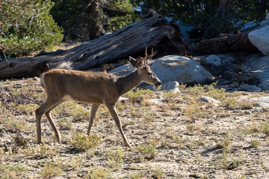
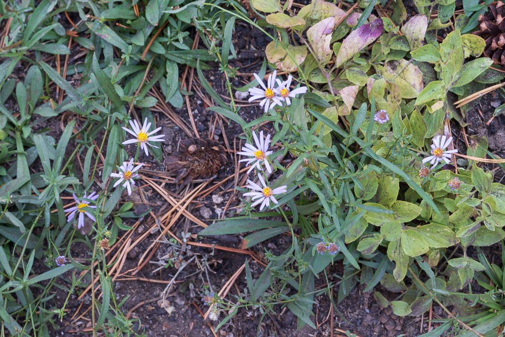
LEFT: Another deer unperturbed by my presence. ABOVE: Some late-season aster wildflowers
This turned out to be an easy, low-mileage, delightful backpacking trip, and I was glad I took the extra time for day hikes and to visit the Grant Lakes. In late September, the weather was perfect and there were few other campers. I can strongly recommend this short trip, as it offers sufficient opportunity for mid-week solitude even in Yosemite.
Photos by Cris Lewis; Sony Alpha 6600, 18-135 mm Sony lens.
LOGISTICS
Reservations for a wilderness permit are required, and a quota system is in place. I was once again pleasantly surprised at my ability to gain a permit with only a few weeks in advance, in spite of record applications during Covid times. Perhaps when the Europeans return post-Covid it will be more crowded. Starting in 2022, Yosemite reservations will be made using a lottery system at Recreation.gov.
Bear canisters are required in all of Yosemite. I saw no signs of bears on any of my hikes.
There is no potable water source at the Ten Lakes Trailhead, but there are bathrooms and ample parking on both sides of the street.
The Tuolumne Meadows backpackers camp will be closed for at least the 2022 season. However, there are other National Forest Service campsites east of the park on Tioga Road for those seeking an extra travel day.
A convenient rock for diving into Lake A after your sweaty climb is at the southern end of the lake.
USEFUL COORDINATES
The side trail to the viewpoint at the top of Ten Lakes Pass is N 37° 54.3535' , W 119° 32.0379'
The waypoint for the switchback turn in the established trail to an easy route to Lakes D and E is N 37° 53.719' W 119° 31.586'.
A nice shady campsite at the north end of Lower Grant Lake can be found at N 37° 53.122' W 119° 32.350'.
A more private campsite at the northwestern end of Lake A is near N 37° 54.367' W 119° 31.618'
Other potential campsites I noted at either end of Lake D are: N 37° 53.812' W 119° 31.717'. and N 37° 53.728' W 119° 31.579'.
As suggested by the topo map, there are potential campsites at the north end of Lake E.