MISTY FJORDS AND REVILLAGIGEDO CIRCUMNAVIGATION 2019

In the summer of 2019 I took my first solo kayaking expedition. I purposely chose a location that was more populated and with calmer waters than previous coastal trips, but long enough to provide a challenge, and wild enough to provide enjoyable scenery. I paddled from Ketchikan Alaska and circumnavigated Revillagigedo Island clockwise, spending some time in Misty Fjords National Monument before returning to Ketchikan along the Behm Canal. The ~3-week trip was well planned and went fairly smoothly, in spite of near constant rain, a few bears, and the fact that I missed the coast!
Route Overview: ~ 224 miles / 360 km, 17 days

I had chosen my arrival date on the Alaska Marine Highway Ferry to coincide with a favorable current in the Tongass Narrows near Ketchikan. The ferry ride north was only 1.5 days, but offered some nice views, including a peaceful sunset.
Day 1 -- Ketchikan Harbor to Settler's Cove, 17 mi / 27 km: After arriving on the ferry, I packed up and walked my kayak on a wheel cart over to the Harbor, about a half mile away. This turned out to be much more arduous than I expected, as I didn't have the cart positioned properly to balance the loaded kayak. The harbor staff were kind enough to let me store my folding wheels in an out-of-the-way location during my trip, which saved some space in my kayak. After a few final phone calls, I launched and headed west along Tongass Narrows. Fortunately, I had a nice east tailwind, and my progress along the Revilla coast was rapid.

I saw the Totem Bight Park as I paddled by, hoping to visit it at the end of my trip (see below). I made great time to Point Higgins, and then turned and headed north through Clover Passage to the campground at Settler's Cove. The current and the wind paid off: I paddled over 17 miles in less than 5 hours. The campground was quite crowded on a Sunday, but I was able to find a site reasonably close to the water. To my dismay, I learned the campground had no fresh water, due either to theft or a mechanical problem. I had been counting on getting water for the first part of the trip here, and so hadn't filled up in Ketchikan. Apparently Ketchikan had experienced little rain during the summer, and locals who relied on rain for their water were struggling. I was able to filter some water from nearby Lunch Creek, and obtained a few extra liters from the campground host. I learned my lesson: *Never pass up an opportunity to fill your water reservoir with treated water!
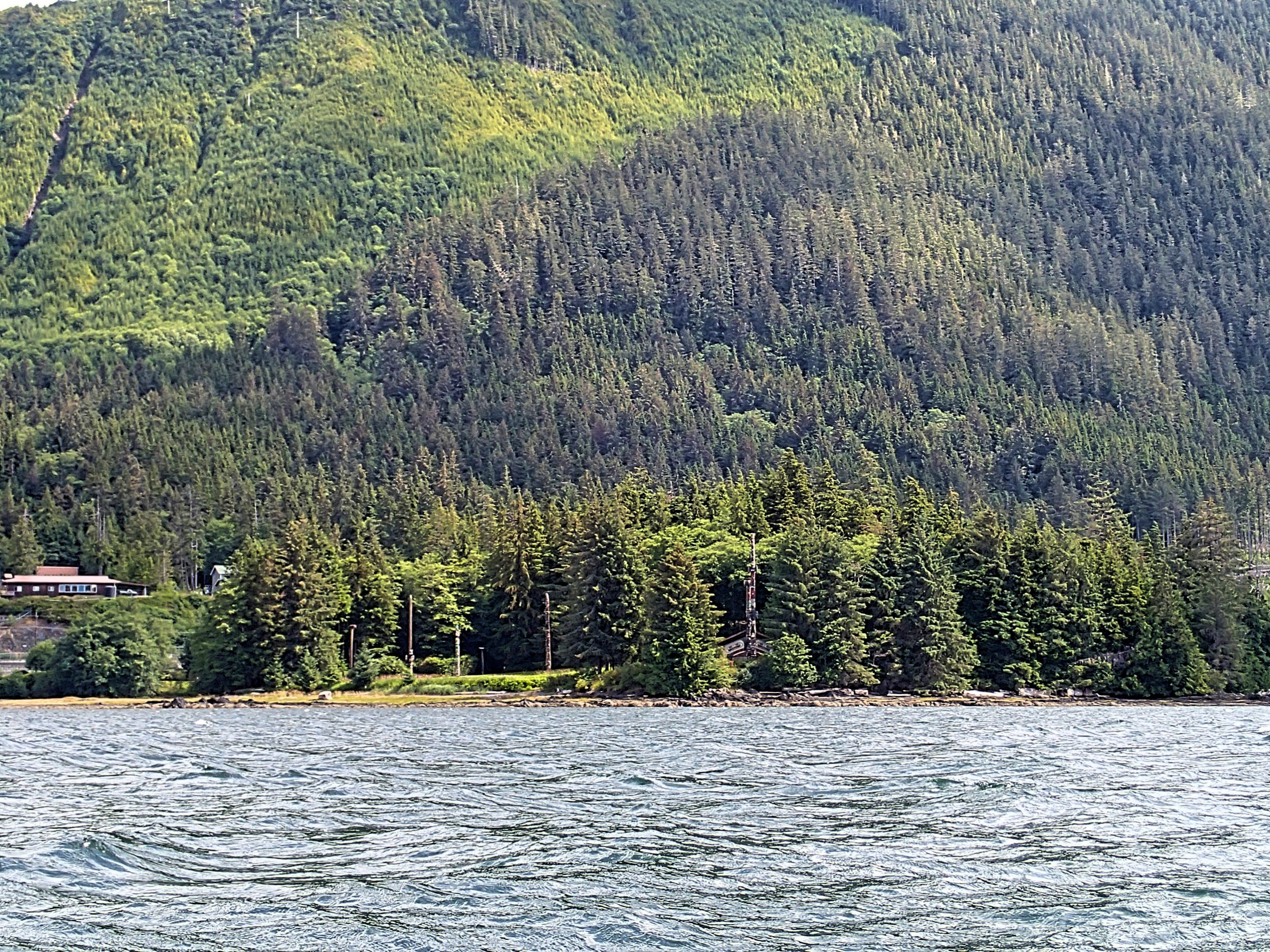
Totem Bight Park from the kayak

Some nice waterfront houses near Survey Cove
Lunch creek in a dry season
Day 2-4 -- Settler's Cove to Bushy Point 19.5 mi / 31 km; Bushy Point to Yes Bay 17 mi / 27 km: From Settler's Cove I paddled north, east of Moser Island and then took a break on a small island to stretch my legs and sign a geocache, aptly placed on "Cache Island".

Geocache on Cache Island
I bypassed Traitor's Cove, a popular boating destination, but found a nice lunch beach. Although I had intended to camp at Bushy Point, the campsites there were very poor, what was to become a common theme of the entire trip. I backtracked a couple kilometers to a beach I had passed previously that looked acceptable. The wind was at my back most of the day, and there was brief light rain in the morning with a forecast for more rain overnight and the next day. But I was lucky, the rain held off until just after I finished packing up on the beach the next morning!
There were quite a few fishing boats on the water in the grey mist, and a light SE wind at my back. I had lunch at a small pocket beach near Nose Point, before crossing to Gedney Island, then turning west to cross to Bluff Point at the mouth of Yes Bay. Yes Bay was bordered by cliffs and dense forest, with almost no places to stop for a break. The large fishing lodge at Yes Bay could be seen from a distance, and I headed there in a steady, light rain to look for the water source from the nearby Lake McDonald. I could paddle up to the waterfall coming from the lake above, but I was unable to find a place to land to gather water safely. I also saw no obvious route to Lake McDonald, even though this was supposedly the location of the trailhead. I paddled across the bay to camp in a forested area, with a long, rocky tidal marsh at its foot. *This was to be another common theme of the trip: long tidal flats with barnacles and boulders that made for long treks during lower tides, and challenging, arduous hauls to secure the kayak above high tide line.

A perfect lunch beach

Paddling north toward Gedney Island

Most of the shore was rocky, with few landing spots.

I was feeling a bit poorly the next day, so I decided to use the day to rest and find a good place to collect water. I paddled back over to the Yes Bay Lodge in the rain, and met very friendly people on the dock, especially Ryan. He very generously filled up all my water bags and bottle with his chlorinated water supply, and offered helpful tips on the local area -- Thank you Ryan! Apparently the trailhead for Lake McDonald could be accessed through the lodge, but I decided to forego this hike. Before returning to camp I paddled around Yes Bay a bit, then rested in my tent during the steady rain.

View from the beautiful lodge at Yes Bay
I took no chances and crab-walked my kayak way up the barnacle-filled shore and on top of a boulder, tied to trees. Just to the right of the boulder was where a large grizzly bear appeared the next morning.

Day 5 -- Yes Bay to Lake Shelokum Trailhead, 11.5 mi / 18.5 km: I had planned to launch a little later in the morning to have a more favorable tide height for hauling gear across the marshy eelgrass. The rain continued overnight and it was still drizzling as I started hauling gear out from the campsite. As I was examining the shoreline to check the tides, one of the large brown boulders moved, and a large grizzly bear emerged from the left. He was meandering along the shoreline, turning over occasional rocks and sniffing. As he was about 50-75 yards away from me, I could clearly see he was a large grizzly, and I froze in place while breathing a "Holy sh**!!" to myself. I slowly moved back behind a boulder and froze. Fortunately, I had my bear spray with me as I had learned previously to *go NO WHERE without it. (UNfortunately, no camera with me, as it was in my PFD.) The bear moved at a relaxed pace along the shoreline, which angled so that soon I was directly in his view. He turned and stared right at me with his big dish face, and I recalled that it is apparently a myth that bears can't see well. I was downwind, about 30 yards away, and I remained frozen in place. He stared at me for just a couple seconds and then resumed his grazing and foraging, slowly moving around the marshy area and eventually off into the forest, just to the south of my campsite. I was so relieved that he didn't head into the woods where my gear and bear cans were stored; they were also downwind of him. And, I was glad I was departing from this campsite! Of the dozen or so grizzlies I have seen in the wild, he was the largest.
The rain stopped as I finished loading and paddled out of Yes Bay, before turning north toward Burroughs Bay. The tides weren't favorable for exploring Blind Pass, so I bypassed that interesting feature. The channel was still quite wide between Yes Bay and Bailey Bay, although with very few places to stop. The boat traffic was minimal now, as I approached the exclusion zone for salmon fishing. I was relieved to be leaving the fishing boats behind.

En route northeast to Bailey Bay
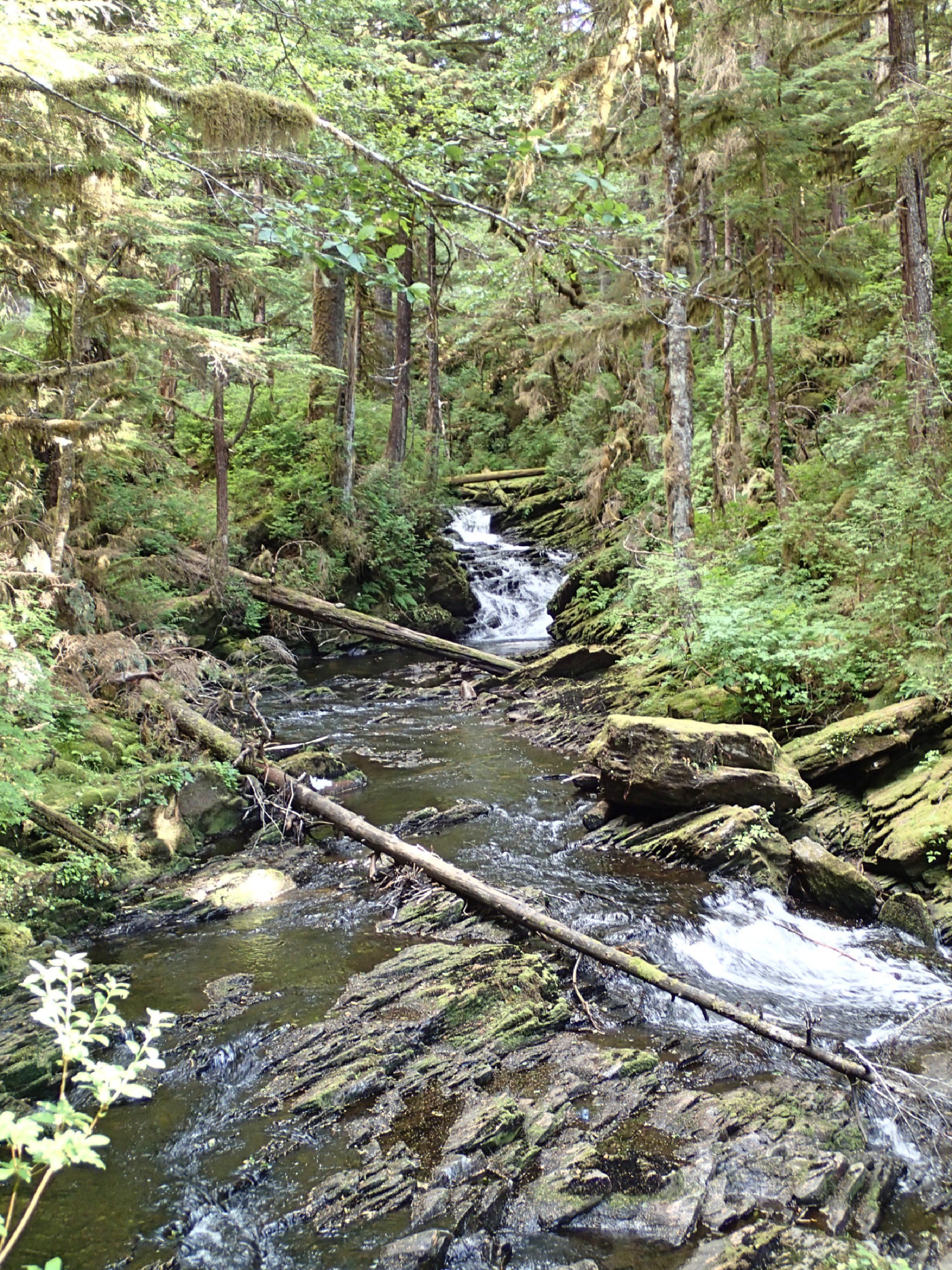
I found the trailhead to Lake Shelokum along the northwest shore of Bailey Bay, conveniently marked by a mooring buoy and an obvious trail up the hill. Although the beach was again full of rocky barnacles, there was a well-developed campsite with a wooden tent platform -- luxury!
After setting up camp, I set off up the trail toward Lake Shelokum. After the first 1/2 mile, the trail became more overgrown, with wet creek crossings and some decaying bridges. I could hear an immense roar from a waterfall, which was barely visible through the tree and brush cover. It was the largest waterfall I had witnessed close-up and the roar and power was incredible. Further up the trail I came to the run-off and then calm Lake Shelokum. Apparently there had been a landslide on the trail, so reaching the hot springs required launching a large canoe from the side of the trail, and paddling it out around a point to another corner of the lake. At this point I felt that a solo canoe trip later in the evening, in an unknown boat and its sketchy life vest, with those incredible falls downstream, wasn't the safest option. My imagination worked overtime envisioning bad scenarios, and I decided the hot springs weren't worth it. But I was able to give a good description of the trail to some folks who stopped by the shore later - a large family group staying in a very nice yacht further northwest in the Bay. These were the only folks I had seen all day.

The start of the trail to Lake Shelokum
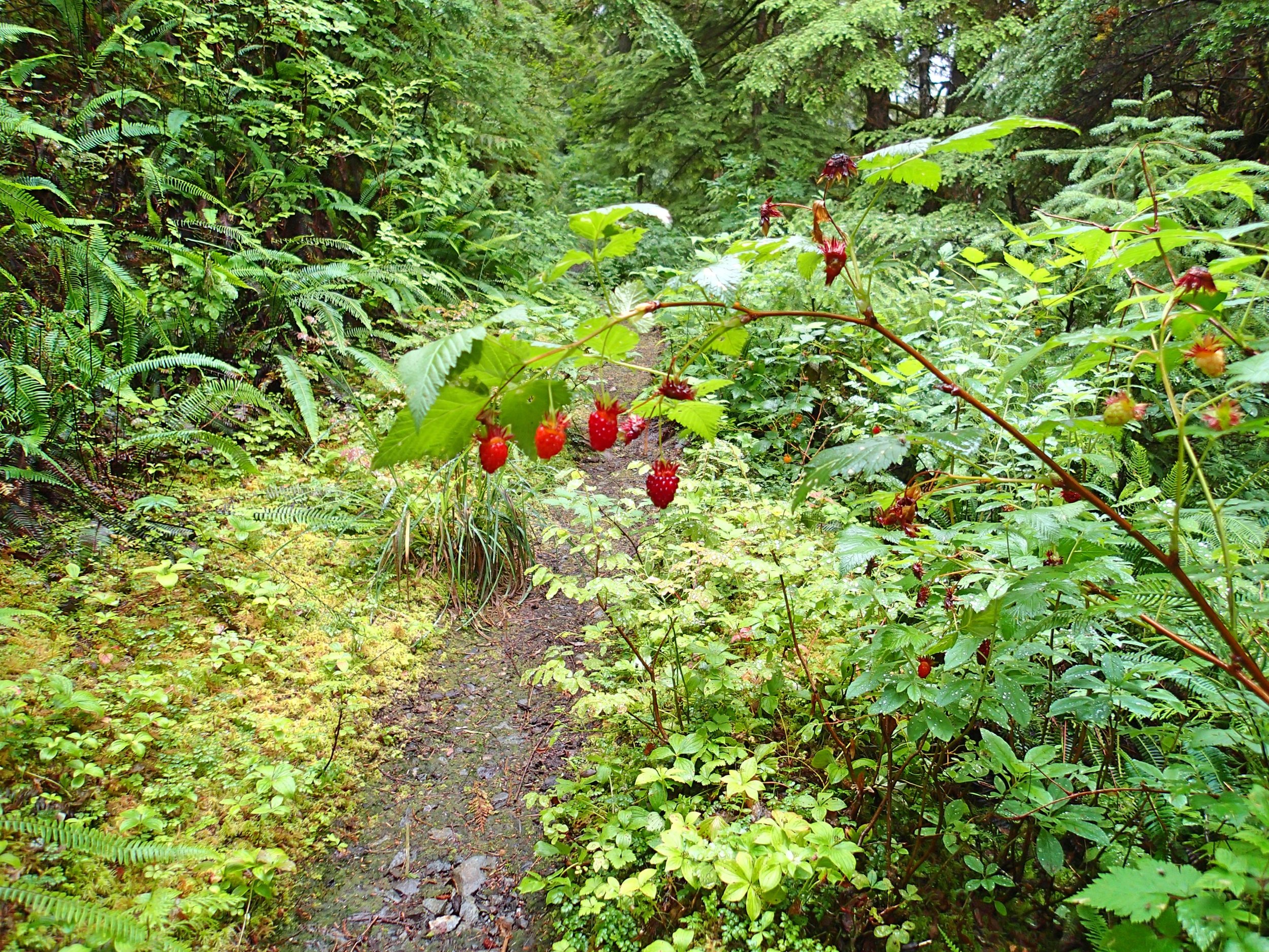
Nice treats along the way
The calmer start to the massive waterfall below
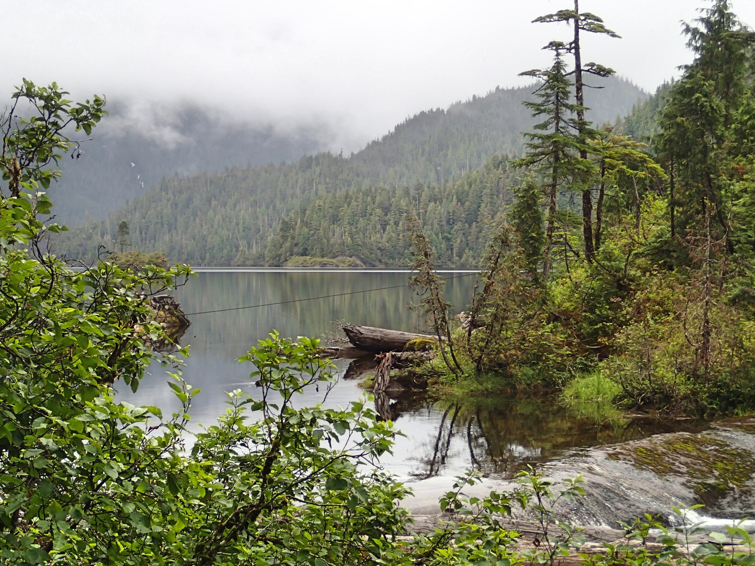
The entrance to Lake Shelokum
Views of Lake Shelokum

Day 6 -- Lake Shelokum to Anchor Pass 13.8 mi / 22 km: It had rained overnight, so my gear got packed up wet. The tide was quite low in the morning, so I attempted to scope out a path to the water that would cause the least damage to my kayak from the rocky barnacles. As I started to crab-walk the kayak to the shoreline, the panga from the fancy yacht arrived, loaded with several adults and kids to hike the Lake Shelokum trail. Richard, a very kind New Zealander, helped me to carry my kayak to the shore and offered tips about where to kayak in New Zealand. As I loaded the kayak and donned my drysuit, the large group took off up the Lake Shelokum trail in high spirits.
Given the lack of suitable landing spots, I planned to paddle to Anchor Bay, knowing that even if the Forest Service cabin was occupied, there would at least be a suitable landing place nearby.

Paddling NE toward Anchor Pass
Bailey Arm grew more narrow as I paddled east, and after much scouting I was able to find a marginal sandbar to stop for a quick lunch on a rising tide. As the arm narrowed I had to pay attention to the currents. As I turned south and headed into Anchor Passage, the opposing current slowed me down as I hunted for eddies. Soon, though, the channel widened enough for the effect of the current to be minimized. Finally, a decent launch beach at the Anchor Pass cabin site!

Approaching the turn to Anchor Passage

Forest Service Cabin at Anchor Bay
Day 7 -- Anchor Pass to Saks Cove: 15.6 mi / 25 km: The rain began again during the night and a steady drizzle continued in the morning as I slowly packed up to depart. As I turned left out of Anchor Pass and headed northeast up Behm Canal, a small mink on the barnacled shore looked at me curiously.

I saw only one boat in the early morning, and then no one after that all day. The solitude was delightful! After a lunch break on a sand bar, sitting on my kayak as there was no real beach, I continued paddling and began the ~ 3 mile crossing to Fitzgibbon Point. I saw lots of fish jumping in the water, and a few curious seals. There was a noisy flock of terns at Fitzgibbon cove that seemed disturbed by my presence, circling and crying. I headed south for Saks cove and arrived before 4 p.m., choosing the northeast corner as it had the shortest tidal flat according to the charts. I was able to find a previously used but sketchy tent site above high tide line.
MORE BEARS! The rain had stopped, and my gear began to dry out as I completed setting up camp and tying up the kayak. Just as I finished, a loud crashing sound emerged from the dense forest behind my tent -- and I froze. That could only be one critter: sure enough, as I stood on a large log and peered into the dense forest, I could make out the black head of a large bear as he tilted some saplings and crashed around in the forest near a small creek. I couldn't see him well given the thickness of the forest and brush, but I started to talk loudly and got out a noise-maker I had purchased before the trip. It was obnoxiously loud, but didn't seem to bother the bear, who continued his poking and crashing around for another ten minutes or so, before he slowly made his way up the hilly forest to the left of and behind my tent.
I was relieved that the bear departed, but started worrying whether he would come back as I made dinner, or during the night. I sat on the log and tried to chill out, then looked down the beach and saw ANOTHER BEAR walking away from me, down the beach to the right of my tent. My noise-maker had probably encouraged him to leave as well, but I thought - "Geez, this place is crawling with bears!" This bear was much smaller, more like a yearling, and of a honey color. He was too far away for a decent photo, but I was starting to re-think whether these coves were really best for camping solo. Although I was hungry, I held off on making dinner for another hour and a half, so as not to tempt the bears with new smells. There was no VHF reception in Saks Bay, as I had expected when I researched VHF reception across the island prior to my trip. Although I couldn't get a weather forecast, I decided to paddle a bit longer the next day to get all the way to Hut Point, nearer to the Misty Fjords National Monument.
There was a slight NW wind in the early morning that gave me an extra push as I paddled south. The breeze calmed in the afternoon and it became uncomfortably warm in my drysuit, under a full sun and a cloudless sky. Just before 3 p.m., after about 20+ miles, I scouted out a small beach and a nice campsite at Hut Point, clearly previously used by others. About 2 hours later, after I had set up camp and dried out some wet gear, a stiff breeze came up rapidly, and within 15 minutes the south wind had increased to greater than 20 knots, with whitecaps all across Behm canal and some spindrift in the wind waves. Menacing dark clouds were blowing over from the south, quite a contrast to the hot, cloudless afternoon! I was glad I had made good time and was not attempting to paddle against those winds, especially with so few convenient places to land along the way.

Paddling SE along Behm Canal toward Hut Point
Day 8 -- Saks Cove to Hut Point: 20.5 mi / 33 km: Whew, fortunately no bear visits during the night! The tide was receding quickly as I packed up in the morning, and I had a long muddy slog out to load the kayak, in spite of choosing the smallest mud flat from the chart. At least it was fairly FIRM mud!
Day 9 -- Walker Cove Day Paddle: 9.6 mi / 15 km: I was happy to spend two days in this nice campsite, and enjoyed a relaxing day exploring Walker Cove as my first view of Misty Fjords National Monument. I got an early start to avoid a repeat of yesterday's afternoon heat, and paddled about 5 miles east into Walker Cove. There were no places to land along the way, so I chose not to paddle further into the fjord before turning around. The day was again warm, and I was happy to peel out of my drysuit in the early afternoon. Several floatplanes zoomed in and out of Walker Cove during the day, along with 3-4 passing pleasure boats. I was surprised not to see any kayakers.
Walker Cove Slideshow


As I was resting in my tent around 5 p.m., the wind again picked up suddenly and then was roaring like a freight train in no time at all. It seemed to be as high as 40 knots, much worse than the previous day, as the sky darkened and thunder roared ominously overhead. My tent rocked and strained under the wind and pelting rain, as I read my book and tried not to worry about the storm. After about an hour, the wind eased and the thunder moved northeast, and I was once again relieved that I had planned to be off the water early. By 8:30 p.m., the skies to the southeast were a soft blue, with a gentle breeze and a light rain. The ever-changing Alaska weather!
Day 10 -- Hut Point to Punchbowl Cove 16 mi / 25.7 km: I launched around 7:30 a.m. the next morning and headed south down Behm Canal, past the beautiful Granite Creek waterfall, and a few others along the way.
Along the steep cliffs I saw plenty of starfish, a reassuring site to see that the populations were perhaps recovering from the wasting disease.
I bypassed Manzanita Bay to the east, and stopped at Eva Point to see if I could get a VHF forecast, suspecting (accurately, it turned out) that I wouldn't be able to get VHF reception once I entered the fjords. The skies were cloudy with no rain, but plenty of rain in the forecast.

Granite Creek waterfall

As I entered Rudyerd Bay and headed for Punchbowl Cove, I saw a few seals and dozens of floatplanes flying in and out, as the majestic cliffs of the fjords rose all around me.

A Paddling in to Rudyerd Bay

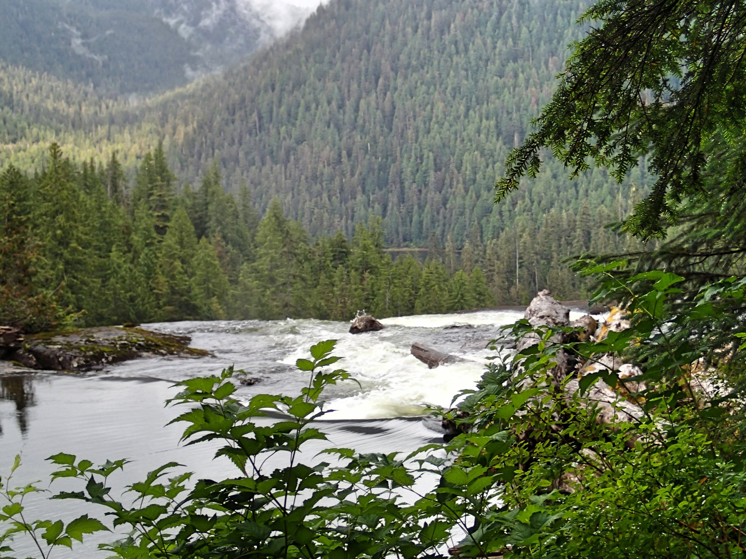
Stream efflux from Punchbowl Lake

Magnificent cliff walls of the Fjords

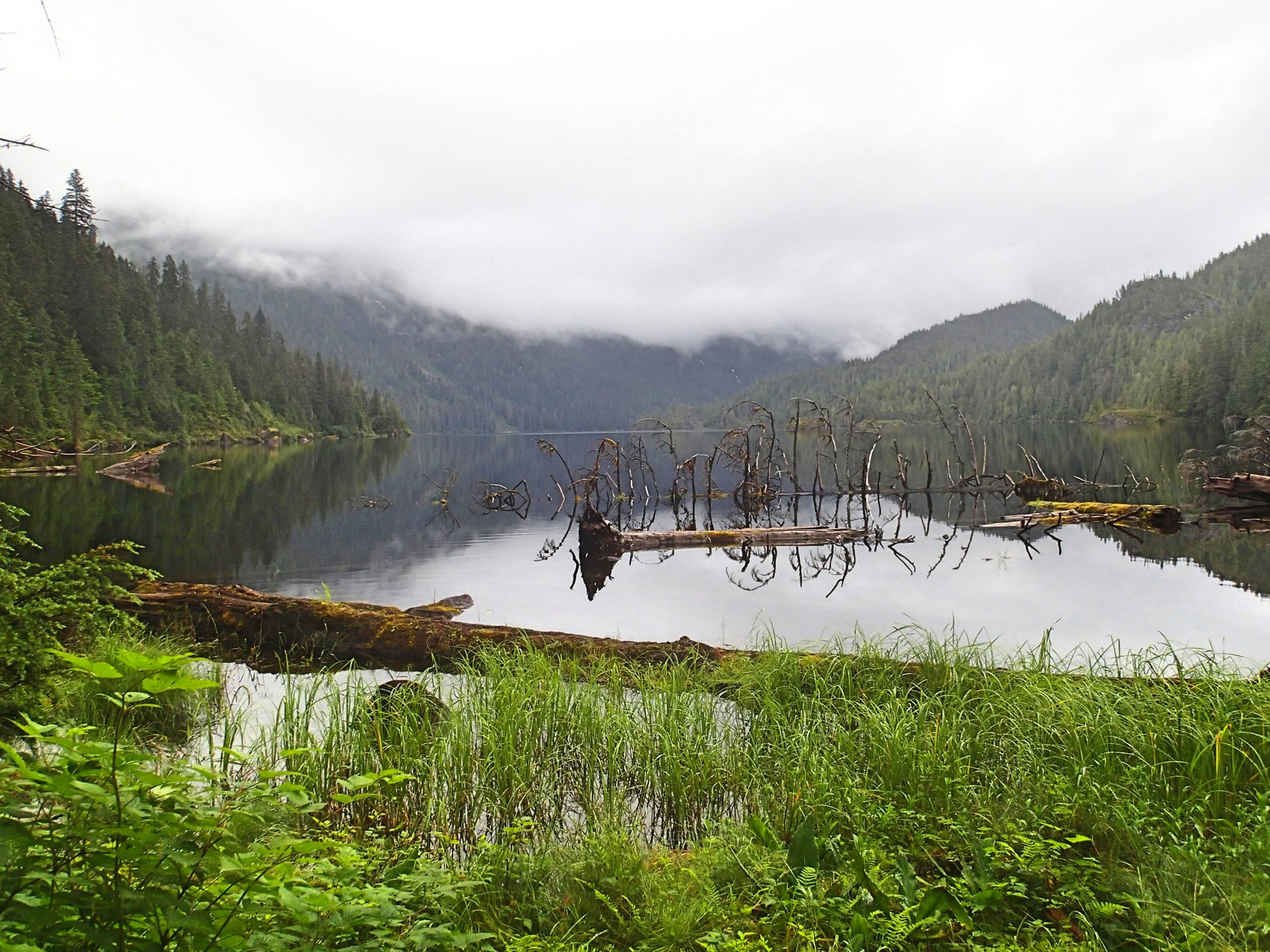
The idyllic beach campsite of Punchbowl Cove
As I paddled into Punchbowl cove I found a nice beach and an established campsite in the southwest corner of the bay, with a delightfully noisy waterfall from Punchbowl Lake on the eastern side. Surprisingly, I had the entire idyllic cove to myself; I had been expecting to see other kayakers here. I was able to collect water from the waterfall outlet, although there really wasn't a good place to land the kayak, and I had to paddle over to avoid getting stranded by the rising tide.
Day 11 -- Day paddle of Rudyerd Bay 11 mi / 17.7 km: I slept in and relaxed the next morning before setting off to explore Rudyerd Bay in a light rain. The fjord cliffs were spectacular, and they were indeed misty on this day. I stopped often to take pictures, knowing the pictures wouldn't fully capture the quiet beauty of the place. However, there were NO places to stop, as the cliffs walls were pretty rocky even at the base, so I didn't paddle all the way to the end of Rudyerd Bay, which would have been far too long for a rount-trip day paddle. The floatplanes and two tour boats went in and out multiple times during the day. I was able to flag down one of the tour boats to get a weather update, since I could get no VHF reception anywhere in the bay, and they also didn't hear me calling them by VHF. The tour boat operators were very friendly, asking if I needed anything. The captain warned me about rounding Alava Point, as some other kayakers had mentioned at Settler's Cove. After wishing me fair winds and following seas, they went on their way, and I eventually returned to camp to relax.
That evening a sailboat motored in and anchored, and a very nice couple (Timothy and Diana) kayaked over, looking for the nearby trailhead. Although I had planned to rest, I took them up on their invitation to join their hike to Punchbowl Lake. It was the typical Alaska trail: boggy, and a somewhat steep scramble up, gaining about 900 ft in only 1 mi / 1.6 km. We hiked up past the waterfall view, but then saw the sky darkening rapidly and rain beginning, and we realized that the way down would be even more treacherous in pelting rain. We reluctantly turned around before reaching the lake above. Later, Timothy offered to report the weather back to me, as he had a much bigger antenna, but he was also unable to get reception.
Rudyerd Bay Slideshow


Day 12 -- Punchbowl Cove to Winstanley Island 14.4 mi / 23 km: I was up early the next morning to beat any headwinds, and launched around 7:30 a.m. As I headed back into Behm canal, there was only a slight NW swell, with a light but dense patter of rain beginning mid-morning. Instead of stopping for lunch I continued paddling until I reached Winstanley Island, with an idyllic cabin and another great launching/camping beach. Arriving in early afternoon in the steady rain, I had plenty of time to relax and plan the rest of the trip.

Paddling south toward Winstanley Island in a light rain

Approaching Slag Point and Winstanley Island

The famous New Eddystone rock through the mist

Winstanley cabin and beach
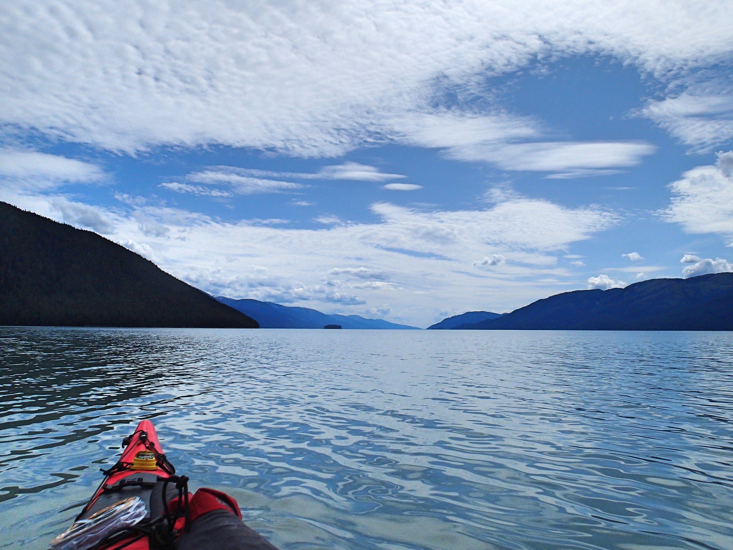
Day 13 -- Winstanley Island to Narrow Pass 20.1 mi / 32 km: The rain continued steadily throughout the night and the next morning, dampening my enthusiasm to pack up and depart. But the forecast for 2 days hence was favorable for rounding Alava Point, so I decided to suck it up and proceed. Packing up, I was still on the water before 9 a.m., and paddling south in the rain along Winstanley Island, to Candle Island. Rounding the southern end of Candle Island, I began the 2.8 mi crossing to Short Pass and the northern end of Smeaton Island. There was very little boat traffic in the misty rain. As with other locations in the trip, there were very few places to stop for a break, but I finally found a small shelf near a seal haulout along Smeaton Island.

Paddling south along Winstanley Island
After a quick lunch of black bean soup, I crossed further west to Revilla island at Sharp Point, and began what was to be a long quest for a decent campsite. Most of the bays were covered with sharp barnacles with poor camping prospects. The SE wind picked up to about 15 knots, and I began looking harder for a campsite. I had started the day tired, but ended up paddling around to Rudyerd Island and several tiny coves trying unsuccessfully to find enough space above the high tide line for a tent. I finally realized I should backtrack about 3 mi / 5 km north to a site I had seen previously, that offered a tiny space above the high tide line. At least the wind gave me a quick push back north. I was faced with the choice of a tent site that might or might not have been above high tide, and another higher space close to a small game trail. I chose the first, then changed my mind as I looked for tide marks, and moved to the higher space. The rain had continued throughout the long day. By the time I finished dinner and headed for the tent, I was weary and starting to anticipate the end of the trip.
Day 14 -- Narrow Pass to Alava Bay 9.5 mi / 15.3 km: At 5:48 a.m. the next morning I heard some bushes cracking just outside my tent and some "chuh-chuh-chuh" noises that sounded exactly like the noise the little bear made in the 1988 movie "The Bear", directed by Jean Jacques Annaud (a must-see!). Aah, I knew I'd regret putting my tent near that game trail! I rapidly started making noises, then saying "No bears in my campsite!" in a loud voice. I followed that with a few bursts on my fog horn. I hear the "chuh-chuh-chuh" noises become more rapid and louder and move away hurriedly - clearly I had alerted it to my presence. I quickly unzipped my tent flap to see the hind end of a yearling honey-colored bear, no bigger than a large German Shepherd, hustling away from my tent just a few meters away. I was tremendously relieved to see only 1 yearling bear, who was probably more scared by me and my noise than I was of him. I actually felt badly for scaring him. No falling back asleep after that!
I launched around 8:30 a.m. and immediately felt the 15 knot S headwinds. As I passed beyond Rudyerd Island, the wind increased, with ~ 1 m wind waves, and my pace slowed. Eventually, I rounded Ape Point and headed west, facing only quartering winds. The Alava Bay cabin was occupied, but I was happy to set up camp on the nearby beach, which offered a nice shell launch and plenty of space above the high tide line. The south wind continued to increase, causing whitecaps even in the bay, and the forecast for the next day included more of the same. I decided to take the next day off and relax on the beach, before rounding the point the next day. Having heard several warnings about Alava Point, I didn't know what to expect, so chose conservatively.

The Alava Bay campsite after the storm
Day 15,16 -- Alava Bay to Coho Cove 13.2 mi / 21 km: The rain continued intermittently, then steady hard rain in the afternoon, with higher wind and plenty of wind waves and whitecaps in the bay. I spent the day relaxing, reading, and doing camp chores. The forecast was for continued rain, but decreasing winds. In the morning, the rain was lighter and the wind was much lower. I launched at mid-morning, aiming to round the point at slack tide, given all the warnings I'd heard. The wind was less than 10 knots as I paddled alongside rugged and wind-tossed picturesque cliffs.
Rounding Point Alava was a complete non-event: a pretty point but certainly not a safety concern under these conditions. The wind lessened even more as I rounded the point and headed west toward several bays. There was an unusual sculpture on one of the cliffs near the Point, perhaps watching over Revillagigedo Channel.

The pictuersque rugged coastline
I didn't launch until ~ 9 a.m. to allow for the tide to rise in my shallow cove. As I returned to Revilla Channel in the light misty rain, there was a slight SE tailwind and some assist from the current, which I did my best to catch. Fishing boats, tour boats and float planes went back and forth, but I STILL saw no kayakers out on the water. I could see the faint outline of Ketchikan ahead in the mist, not quite as far away as it looked.

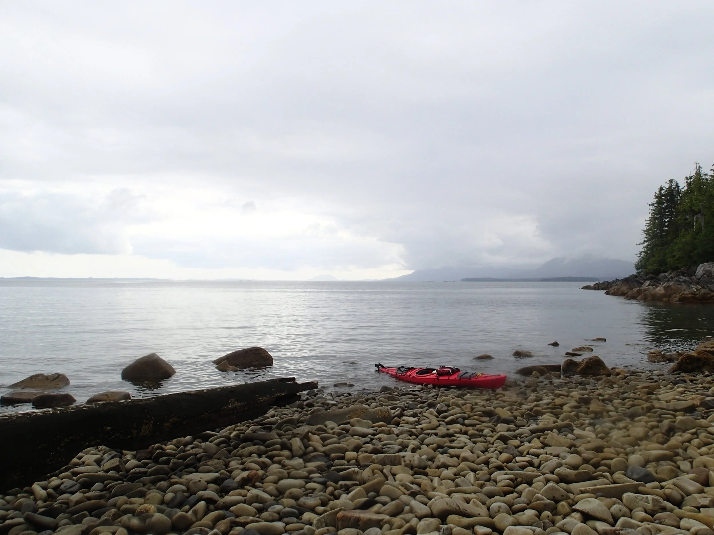
Pitstop at a cobblestone beach
Point Alava under perfect conditions

Watching over Revilla Channel
There were more fish jumping and fishing boats in this area, as I crossed Thorne arm to the bays near Coho Cove. As I paddled past Thorne Arm, I saw endless rocky shores with few places to stop, and quite a few fishing boats. I was fine with my decision to avoid exploring that bay and return sooner to Ketchikan. I set up camp in a small cove just east of Coho Cove and relaxed in my tent to escape the mosquitoes.
Day 17 -- Coho Cove to Ketchikan 15.2 mi / 24.5 km: With the increasing number of fishing boats, roads, and population as I neared Ketchikan, plus the near constant rain and poor campsites, I decided to forego paddling in George and Carroll Inlet and just head back to Ketchikan to complete my trip. I figured my timing was such that I could have an extra day or two in Ketchikan to do laundry and sightsee before catching the ferry south to Bellingham that week. Aaah, what do they say about best-laid plans?

Ketchikan was barely visible in the misty rain
In the drizzling rain I started the 2.5 mile crossing of George and Carroll inlet, enjoying the view of the Ketchikan houses growing closer. Boat traffic was much heavier, but mostly pleasure boats and tour operators. I finally arrived at Mount Point and stopped in the cold rain for a quick lunch of black bean soup. Heading west into Tongass Narrows, the current was inconsequential, but the size of the huge cruise ships gave me pause. I definitely didn't want to be in their path if they chose to transit the channel! Fortunately, they all remained stationary, and I paddled slowly past their hulking presence. I passed Thomas Harbor and downtown, and eventually turned into the main harbor where I had started 17 days ago. As I entered the harbor, I saw the Alaska Marine Highway Ferry at dock to the west, and was surprised that it had arrived early for its next sailing. The kind harbormaster responded to my radio call, telling me where I could dock my kayak and even bringing out the wheels that I had stored there -- what a sweetheart of a harbor master! As I began unloading and sorting gear, the rain stopped and it didn't rain again for several days. I was looking forward to that hot shower!

The southern tip of Ketchikan

Massive cruise ships that I paddled around quickly!

Downtown Ketchikan

Epilogue
My plan to take the Alaska Marine Highway Ferry back to Bellingham Washington that week was not to be: the Ferry staff were on strike for the first time since the 1970's. I got a ride into town from a very kind and friendly ferry worker, and she explained that the ferries were all docked with an unknown departure date. I hadn't been expecting this, but as I read the news and talked to the locals, I realized I could be stuck in Ketchikan, like many others who rely on the ferry, for quite some time.

The helpful staff at Alaska Marine Transport preparing my kayak for loading
Fortunately, I was able to make arrangements to stay at a nice hostel near town, and I was able to walk my kayak just a few blocks to the Alaska Marine Cargo company, who would transport my kayak via cargo ship to Seattle. This was a huge relief, and I was thrilled with the excellent service I received from this company. I spent a couple extra days in Ketchikan sightseeing at Totem Bight and downtown, and hiking at Ward Lake, before flying to Seattle a few days later. Of course, I then had to take a Greyhound bus from the Sea-tac Airport to Bellingham to pick up my car, then drive back to Seattle to pick up my kayak. All told, it was quite an adventure!
This turned out to be a great route for a first solo kayaking expedition. By timing the currents, and proceeding clockwise, I could make good time by taking advantage of prevailing winds for most of the trip. The water is quite calm throughout the area, making for safe paddling conditions. The advance planning helped to avoid any major issues, and I was thankful that the bears left me alone. Most of the Alaskans I met were exceptionally friendly and helpful. There is plenty to see, and the trip could easily be extended by exploring more bays along the way. I found the solitude delightful, even though I was surprised not to see any other kayakers the entire trip, especially in this beautiful and well-known kayaking destination.
On the negative side, the good beaches for launching and camping were very few, requiring much effort to get a heavy kayak over the rocky barnacles and above the high tide line each night, especially working solo. In addition, there are few places to stop in the Misty Fjords, requiring long days with no bio-breaks to see the entirety of the fjords. But Punchbowl Cove is considered to be the highlight, and it certainly didn't disappoint. I found I missed the more open coast, and hope to plan a future solo trip along a coastline.
REFERENCES & INFORMATION
Photographs by Cris Lewis, Olympus TG-2
Guidebooks:
Jim Howard, "Guide to Sea Kayaking in Southeast Alaska: The Best Day Trips from Misty Fjords to Glacier Bay" Globe Pequot, 1999. ISBN-10: 0762704098
Alaska Marine Highway Ferry: https://dot.alaska.gov/amhs/
Alaska Marine Transport: https://www.lynden.com/aml/ The Service from this company was outstanding for transporting my kayak from Ketchikan to Seattle.
There is a convenient harbor for launching your kayak about 0.5 mi / 0.8 km from the Ferry Terminal. This harbor offers public bathrooms and paid hot showers, a wooden rack for kayak storage, plus some information and books to trade. The Forest Service office is next door. A laundromat is a further few blocks east. A bit further east is a Safeway shopping center with a public bus stop, which allows catching a frequent trolley bus to downtown, or one of the public buses that travels the length of Ketchikan. I was able to use the public bus system to travel all the way to Ward Lake and Totem Bight, as well as to the public library.
Feel free to download and share this GPX file of waypoints and campsites. Possible campsites, designated with pins, were selected from marine charts and google earth maps.