
Cape Scott Vancouver Island 2022
A sea kayaking expedition from Port Hardy to San Josef Bay, around Cape Scott, on Vancouver Island in British Columbia
Rounding Cape Scott by Kayak has long been on my bucket list of iconic sea kayaking paddles. I finally made the opportunity in the summer of 2022, when Canada opened back up to tourism after the Covid pandemic. Cape Scott is infamous for dangerous waters, with all the guides and books urging caution in rounding this northernmost point of Vancouver Island. With careful planning, and lucky weather, the conditions at Cape Scott could not have been more perfect. But conditions on other days and at other points and locations reinforced the need for advanced skills and careful planning. This was a very enjoyable trip, and one I would recommend for advanced paddlers.
Route Overview: 92 miles total, 11 days


I was undertaking this trip with my paddling buddy Ken Sund, with whom I had done other expeditions. We drove up to Port Angeles, took the Blackball Ferry to Victoria, and drove to Port Hardy. We spent one night in Port Hardy to reconnoiter launch spots and look for nearby, secure parking locations, which turned out to be a valuable exercise.
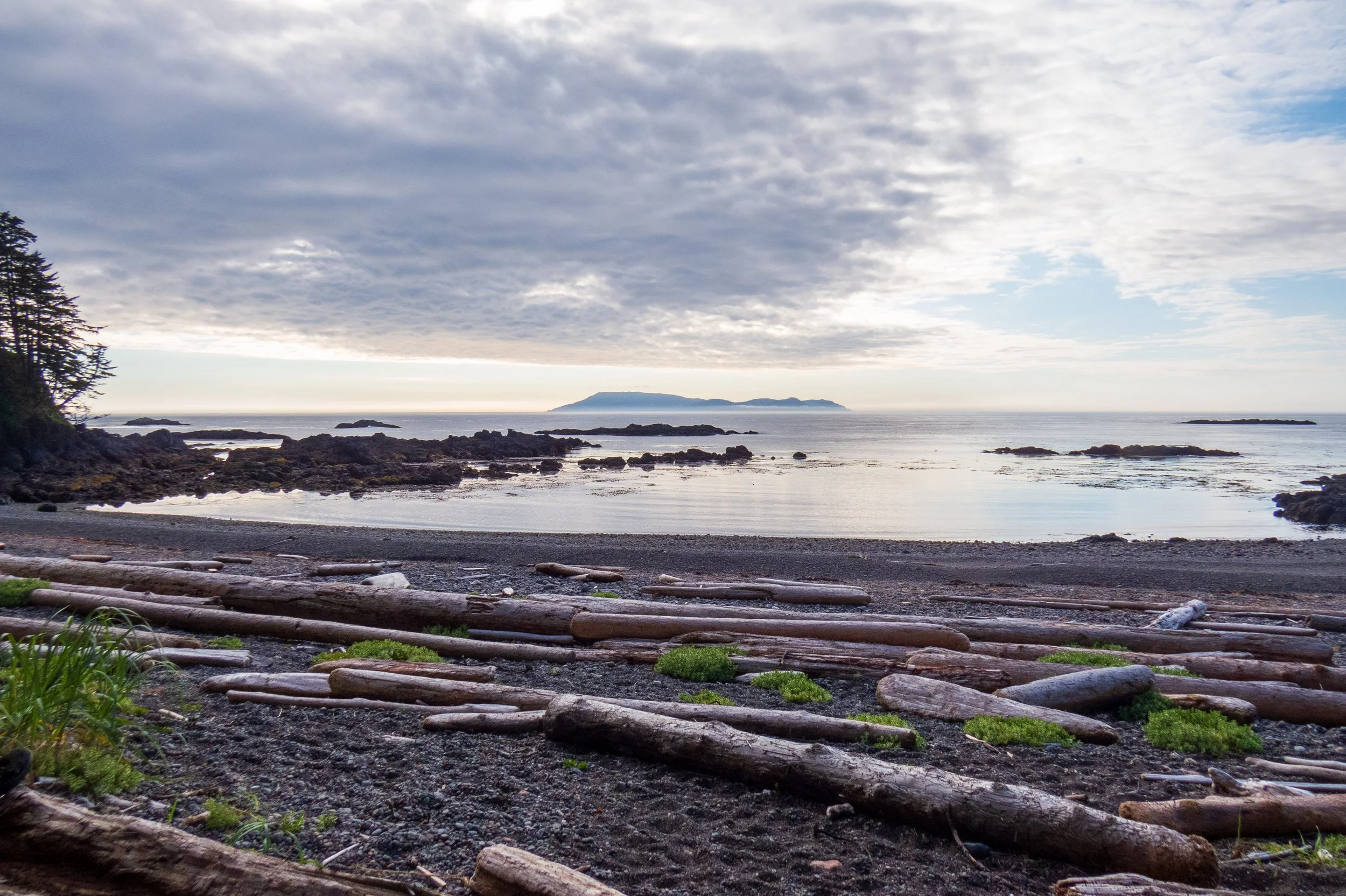
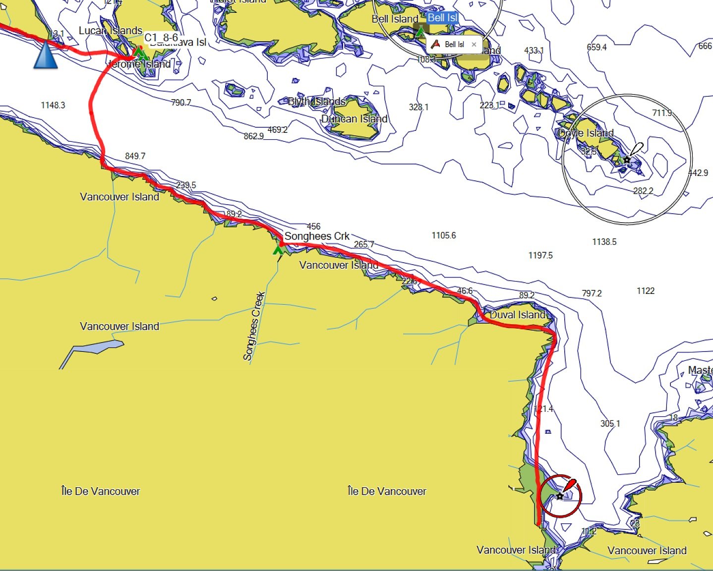
Day 1: We were glad we had taken some extra time the previous day to scout parking locations. There was limited space on the side of the road for long-term parking at Bear Cove, and it didn't seem particularly secure either. The Port Hardy harbor has a small lot for long-term parking, which cost ~$70 CAD for 2 weeks. However, it was also full of large boat trailers, and it was not close to a suitable launch location. After quite a bit of asking around, we ended up parking near the Pier and the Backpacker's hostel, close to our launch from Carrot Park (see the image below). It was not a big parking area, and other kayakers were parked there, but there was sufficient space. Our launch location at Carrot Park (Launch 1) was tide-dependent, but close to the car. As we paddled north we saw a better location closer to the road (Launch 2), which would require a short (500 meter) walk back from the parking area.

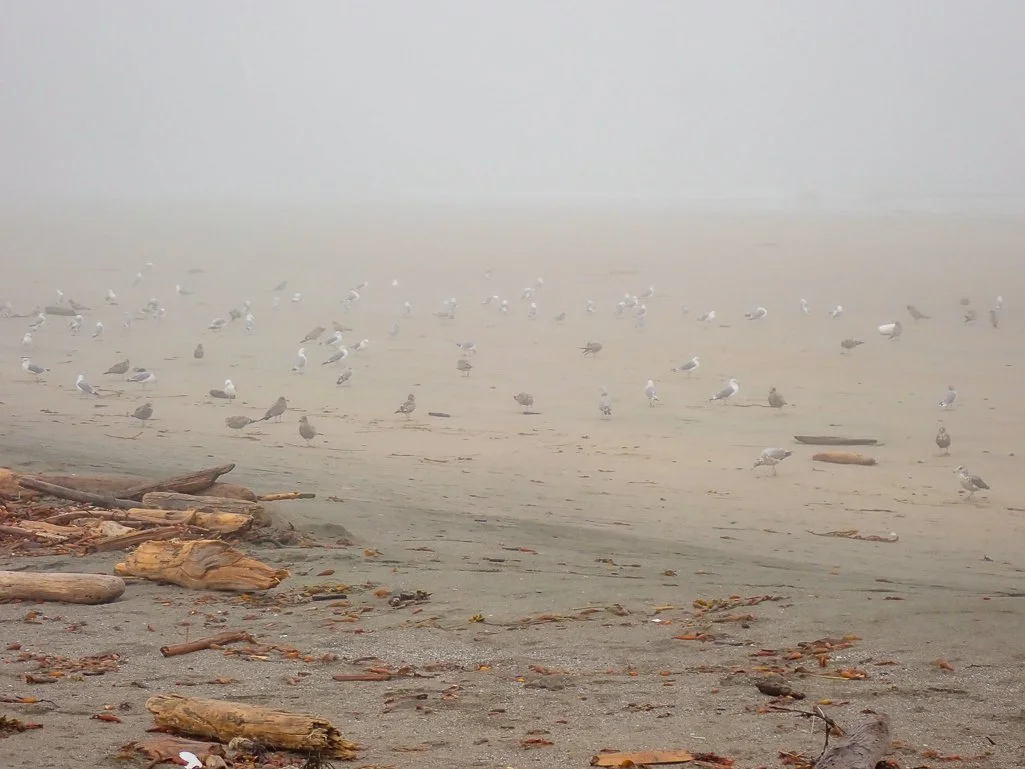
We loaded our kayaks and launched into a foggy morning at 9:00 AM. The water was like glass and we had a peaceful paddle north to Duval Point, seeing sea otters, rhinoceros auklets, and red-necked phalaropes. We stopped for a quick lunch at Songhees Creek, before continuing up Goletas Channel as the wind picked up. With significant chop in the channel, we set an aggressive ferry angle to cross to Nolan Point, arriving early in the afternoon. There was a large group at the best campsite on the point, but we found a nice campsite just a bit further north on Balaklava Island.
Day 1: Carrot Park, Port Hardy to Balaklava Island
12.8 mi / 20.6 km


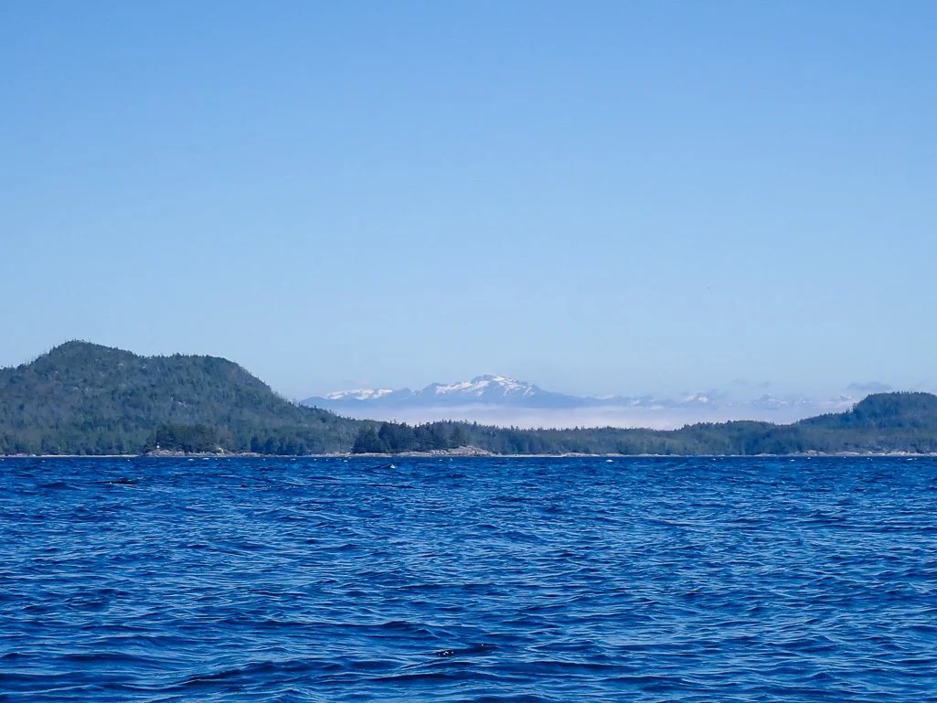


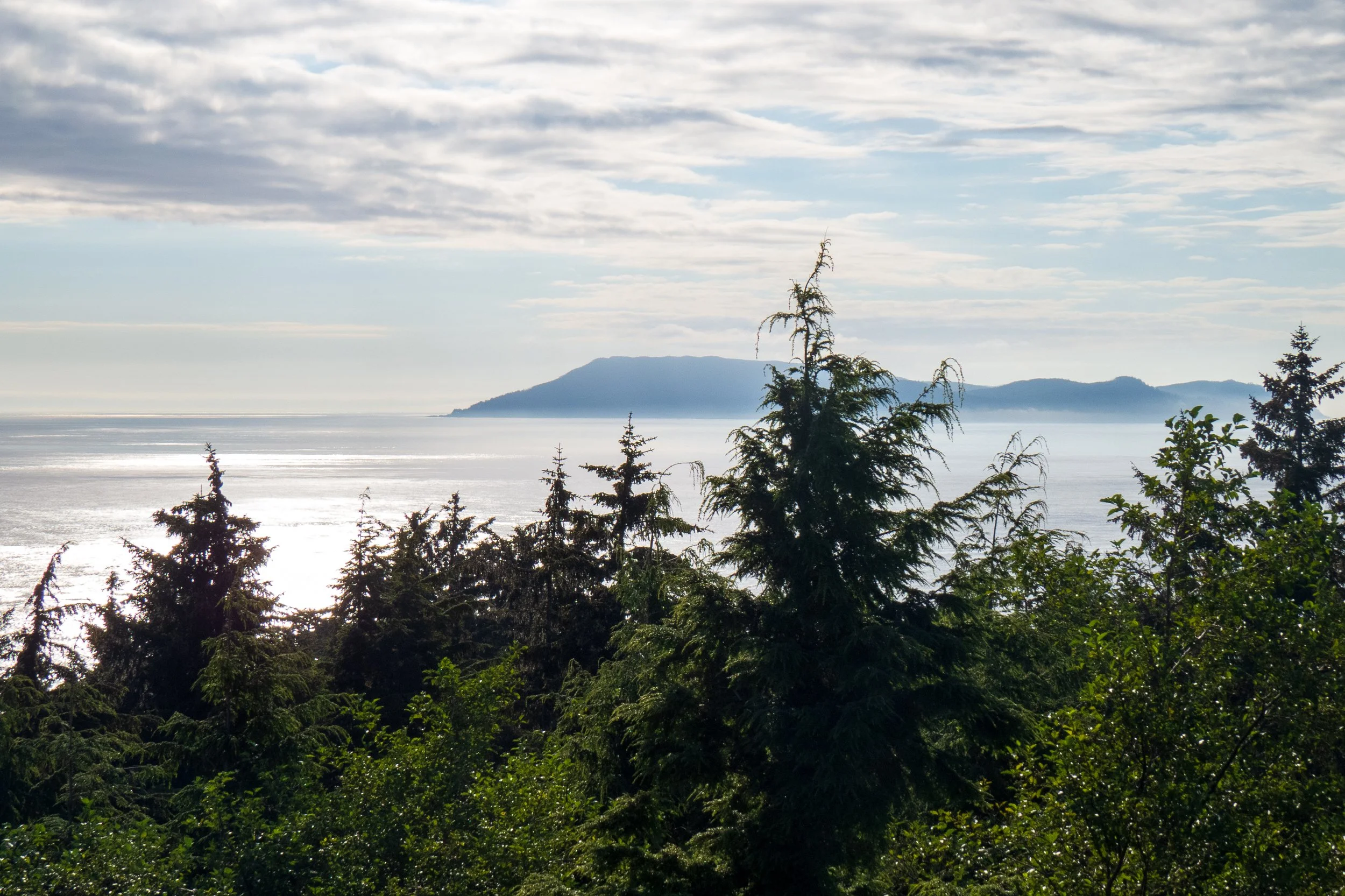
Day 2: We launched early the next morning to try to beat the wind, famous for channeling east down Goletas Channel. We still faced wind and a significant flooding current that made for a bit of a slog as we paddled west on the north side of the channel. However, as we got to Loquillilla Bay, the wind diminished, and almost magically disappeared! We felt incredibly lucky for the good weather as we crossed the channel and continued west to Shushartie bay. We found a small campsite above the high tide line and relaxed to watch a sea otter lounging in front of a humpback whale in the channel.

Day 2: Balaklava Island to Shushartie Bay 13.5 mi; 21.7 km


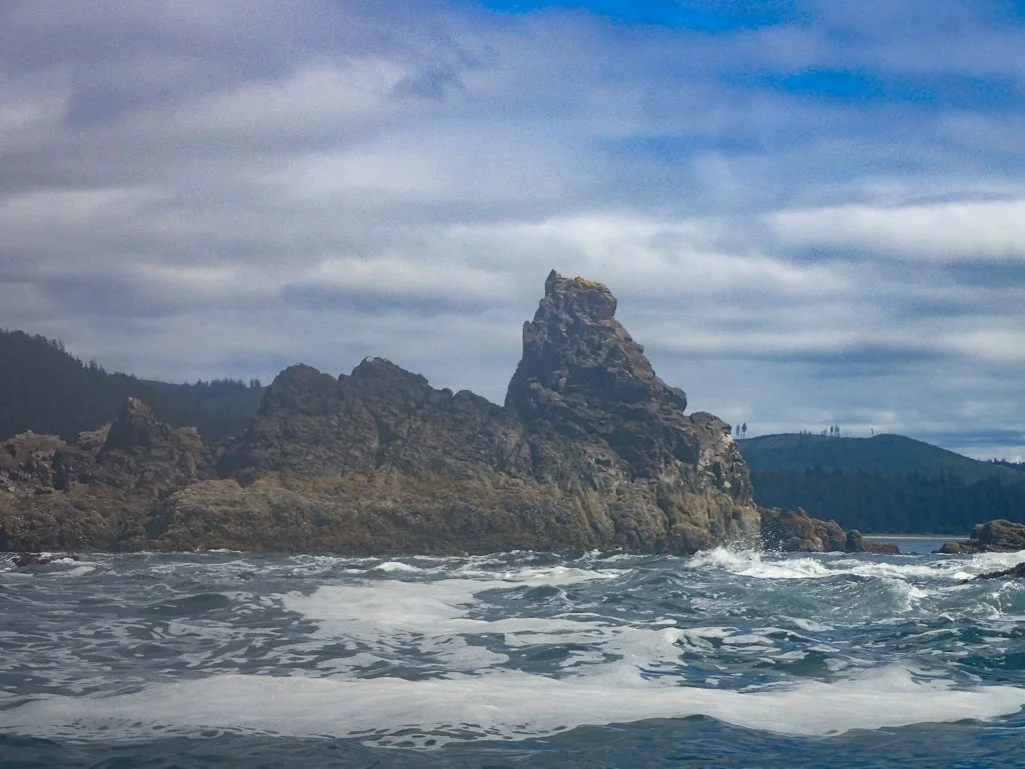
Day 3: We launched in great conditions and continued paddling west. As we rounded Jepther Point, there was less protection from land and we began to experience mild ocean swell, with surf on the beaches. I had planned the dates of this trip to coincide with currents of slack shifting to ebb during convenient paddling hours, primarily for the crossing of Cape Scott. However, it worked out great for our transit of Tatnall Reefs as well; we reached the eastern boundary of Tatnall Reefs at the start of slack, moving to an ebb. The water was bouncy and turbulent, but flattened out more as we rounded the second point and paddled parallel to the beach near Skinner Creek and the Nahwitti River. We stopped for a relaxing lunch at a beautiful protected pocket beach on the northeastern side of Cape Sutil, where there was minimal surf.

Day 3: Shushartie Bay to Shuttleworth Beach 15.4 mi; 24.8 km.
As we rounded Cape Sutil after lunch, it seemed all hell broke loose. We rounded the Cape at almost exactly the time of max ebb at -1.6 knots, and the water was very turbulent with many breaking waves and high rollers. It was somewhat unexpected after the calm of the bay just south of Cape Sutil, and we also didn't appreciate the effect of max ebb on this cape. These were probably the most turbulent and rough conditions I have ever paddled with a loaded expedition kayak, and it required our full attention with plenty of in-stroke bracing and paddling fiercely to maintain momentum. The rollers were over our heads, and left our boats crashing down the other side as we crested them. At no time did we feel we were in danger of capsizing, but I would not recommend these conditions for novice paddlers. We continued paddling, and as we passed the second smaller point west of Cape Sutil we entered calmer waters.
As we approached Shuttleworth Bight, there was mild surf, but the waypoint provided by John Kimantas in his BC Coastal Atlas series (see below) had minimal surf, and was also closest to the best tent sites. Before setting up camp, I paddled upriver to collect 26 liters of water. The forecast for the next day was not favorable, with 20-30 knot west winds, so we decided to check the conditions in the morning.


Day 4: Although it was a nice dawn, the weather forecast had worsened slightly the next morning, calling for 25-30 knot winds and > 1 meter surf in western Queen Charlotte Sounds. Because there weren't as many easily landable beaches between Shuttleworth and Experiment Bight, we opted to stay an extra day at Shuttleworth Bight, and rest and enjoy the long beach. Ken paddled up the Stranby river for a freshwater bath, and I discovered, to my chagrin, that the water I had collected from the river the previous day was salty! Although I collected it from downflowing water, it was still a tidal area so the ground and water was likely salt-saturated. Be forewarned for this campsite! We opted to make the long haul east to the far end of the beach and walk upstream to collect water from Irony Creek. It was a nice walk on the beach, but a long walk back with 25 liters of water! There were no campers at the backpacker site at Irony Creek, and we had the entire beach to ourselves. It rained intermittently in the afternoon and evening.


Day 5: Shuttleworth Bight to Experiment Bight 15.3 mi; 24.6 km
Day 5: This turned out to be an excellent paddling day! The forecast included rain with a possibility of thunderstorms, but light wind. There was negligible surf at my beach launch site, but the lower tide required some longer gear hauls for me. (Ken was smart enough to launch from the river mouth.) We launched into glassy water and fog. We rounded the point of Shuttleworth Bight, and picked our way through the rock gardens. The growing ebb allowed us to make good time. The fog grew thicker, obscuring our views of the beaches of Christensen Point and Laura Creek and requiring navigation by GPS and compass. We were able to see a few sea otters on the water, dozens of red-necked phalaropes, and a large pod of Steller sea lions that croaked and roared behind us in the fog. With less than 200 feet of visibility, we navigated to the beach at Nissen Bight, where we stopped for a quick lunch. We explored the beach a bit and greeted some backpackers hiking the North Coast trail.


We continued paddling west through the fog, and couldn't see much of the land at all from offshore. Just as we entered the bay of Experiment Bight, we were thrilled to see a pod of orcas! The females and a juvenile were in front of me, while Ken said he saw the male behind my kayak. They dove and disappeared quickly, but what a thrill! We landed in no surf, happy to finally be at Experiment Bight, just around the corner from Cape Scott. We were eager to set up camp and see as much as we could in the remainder of the day.


As we began unloading our kayaks, a black bear appeared in the dunes and I scrambled for my camera. As he approached me, I could see he wasn't aware of me. Unfortunately, I quietly said "Hey bear", before I snapped a picture - always a balance between startling a bear and capturing a prize photo! He ambled off down the beach unhurriedly after he saw me, leaving me only a few pictures of his rear end. In the evening, we decided to hike 3 miles round-trip to the Cape Scott lighthouse, including a trip across the spit to views of peaceful Guise Bay.
Experiment Bight Slideshow


Day 6: Today was the day to round Cape Scott! Slack in the Scott Channel was at 1:08 PM according to the Canadian Tide tables. We decided to launch around noon and paddle about 45 minutes to the point. The fog was fairly thick in the morning, but lifted as we began packing our kayaks. The water was like glass, with less than 1 foot of surf - perfect conditions! After our experience at Cape Sutil though, I was still anxious to see what was around the point, given that the guidebooks offered no warnings about Cape Sutil and plenty about Cape Scott!

Day 6: Experiment Bight to Lowrie Bay
13.1 mi; 21 km
As it turned out, the trip around Cape Scott was as smooth as could be. As we launched, we noticed from the kelp that the ebb was already flowing. The water was as calm as it had been on the entire trip, and the fog lifted enough to provide for great visibility of the Scott Islands. We kept an eye out for riffles in the water as markers of high current or whirlpools, but only noticed a slight turbulence out from the point. Just as I began to take some photos, that area of turbulence sprouted flippers and woke up: a sleeping pod of Steller sea lions, and a huge one! They were not happy about being disturbed, and they ganged up and came charging at us, roaring and growling loudly. It was the first time I'd been 'charged' by a herd of Stellers, although we had some follow us around in Alaska near Yakobi Island. There seemed to be almost 50 of them, and they came closer and closer, showing no signs of stopping. I hastily put my camera away and didn't try to film. As they continued approaching, we started paddling quickly out of there, to a continued roaring and growling pursuit. Finally I roared back loudly, hoping that would deter them from actually charging our kayaks. As we sped away, they dispersed and quieted down a bit. I felt badly for disturbing their siesta. Clearly this was their territory that they probably rarely shared with others!


After rounding Cape Scott, our destination was Lowrie Bay. We had decided that it's north-facing bay was a good refuge for the southerly storm front that was in the forecast. We landed in minimal surf and had a leisurely afternoon unpacking, setting up camp, and exploring the beach. Although there was ostensibly a habitable cabin and a private outdoors loo, we were pretty disappointed in both structures! The cabin was only about 12 x 8 feet, very moldy, and filled with trash. The loo was also nasty; we decided we'd be far happier with our tents and the forest or private beach spots below the tideline.
Day 7-10: Although our initial plan was to paddle around the corner to the Helen Islets, we weren't sure of the protection these small islets would provide from the coming storm, and we doubted it could improve upon the beach at Lawrie Bay. I felt sick and exhausted the next morning, with very little energy. I wasn't sure of the cause, but I didn't have the energy for a walk down the beach, much less packing and unpacking for such a short paddle. I asked Ken if we could take a rest day, and he was a good sport about it. But with the coming storm forecasting > 20 knot southerlies and thunderstorms, we ended up being stuck at Lawrie Bay for the next several days. The rain began that night, and continued, along with wind and occasional thunderstorms, slowly moving north. We set up a tarp, collected rainwater, did camp chores, and caught up on our rest and reading.
On the fourth day of being pinned down at Lawrie Bay, two sea kayakers paddled in from the north and we encouraged them to join us. They were Dan and Charles, both of Oakland, California, just a short distance from my home in Half Moon Bay! They had just completed a paddling trip in the Broughton archipelago earlier in the month, and had launched out of San Josef Bay to explore Cape Scott. They were pinned down by the storm at Guise Bay, and they said the high winds were really pounding their tents. We realized that, as at Cape Sutil, our protected bay was shielding us from the worst of the wind and storm, and we were glad to have had the protection of Cape Russell for the last few stormy days.


Day 11: My original plan had been to paddle south along the coast and into Quatsino Sound, paddling in to Coal Harbour and retrieving our vehicle after a bus ride back to Port Hardy. The forecast for the day called for 15-25 knot winds, decreasing in the evening. However, the coming days called for a northwest wind of 20-30 knots with 2 meters of surf. So far, the forecasts had been pretty accurate. The section of coast between San Josef Bay and Quatsino Sound was quite exposed, with guaranteed surf landings. While we liked the idea of a tailwind, a 20-30 knot tailwind in open ocean with loaded kayaks might be a bit much. And we were tired of waiting out weather on the beach, even a nice beach!
I realized overnight that we had a golden opportunity to take out at San Josef Bay instead, if one of us could hitch a ride with Dan and Charles to retrieve Ken's truck. Ken was okay with this plan, and when I asked Dan and Charles in the morning, they were more than willing to offer us a ride. They apparently had the same idea, and may have suggested it if we hadn't first. Although we were both disappointed to end the trip early, I realized I could always return to explore that part of the coast by paddling out of Quatsino Sound, a much safer proposition that would be less subject to fickle, inclement weather.
Day 11: Lowrie Bay to San Josef River Take-out 10.3 mi; 16.6 km

We launched mid-morning, right at slack, and paddled out around the point. As soon as we left Lowrie Bay the water was choppier, and the wind was ~ 18-22 mph, with big rollers at the point. It was not nearly as bad as our experience at Cape Sutil, but with the headwind it felt like a slog around Cape Harris. Dan and Charles launched after us, and zoomed ahead of us quickly, cutting in closer to the point and behind the Helen Islets, while we went around them. There were a few avoidable boomers, and as we turned due east the headwind thankfully became a side wind. I was very glad not to be paddling the entire way south to Raft beach today! Sigh, I have not been super lucky for good weather on recent kayaking trips.


I didn't want to keep Dan and Charles waiting, and I wasn't quite sure where their takeout was, so I paddled as quickly as I could up the San Josef river. It started to get too shallow to continue, so I waited on the narrow shore. Soon I heard a holler from downstream, and saw one of the guys had come looking for us - we had passed the take-out. Soon we were all busily unpacking and re-organizing gear. Charles and Dan loaded up quickly, made room for Ken in their SUV, and I stayed behind to watch the gear, swat mosquitoes, talk to a few tourists who walked by, and read my book. The drive back to Port Hardy was fairly long on curvy mountain roads, but we celebrated our successful trip with a nice hot meal and hot showers at a hotel in Port Hardy.
This trip around Cape Scott is on the bucket list of many kayakers, and it certainly did not disappoint, in spite of the weather. If possible, I'd recommend allowing for extra days at the Cape, to explore the lighthouse, beaches and historical features, as well as waiting for safe conditions. I learned valuable lessons about not getting deceived by a flat, calm bay prior to rounding a point that is subject to wind and current. The eastern portion of Vancouver Island is beautiful and offers wilderness paddling opportunities, while not as spectacular as the western coast. I'm hoping to return to Quatsino Sound to explore the sound and the area north of the Brooks peninsula. Finally, I'm very grateful to Dan and Charles for rescuing us from what was sure to be challenging conditions on the open coast and more days waiting out weather!
Photographs by Cris Lewis and Ken Sund
REFERENCES AND INFORMATION
GUIDEBOOKS:
John Kimantas, "The Wild Coast: A Kayaking, Hiking and Recreation Guide for North and West Vancouver Island" Whitecap Books, 2011. ISBN-10: 1770500138
John Kimantas, "BC Coastal Recreation Kayaking and Small Boat Atlas Volume Two: British Columbia's West Vancouver Island Whitecap Books, 2012 ISBN: 978-1-55285-865-3
LOGISTICS:
I was glad I had planned ahead and had chosen the days of the trip to coincide with the time of slack turning to ebb (for a counter-clockwise trip) to occur during convenient paddling hours. Canadian tide and current tables can be found here. Remember that times listed are in Standard Time and one hour must be added for Daylight Savings Time during summer paddles.
There seemed to be limited camping opportunities in Port Hardy, as some historical campsites had closed. However, we noticed the Quatse River Campground had room for both tents and RV's, hot showers, and laundry facilities.
See Day 1 notes above about long-term parking in Port Hardy.
Wx radio: This website illustrates the regions of weather broadcasts, so listen for these area announcements on the broadcast. Queen Charlotte Strait and Pine Island were relevant Wx targets for the east side of Vancouver Island, and Vancouver Island North is the target for the Cape Scott region. However, the weather buoys for the 'Vancouver Island North' broadcast are near Cape Scott and the Brookstone Peninsula, so may offer forecasts that are worse than actual, or simply not accurate, as those areas tend to be unique and more sensitive to weather systems. We found the "Vancouver Island North" forecasts to be pretty accurate.
Shuttleworth Bight: If you collect water from the Stranby River, go very far upstream to avoid salty tidal influx. Alternatively, collect water upstream at Irony Creek by the backpacker's campsite.
The cabin at Lowrie Bay is barely habitable, and certainly not preferable to a sturdy tent given the debris and mold.
Proceeding further up the San Josef River than my red track is highly tide- and condition- dependent. The GPS waypoint is for a small take-out that is further downstream than the major launch site is at N 50 41.013, W 128 15.157 and is included in the GPX file of waypoints below. Note that this is a small boat launch only, there is no boat ramp for vehicles. I believe Dan got special permission to park his SUV in a nearby area, as there is no room to park multiple vehicles at the small shell ramp.
Feel free to download and share this GPX file of campsites and waypoints for this trip.