STUART FORK TRINITY ALPS 2020

As the Bay Area shelter-in-place orders eased for the Covid-19 pandemic, I took an opportunity to escape to the Trinity Alps Wilderness in Northern California, where there was only 1 reported case of Covid! The Stuart Fork of the Trinity Alps is quite popular, and offers a path to alpine lakes with a gentle grade, and well-developed trails and creekside campsites.


Round-trip elevation change in feet / mile
Day 1: Trailhead to Creekside Campsite: 3.8 mi / 6.1 km
After the 5.5 hour drive to Weaverville to pick up my wilderness permit, and then to the trail head near the Trinity Alps resort, I had enough time for a short hike up the trail to set up camp. This was to be my first trip hanging my food instead of packing a bear can, and I was happy to save the weight and test the 2CR method described on Youtube. The trailhead was fairly crowded for a Monday, perhaps to be expected after folks were stuck indoors while sheltering in place for the past many weeks. The trail was well maintained and clearly signed at all branch points.
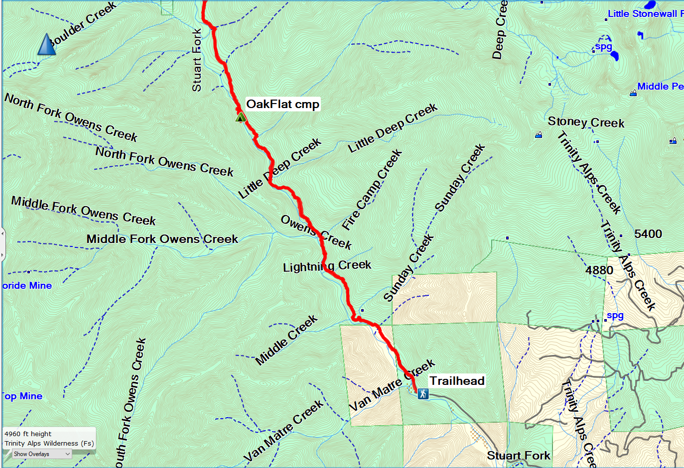
As I hiked up the trail, I eventually could see a glimpse of the mountains in the distance, looming over the Stuart Fork creek.

After about 4.5 miles, I came to an obvious creek-side campsite with quite a bit of space. It seemed to be just a bit south of "Oak Flat" camp on the maps, but larger than any area that corresponded to the Oak Flat location. I had the entire campsite to myself, except for a large deer who moseyed slowly through the camp. I was successful with my first bear food hang; the 2CR method doesn't require a leaning tree, and although it requires a bit of trial and error to achieve the desired height, it seemed easier than the counterbalance or the PCT method for height- challenged people like myself.


Aaah, it is nice to be back in the woods again! The rushing creek lulled me to sleep.
Day 2: Creekside Campsite to Portuguese Camp: 8.7 mi / 14 km
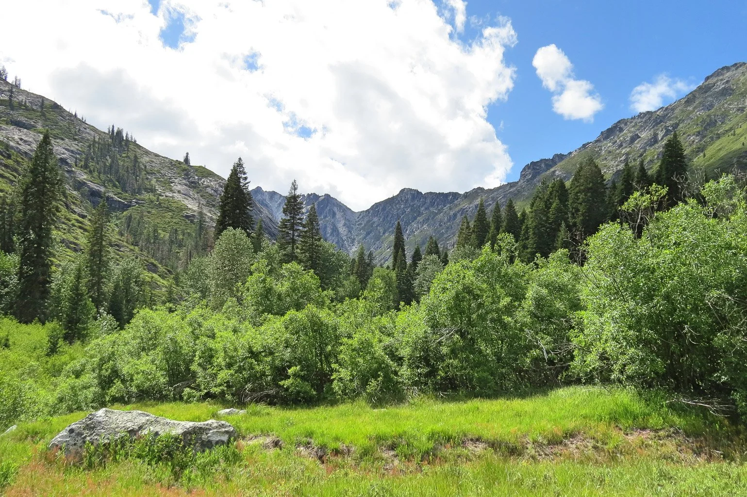
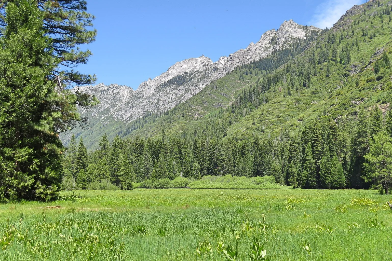
After sleeping poorly during the night, I was up at ~ 8 a.m., and it felt quite cold. After experimenting with photos of the creek, I hit the trail around 11 a.m., heading north for Morris Meadows. Along the way, there were nice views of Deer Creek and the mountains in the distance.


After exploring the campsite areas in the meadows, I headed north through the meadows on the northbound trail. While walking past the creeks after the trail turned west, I heard a little whinny of surprise and saw a shaggy cinnamon-colored hind end of a critter disappearing into the brush. Peering into the bush, I saw a large adult sow black bear, who was patient enough to allow me to take some quick photos of her hiding in the shrub. Then I heard additional noise and saw a 1-2 year old cub also hiding in the brush -- I hadn't seen him originally. I moved on quickly then, not wanting to disturb their foraging or strain her maternal instincts.


Mama bear hiding in the brush. Although I didn't see him at first, a 1-2 year old cub was hiding in the brush on the lower right. Once I saw him, I moved on quickly.
I continued down the trail toward Portuguese camp, arriving after 8.7 miles. I was happy to see that no one else was camped there, and I got a nice site set back from the creek.

Day 3: Day hike to Emerald and Sapphire Lakes from Portuguese camp: 5.8 mi / 9.3 km The next morning, I had a leisurely breakfast before removing the trekking poles from my tent and starting an enjoyable hike to the Lakes. The first mile up to Emerald lake was an easy forested trail, which then became more rocky and exposed.


Emerald Lake
I relaxed a bit at Emerald Lake and basked in the sun before making the trek to Sapphire lake. Quite a few folks were camping at Emerald Lake, and I was glad I had stayed at Portuguese camp. Some of the campers at Emerald Lake warned me of an aggressive mountain lion in their site the previous night. They seemed a bit shook and were moving their camp further back into the forest away from the ledges. The trail to Sapphire was much rockier and more exposed, and as I arrived, I saw there were no people camping there, just day visitors.

Sapphire Lake. Mirror Lake is on the ledge, center right. I chose not to scramble up there.
I relaxed by Sapphire lake for quite a while, having lunch and taking photos. A ground squirrel tried unsuccessfully to steal my food, so I snapped a few shots of him. The sun was warm and the weather perfect, so I enjoyed the scenery for a bit before hiking back to Emerald and then to Portuguese camp.


Looking down on Emerald Lake from the trail to Saphhire Lake


Day 4: Portuguese to Creek Camp: 9 mi / 14.5 km I packed up the next morning in a leisurely fashion and started hiking southeast back to Morris Meadows. I stopped in Morris Meadows again to enjoy the scenery and to get more water. It was quite warm and got progressively hotter as the day went on. I continued hiking south on the gentle descent and stopped at a pretty little spot at Deer Creek for a picnic lunch of rice cakes and re-hydrated chocolate hummus. While I was there, a very friendly group of 5 women hikers also stopped there for a break. They had hiked down from the Four Lakes loop (one of my future destinations I hope), and said they hiked a lot together. I continued south on the trail and arrived at my first night's campsite south of 'Oak Flat' around 4 pm. Because of the long drive, I didn't want to just hike all the way out, but preferred to start the drive in the morning. I was once again lucky enough to have the entire campsite area to myself.


Day 5: Creek camp to Trailhead: 4.5 mi / 7.2 km I slept a bit better on my last night and packed up fairly efficiently for the hike out. I was back at the trailhead around 10:30 or so, before it got too hot. There were plenty of hikers heading in on the Friday morning, so I was glad to be off the hiking trails and avoid any risk of exposure to Covid-19. Another great backpacking trip in a beautiful wilderness!
As even my amateur photos attest, this trip offered beautiful scenery, and plenty of flora and fauna to admire. The trip is quite easy with a gentle slope the entire way. Plenty of campsites exist along the creeks (see below), and by avoiding the more popular lakeside sites (quite overused and likely fragile anyway), one can experience solitude even among a post-Covid-shutdown crowd. It could easily be done in a weekend, but I highly recommend taking the time to savor this trip!
LOGISTICS
Photos by Cris Lewis Canon Powershot HS50
Wilderness permits are available on a walk-up basis from the Weaverville Ranger station. Even if the station is closed, permits are available from the outside kiosk, and are free. No quotas exist, at least as of July 2020.
An excellent guidebook for the Trinity Alps Wilderness is Lewon, Dennis (2001). Hiking California's Trinity Alps Wilderness Falcon Guide, Morris Publishing. ISBN978-56044-713-9
If you arrive late, or want to camp overnight before driving to your home destination, there is no shortage of delightful campsites on the west side of the trail along Stuart Fork, before the Oak Flat area.