PACIFIC CREST TRAIL SECTION TRINITY ALPS 2022

I've had the Carter Meadows section of the Pacific Crest Trail on my list for a while, and the weather in September was accommodating. I knew the area had suffered in the recent wildfires, but I wanted to go anyway, to witness the damage and to see this part of the Trinity Alps and the PCT. I confess I was unprepared for the emotional impact of the devastation from the fires.


Overall GPS track on GaiaGPS map, with elevation plot

Day 1: Carter Meadows Trailhead to Hidden Lake: 1.1 mi / 1.8 km
I had a long drive from the Bay Area to Weaverville to pick up my wilderness permit, and then to the trailhead northwest of Callahan, so I decided to spend the first night at Hidden Lake, just a short hike in. There were ominous clouds looming, and I saw the first evidence of the wildfire damage right at the trailhead.


It was a quick hike in, and I had time to set up my tent and take a few photos before the first few drops of rain began to fall. The rain was light, and continued during the night. I had the entire small lake to myself, to my delight. The fire had hit most of this area, sparing a few trees near the lake.
Day 2: Hidden Lake to Trailhead and Mavis Lake: 8.5 mi / 13.7 km
The next morning I was up early to hike back to the trailhead and drop off a few items from my pack, before beginning the hike to Mavis Lake. The rain had stopped, fortunately, and didn't resume for the rest of the trip.
I had examined the Recent Fire overlay in Gaiagps.com before I left, so I knew I would not escape the burned forest until I reached the East Boulder Lake area. Nevertheless, it was shocking to see so many completely scorched trees and hillsides. The forest felt eerie and silent, in spite of the occasional birds. The Pacific Crest trail was well maintained, however, and I had forgotten that it is designed to not have dramatic changes in elevation. This made the entire trip mostly a gentle hike


Entire hillsides were scorched.


Throughout the hike, I saw evidence of trees "bleeding" red sap. I'm not certain if this is caused by beetle infestation, which is common after a fire, or some other post-fire damage.
The hike down to Mavis Lake was somewhat steep, and as this area was severely damaged by the fire, it was like hiking through a moonscape. There was very little green to be seen on the way down, and the soil was mostly a dusty, ashy gray. There appeared to have been significant digging and excavation throughout the Mavis Lake area, I assume by firefighters attempting to quench any smoldering roots. Although I saw some wildflowers valiantly brightening up the trail on the PCT, the day's views made for a very sobering hike. I had Mavis Lake all to myself as well, and the silence added to a somber atmosphere.


Day 3: Mavis Lake to East Boulder Lake: 7.9 mi / 12.7 km
With the big hill east of Mavis Lake, it took a while for the sun's rays to reach my campsite in the morning. I was eager to hike into the area that was undamaged by the fires, and to see the Boulder Lakes areas. The stretch of the PCT between the Fox Creek Lake Trail and the cut-off trail to East Boulder Lake is fairly dry, but there are two springs that were running where one can fill water bottles, even in September during a drought year. (Waypoints are included in the GPX file below and on the map above). I passed a few solo PCT through-hikers on the trail, who were all moving quickly. I exchanged a few words with one fellow, and we commented on the difference in atmosphere between a live forest and this devastated one. It seemed to me that the air felt entirely different, less invigorating and almost oppressive, although there was of course no smoke present. The woods were silent without the usual noise of the wind in the trees. Perhaps on some subliminal level I was sensing lower levels of oxygen and oxygen radicals in the scorched forest. I felt as if I was at a funeral, surrounded by recently dead entities.


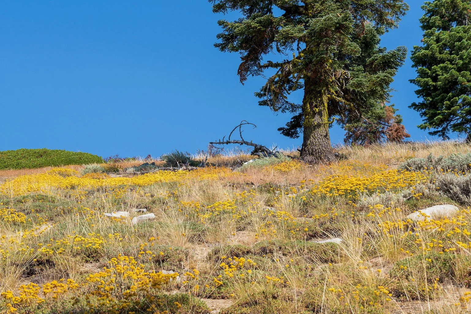
I passed more devastated hillsides, with a few opportunities of vistas to the east. However, there were also reassuring swaths of delicate wildflowers coming back, and some wildlife.


I looked down into the valley that held Middle Boulder Lake and its lakelets, but I noticed that the trail to Telephone Lake did not seem clear, at least what I could see of it from the PCT. At the 4-way intersection with the PCT and the 5582 and 8W02 trails, I saw a faraway peek at Marshy Lakes to the east, and the Upper Boulder Lake and lakelets below me. At this point, the trail became much more green, as I exited the burned area, and the terrain became much more rocky and arid.


As I made my way down toward Upper Boulder Lake and its lakelets, I saw the first sign of the cattle the guidebook had mentioned. They were grazing in the parched area by the lakelets and there did not seem to be much grass available. They were shy, and trotted off as I quietly approached. I was looking forward to reaching East Boulder Lake, as it was reviewed positively on hiking websites. However, when I arrived, I found campsites that had been quite trashed by the cattle. Most of the tent sites contained several piles of cow dung in various stages of decay, from fresh to dried powder. The ground from the trees to the lakeside was pitted and torn from the cattle, and the grass was minimal. Between the drought and the cattle, poor East Boulder Lake has seen better days! I was able to find a site for my tent that was dry and dusty, but at least devoid of cow dung, and I set about hanging my food and doing camp chores.
Overall, I was pretty disappointed in East Boulder Lake, considering it perhaps the second worst lake I had camped by in recent treks, with Grouse Lake in the Emigrant Wilderness being the worst. Once again, I was happy to have the entire lake to myself. I watched the ducks in the lake, relaxed, and took some photos. That night, it was COLD, and I slept poorly.


The campsites were filled with cow patties and the green grass was sparse.
However, the lake was peaceful.
East Boulder Lake Panorama

Day 4: East Boulder Lake to Mavis Lake: 8.4 mi / 13.5 km
I wasn't unhappy to leave East Boulder Lake behind, and was looking forward to hiking up to the Boulder Tie trail to complete the loop back to the PCT. Once past the cattle in the valley, the ridge was a delightful hike west then south, at first shaded and forested with few views. Further south, the trail opened up a bit for views of Middle Boulder Lake below, before making a steep climb through boulder fields and some marshy areas, back up to the PCT.

Middle Boulder Lake from the Boulder Tie Trail
Back at Mavis Lake, I explored a bit more, but was happy to relax and head to my tent as the light faded.


Fireweed among the burned logs, in fading sunlight.
Day 5: Mavis Lake back to the Trailhead: 7.3 mi / 11.7 km
I took one last photo of Mavis Lake in the dawn light, then began the hike out. The trip back to the trailhead was enjoyable, especially as the day warmed up. I arrived at my car near noon, but wasn't able to leave until nearly 6 pm, as I had foolishly left on the dome light in my Prius, and had to contend with a dead car battery!

Mavis Lake at dawn
It was sobering and heartbreaking to see such widespread devastation in this beautiful area, especially knowing how much of it is due to human interference. Although I believe the forest will recover, it will take many years, and thus I would hesitate to recommend this part of the PCT for some time. Unless the cattle grazing situation is changed, I would not recommend East Boulder Lake for an overnight visit; there are much better lakes throughout the Trinity Alps Wilderness. The Pacific Crest Trail was well maintained and followed a gentle terrain; I'm now prompted to seek out other parts of the PCT to explore.
Photos by Cris Lewis; Sony alpha 6600, 18-135 mm Sony lens.
LOGISTICS
Wilderness permits are available on a walk-up basis from the Weaverville Ranger station. Even if the station is closed, permits are available from the outside kiosk, and are free. No quotas exist, at least as of September 2022.
An excellent guidebook for the Trinity Alps Wilderness is Lewon, Dennis (2001). Hiking California's Trinity Alps Wilderness. Falcon Guide, Morris Publishing. ISBN 978-56044-713-9
There is limited cell reception in the nearest town of Callahan, and none at the Carter Meadows trailhead, although I was told it might be available by hiking a bit further east up the mountain road.
Feel free to download and share this GPX file of waypoints for this trip.