Hetch Hetchy Loop 2023
Earlier in the summer, I had made reservations in the Hetch Hetchy area for a loop backpacking trip, hoping to take advantage of the cooler weather to squeeze in a ‘shoulder season’ trip before it got too cold. The best laid plans… It turned out to be a very hot week!

Location of the Hetch Hetchy entrance to Yosemite National Park in California

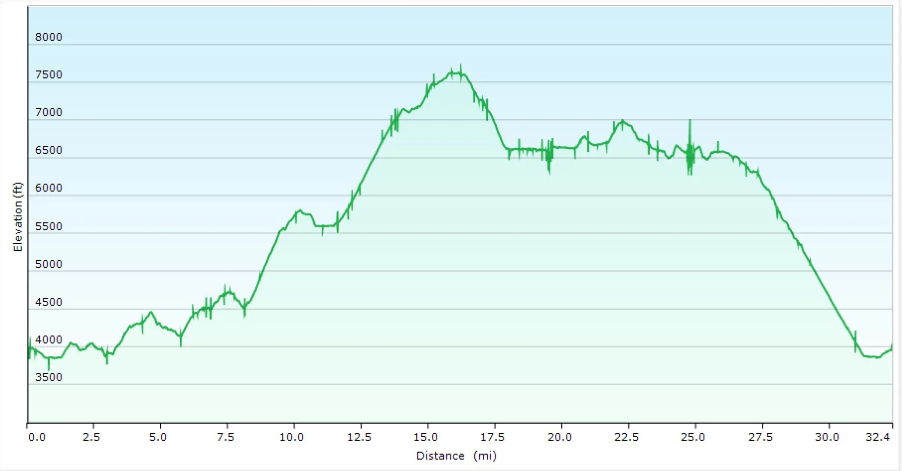
GPX Track of my loop route (L) and altitude profile (R) Total Distance: 32.4 Miles ( 52.1 km)
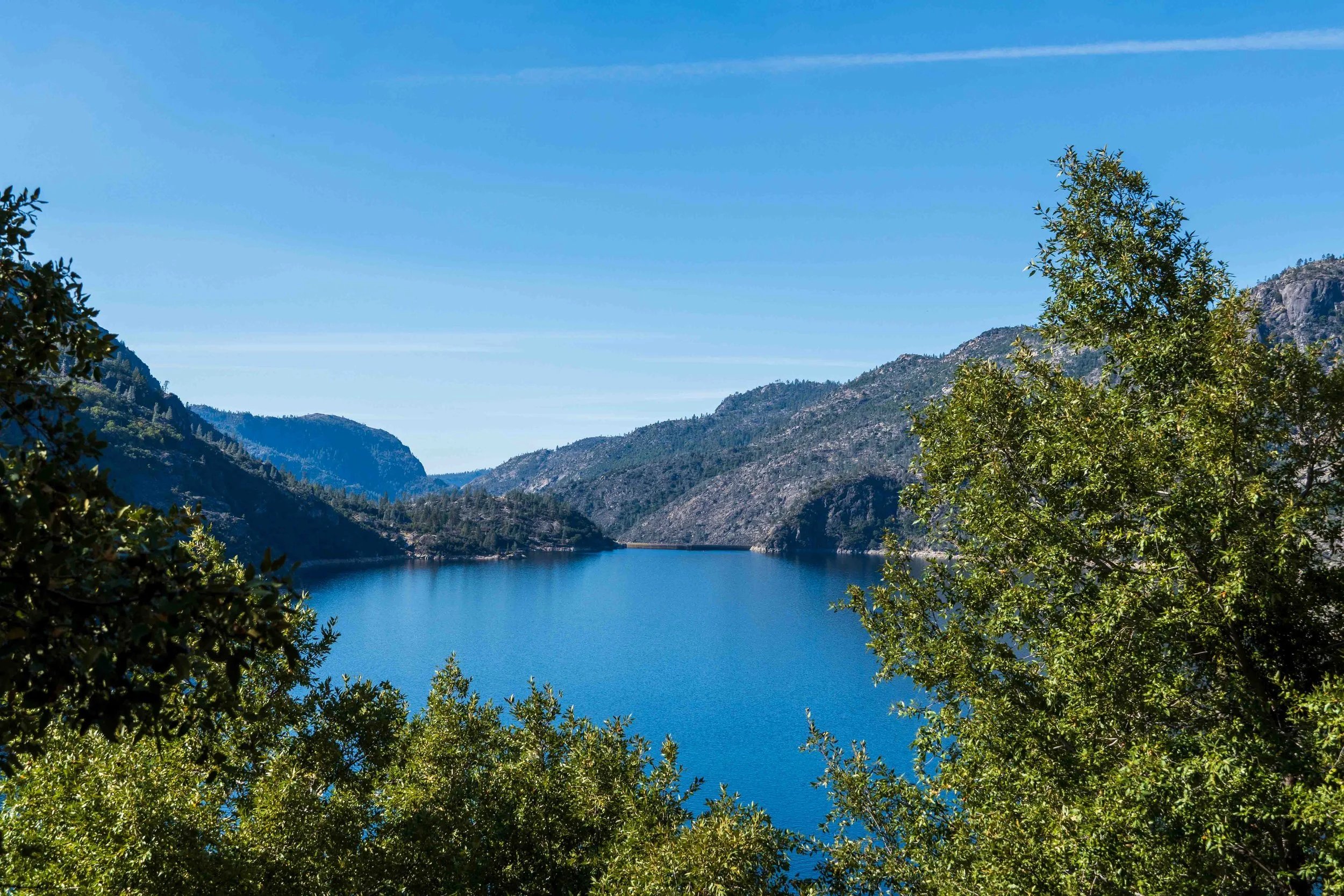
Arrival in Yosemite National Park: For convenience, I drove out to Yosemite from the Bay Area the day before my hike, picked up my permit and camped overnight in the Hetch Hetchy backpacker’s camp. The rangers I spoke to warned me it was going to be hot, up to 80°F, and to take precautions for the heat. I was disappointed by the conditions, as I had been hoping for crisp fall weather. I debated whether to change my plans for a short trip at higher elevation, where I might still be able to get a last-minute permit. But I decided to proceed with my plans, reasoning that it would be cooler at higher elevations. I walked out to get my first look at the reservoir and take some photos.


Day 1: Trailhead to Rancheria Falls and Camp: 8.1 miles - 13 km
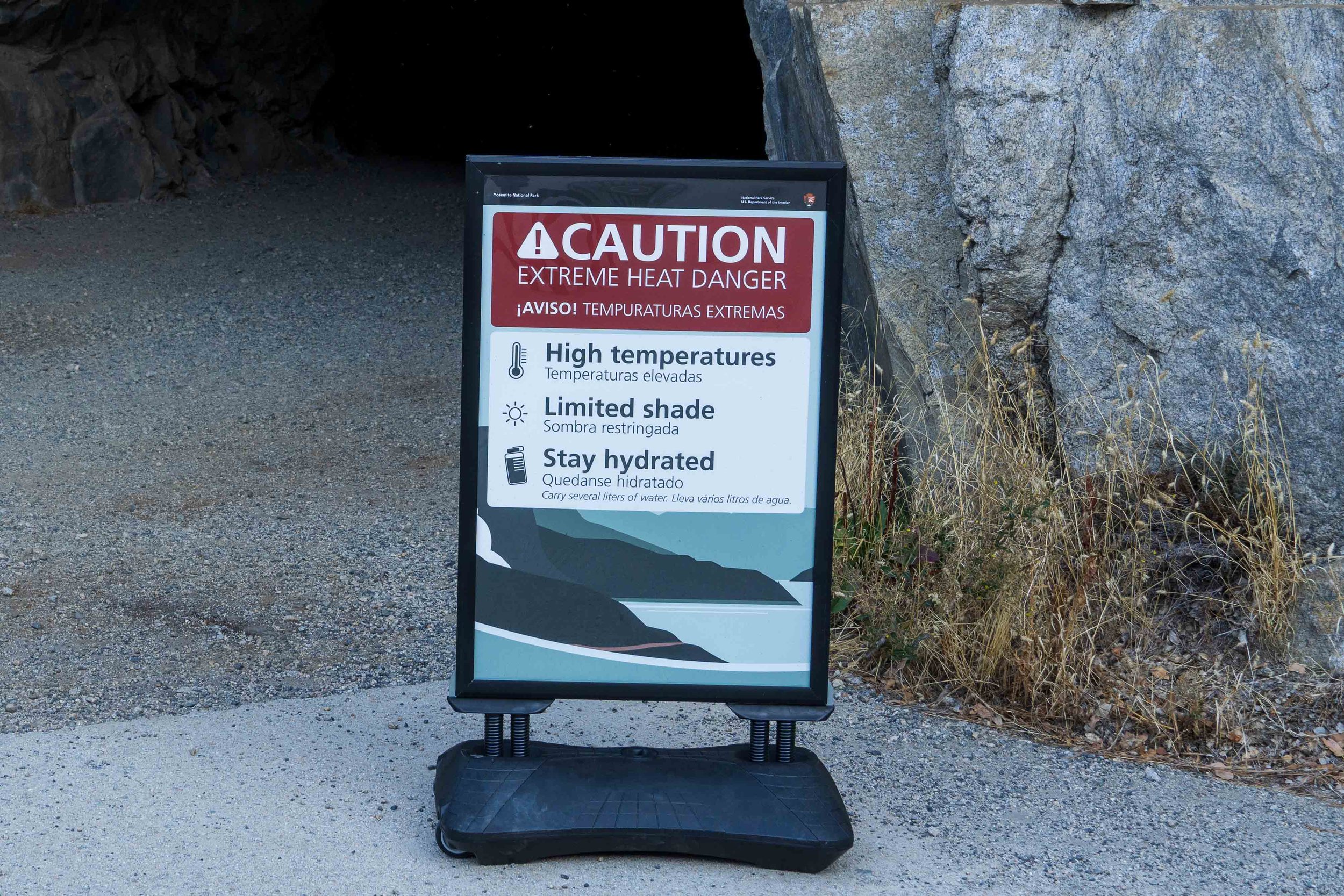
I had a leisurely start and the morning was cool. The dam was already busy with work crews doing construction and maintenance at the bridge, and the sign at the tunnel entrance warned hikers of the heat.
It was indeed warm as I hit the full sun once I passed through the tunnel. I passed a trail crew hard at work; they begin trail work at 6 am to beat the heat!

Wapama Falls
I stopped at Wapama Falls to refill water and take a photo, and the hike to the Rancheria campsite was easy. I put on my headnet to avoid the bugs after Wapama, and I passed two hikers on their way out who reported the bugs were bad. In the later afternoon, I collected more water and hiked to Rancheria Falls for photos. I was early into the tent after dinner to cool off and avoid the bugs.


Day 2: Rancheria Cmp to Lake Vernon 11.3 mi
I was on the trail before 8 a.m. in an attempt to beat the heat. The climb up to Tiltill had plenty of switchbacks so was not too taxing. As the sun came out, so did the bugs, and a backpacker descending the trail told me he found it too buggy. Indeed, they were swarming heavily as I stopped at the creek for a water refill. The rest of the day was more difficult, hard and steep in places, with no shade on mostly exposed granite, and I was carrying extra water.


Near the top of the climb was a pretty spot with a small creek, and I saw three samples of bear scat. It was a good location for a bear to avoid people.

The descent from the pass was mostly cobblestone granite on a well-maintained trail. Although a sign near the bottom said the lake was only 0.1 miles away, it was another 0.8 mile to the campsites. I found a beautiful spot on the northeast side of the lake, and had the entire lake to myself. After dinner I took some long exposure shots of the lake at sunset. At this higher altitude, it was cooler and the bugs were minimal. It was worth the hot and tiring day!


Day 3: Lake Vernon to Laurel Lake 5.3 mi
I packed up leisurely the next morning, taking my time knowing I had a low mileage day. It was already hot, but thankfully most of the hike was in shaded forest. I spied this white-breasted nuthatch working away; not a bird I see at home.

Laurel Lake was beautiful, and once again I had the entire lake to myself, with a nice breeze and no bugs. I had a relaxing afternoon, exploring the lake, taking photos, and doing camp chores. That night, a juvenile great horned owl called most of the night. Camping at this lake made the entire trip worthwhile!


Day 4: Laurel Lake to Trailhead 7.6 mi
I was up around 5:15 a.m., hoping to get an early start to beat the heat for the hike out. The forecast was for higher temperatures on this day, and I knew the trail was more exposed. Fortunately, it offererd a mix of shade and sun for the first half, then endless switchbacks and a long fire road trail finally dropped down to the original trail near the tunnel. I arrived back at the car before noon, and was happy to be heading for the coast, leaving the heat behind.


I believe Hetch Hetchy is best visited in late fall, winter or early spring, although snow can persist at the higher elevations well into June. The loop provides an enjoyable variation in scenery, and I found plenty of solitude at every campsite mid-week. The climb from Rancheria Creek to Tiltill Valley, over the pass and down to the Lake Vernon campsite can be long, especially with the heat and the need to carry extra water. But the higher elevation makes Lake Vernon and Laurel Lake delightful campsites. Just don’t go in the summer, and aim for a cool weather forecast!
Photos by Cris Lewis: Sony Alpha 6600, 18-135 mm Sony lens.
LOGISTICS
Wilderness Permit reservations for Yosemite National Park are available 6 months in advance, or up to 7 days in advance where openings exist. After leaving Rancheria Creek, I saw no other backpackers the entire trip!
The entire loop trail is well maintained and the campsites are spread out to offer expansive sites and privacy at each location.
Bear-proof containers are absolutely required in Yosemite National Park.