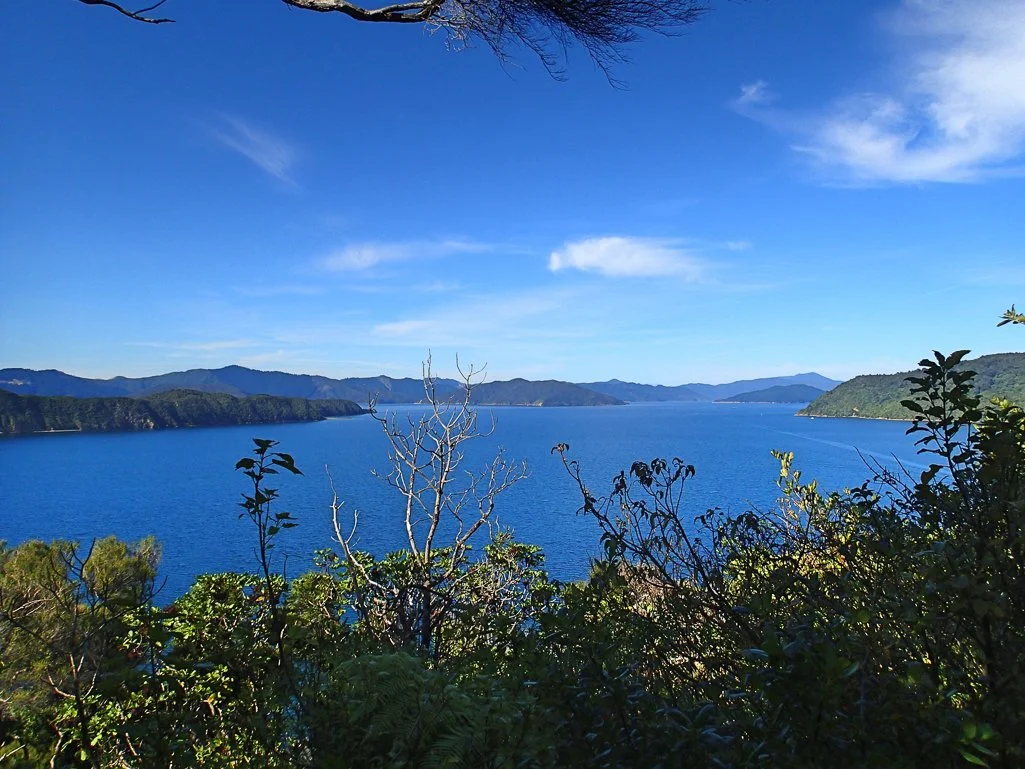
MARLBOROUGH SOUNDS

After paddling along the golden sands of the Abel Tasman Coast, my next paddling destination was Marlborough Sounds. A premier ocean paddling area between the North and South Islands in New Zealand, Marlborough Sounds offers some beautiful protected bays, plenty of marine and avian wildlife, and greater opportunities for solitude. All the camping areas are maintained by the Department of Conservation, and offer the relative 'glamping' conditions that New Zealand is known for: established campsites with maintained outhouses, fresh water, and idyllic scenery.
Route Overview: Seven Days, 84.2 km / 52.3 miles


After a week or more of waiting out a cyclone and some accompanying poor weather, I had to forego my plan to paddle out of Havelock in Pelorus Sounds, the area to the north of Marlborough Sounds. I had planned for a week in Pelorus and Kenepuru Sounds launching from Havelock, followed by a week or so in Marlborough Sounds launching from Picton. Instead, after the weather cleared I made my way to Picton to scout a launch spot and check in with the DOC site. Picton is a charming little town right on the harbor, with pubs and a few grocery stores and shops. The two major ferries to Wellington dock in the north east section of town.

Day 1: Paddling route (in gold) from Picton Harbor to Ratimera Bay.
Just outside the harbor, I crossed over to the north side at a small island, to avoid potential ferry traffic. I was glad I did, as there were fewer houses on the northern side, and far less boat traffic. Conditions were excellent and I turned into Ruakaka Bay before noon. A motor boat was anchored at Ratimera Bay, and 2 couples were nude sunbathing and picnicking on the beach. I felt badly about invading their idyllic picnic, but they were incredibly friendly and accommodating. As I unpacked and set up my tent, they offered me some of their picnic lunch, an apparent iconic New Zealand dish: Whitebait fish fritter sandwiches! Whitebait fish are small (~2 cm) fish that look like minnows, and are eaten whole after being packed into a fritter and fried. The fish themselves didn't have a lot of flavor, but the fritter sandwiches were great, especially after my morning paddle. I had plenty of time to lounge on the beach, as a couple small groups of boating picnickers came and went. A doubles kayak pulled into the bay at dusk to camp, but there was plenty of room for just three of us at this nice campsite. When I was up during the night I saw many sets of glowing eyes -- lots of maurading possums about.


Day 2 -- Ratimera Bay to Cannibal Cove: 23.2 km / 14.4 mi I was up early the next morning and packing up while listening to the weather report -- on Channel 68 instead of 67, the channel I had used on the Abel Tasman Coast. The forecast was consistent, with good weather for the next two days but a strong gale after that, so I planned not to paddle on that day.

Day 2: Paddling route (in gold) from Ratimera Bay to Cannibal Cove, at the mouth of Queen Charlotte Strait.
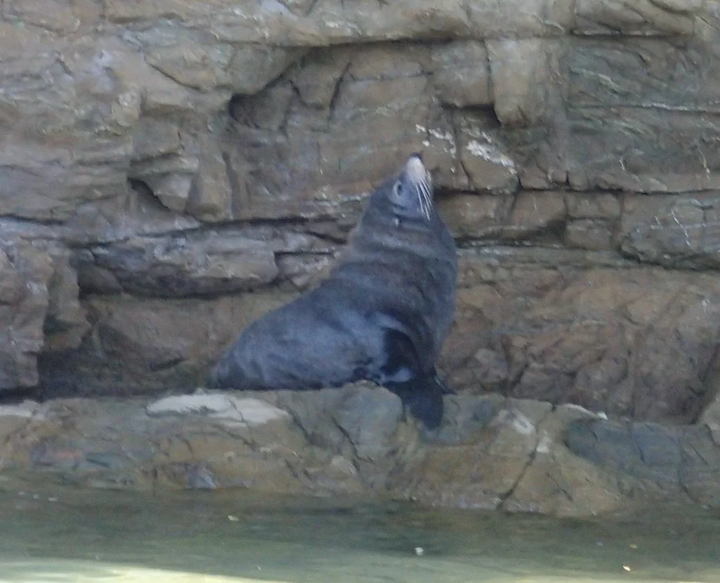
I was on the water before 9:30 a.m., paddling in warm sun and clear skies with very little breeze. I stopped a few times to take pictures and watch the "shags" (cormorants) and a contented fur seal along the way.


I decided to pass on stopping for lunch, and instead paddled on to Cannibal Cove, landing a little after 2 p.m. Apparently, Cannibal Cove was named by Captain Cook's european explorers, who claimed that the natives had admitted to eating human remains. The beach was quite rocky, but fortunately there was a small stretch of sand on the western side that allowed me to avoid dragging the kayak over the barnacles. The campsite area was pleasant, if small, and the long-drop loo was a short walk into the woods from the tent sites. Water had to be gathered from a stream just east of the camp sites.

Approaching sunset at the field just east of camp


Sunset at Cannibal Cove
In the evening a kayak double landed on the beach, and a very nice German couple set up their campsite. They prepared a huge meal of curry vegetable stew and were kind enough to share it with me --- Delicious! We traded kayaking adventures and plans, and we all considered ourselves so lucky to be able to paddle in this beautiful location.
Day 3 -- Cannibal Cove to Motuara, Long, and Blumine Islands: 19.4 km / 12 mi This was the paddling day I had most anticipated, as I had read about the Motuara Island bird sanctuary and was eager to visit these predator-free islands. Unfortunately, camping is not allowed there, but it is well set up for boating visitors, with well tended walkways and exhibits, and fantastic views. As the gale was due the next day, I wanted to keep a close eye on the weather in case the winds picked up early in the afternoon.

Cannibal Cove to Motuara and Long Islands, then to Blumine Island (in gold).
It was already a warm, sunny day as I packed up and launched from Cannibal Cove. I was treated to a beautiful sunrise from the shore.
I paddled straight over to the boat mooring pier at Motuara, and a tour boat had just arrived. The kind boat operator helped me tie up my kayak to the tall pier. Still wearing my sprayskirt, PDF and kayaking booties, I hiked up the trail around 10:00 a.m. There were quite a few tourists on the trail, some proceeding quietly with cameras and others talking. I had been warned by my German camp-mates to wait out the noisy crowds in order to fully enjoy the island, so that was my plan. There was a well-maintained trail to the top of the island, and the bird noise was noticeable, particularly in comparison to the mainland. I saw quite a few South Island robins; most of these birds were banded and not at all shy, as I had observed on the Milford Track. One even pecked at my smelly neoprene kayak shoe when I stopped to take a picture! I enjoyed the beautiful sweeping panoramic views en route to the lookout platform at the top, and stopped there long enough for the crowds to head back down. On the way down, I stopped at the bird bath structure for a while, and with most of the people gone I could watch the birds fly in for a bath. What a magical island! It would be great fun to work here on one of the ecological projects.

Motuara Island Slideshow


When I finally returned to the pier, the tide was quite a bit higher and the tour boats were gone. I reluctantly departed Motuara, as I wanted to allow enough time to see Long Island before the afternoon winds picked up. I circumnavigated Motuara, enjoying the melodic birdsong from the water, and watching a lounging fur seal. I also saw lots of shrimp krill in the waters, the first time I'd seen these while paddling, although they are a plentiful food resource for whales. Near the south end of Motuara I crossed east to Long Island, which is also a marine and bird sanctuary. This island is more barren and steep, and heavily cleared from bygone logging and goat farming days. There were few places to land, except for a small pebbly and boulder-strewn beach on the southwest side. As I stopped for a quick lunch, I saw the northwest winds were already picking up, with frequent whitecaps, but fortunately it was a tailwind! After a quick look around the corner at the east side of Long Island, I headed back south. I made a quick jaunt to Blumine Island, assisted by the wind and a few surfed wind waves. Blumine is another nice island that offered extra hiking areas and historical World War II embankments to visit. There were several cheeky weka hanging about the campsite.


Day 4,5,6 -- Lounging and waiting out the weather on Blumine Island: 11.6 km / 7.2 mi Hike
I had all of Blumine Island to myself the first day, as I set up camp, treated water and rested. The weka almost made off with my water purifier, so I started keeping everything inside my duffel bag when not in use. The next day, the gale winds arrived as predicted, with building whitecaps and ultimately wind surf and whitecaps all the way into the bay. It was a good to rest in camp, read, and nap. I had the island to myself until late afternoon, when a trio of kayakers paddled up and set up camp. They had paddled from the north with the wind, but still seemed relieved to be on land. On day 5, I made the mistake of leaving my plastic camping cup unattended while talking to one of the campers from Auckland, and the cursed Weka stole my empty cup from the picnic table! I looked all over the bushes for it, but it had well and truly disappeared into the hidden Weka cache.
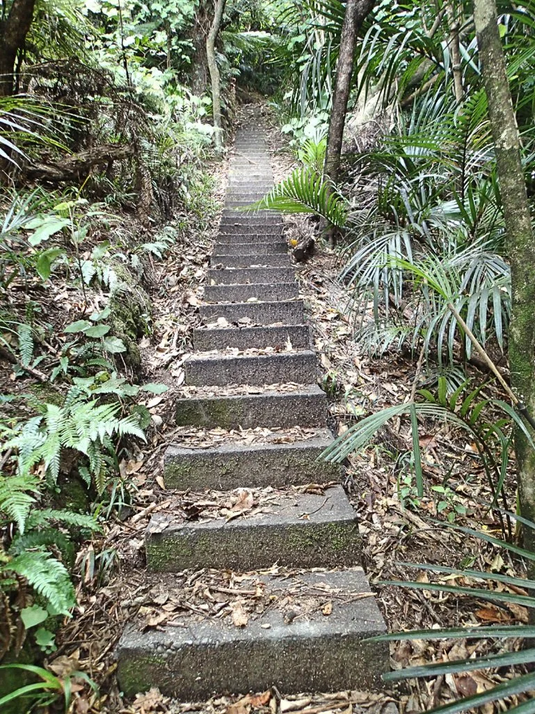
I set off to explore the hiking trails at mid-morning, and enjoyed a long day of hiking the trails, seeing the historical barracks remains, finding a few well-hidden geocaches, and exploring the other side of the island. Most of the island seemed partially inaccessible due to overgrowth, so the trails were appreciated.

The hiking path I took while exploring Blumine Island


The weather forecast for the next day brought unexpected news: another front was moving through, this time from the south. A strong southern wind and rain was forecast for overnight and the next day, requiring me to change my plans and stay another day on Blumine. I had plenty of food, so wasn't worried. That evening, there were dark clouds in the sky and the wind surf was pounding the shore. It rained throughout the night, and I lazed in my tent reading and resting.
When I emerged from my tent after 9:00 a.m., I saw that it was sunny, and the water was calm. I was surprised that the storm might have blown over so quickly. I had breakfast and decided to pack up and circumnavigate Blumine Island and then cross over to Ruakaka Bay. As I was packing, however, I felt the wind pick up, and within 30 minutes there were whitecaps from the south on the strait, with large wind waves coming in. It suddenly looked very windy out on the strait. I watched a sailboat approach our bay, quite heeled over and struggling to get out of the wind. That boat and several other pleasure boats came into the bay and anchored in front of the campsite, one group saying the wind was "terrible out there". As I was warned, the weather can change very rapidly in New Zealand! Given that it would have been a significant headwind, I decided to stay in camp as I had originally planned and depart on Sunday, paddling either to Ruakaka Bay or Picton. As the wind died in the late evening, I was rewarded with another sunset over the mountains.
Day 7 -- Blumine Island to Picton: 25.2 km / 15.7 mi The next morning, the forecast for the day was perfect - a light south wind and clear skies. But yet another front was moving in the next day, with winds forecast for 25 knots in late afternoon and up to 30 knots the day after. I decided to just paddle all the way back to Picton and end the trip after seven days. I had seen most of the area I had wanted to see, but would have liked to circumnavigate Blumine island and even explore Pickersgill and Arapawa Islands to the east. I had already booked passage on a ferry to Wellington 2 days hence, and might benefit from time to unpack and dismantle my kayak. But I was thrilled to have enjoyed what I did of Marlborough Sounds, and so packed up with a light heart.

Blumine Island back to Picton Harbor
The paddle back was uneventful but enjoyable - warm with a slight headwind that dissipated toward the afternoon. Aside from one bio-break stop on a tiny patch of shore past Ruakaka Bay and a coasting lunch on the water at AllPorts Island, I paddled straight through, enjoying the sunny day and the beautiful northern shoreline. I managed to dodge both ferries by 40 minutes or so, and paddled past the community of Waikawa and "The Snout", the isthmus near Picton that pokes into the Strait. I arrived back in Picton Harbor a little after 2:30 p.m., and began the process of unpacking and sorting gear.


Paddling back to the charming Picton Harbor
Marlborough Sounds made for a delightful kayaking destination, and one that offered more solitude than the Abel Tasman Coast, and more of a 'wilderness' experience. The weather can be more fickle than the Tasman Coast, as it is less protected and the winds can move along Queen Charlotte Strait with its long fetch. Motuara Island was a true gem, and I could easily have spent more time visiting there. All the campsites I stayed at were charming, and not very busy in this late February time frame. I highly recommend this as a world-premier paddling destination for a relaxing kayaking trip with plenty of birds, history, and idyllic scenery.
REFERENCES AND LOGISTICS
Photographs by Cris Lewis, Olympus TG-2
Information about paddling in Marlborough Sounds can be found at the local DOC site, just a few steps from the Picton Harbor. Staff there are very helpful, and can even help to book ferry passage. They recommend bringing cash for the campsite fees, rather than registering in advance.
There is a designated lot for secure long-term parking at the Picton Harbor, just a few steps from the convenient harbor-front launch used by the kayaking tour guides. There is a ramp to drive a vehicle down for unloading. Parking in the lot is $5 / day, payable by credit card. I had no problem with theft or damage to the camper van during my trip. Launching is also available from a bigger marina and launch spot in Waikawa, about 8 km north. However, the long-term parking area in Waikawa is much further away from the launch, and the launch facilities are far more suited to larger boats than kayaks. Picton offers the ideal launch location.
All of the campsites I visited had fresh water, either from a faucet or from a stream at Cannibal Cove. In all cases, the DOC recommended purifying the water. The campsites were well maintained, with long-drop loos, some of which had been (necessarily) sprayed with wasp deterrent. I chose campsites that were less frequented by the backpackers, and had been recommended as optimal for kayakers. Indeed, they were all wonderful boat-in campsites.
I recommend paddling along the north side of Queen Charlotte Strait for prettier scenery, and to avoid most of the boat traffic.
The weather forecast in the Marlborough Sounds area was broadcast on Channel 68.