DINKEY LAKES WILDERNESS 2020

I came up with a plan to backpack in the Dinkey Lakes Wilderness when I was seeking a more remote location that might allow me to avoid crowds in times of Covid. The Dinkey Lakes Wilderness is within the Sierra National Forest, approximately 45 miles east of Fresno, CA. It offers a nice array of alpine lakes, a lollipop loop hike, flexibility and opportunities for side trips, and even some educational Earth geocaches. I chose the longer entrance to the Wilderness at Courtright Reservoir rather than the one at Willow Meadow, which requires 4-wheel drive to access. This trip offered low-mileage days with beautiful scenery and extra time to explore each alpine lake.
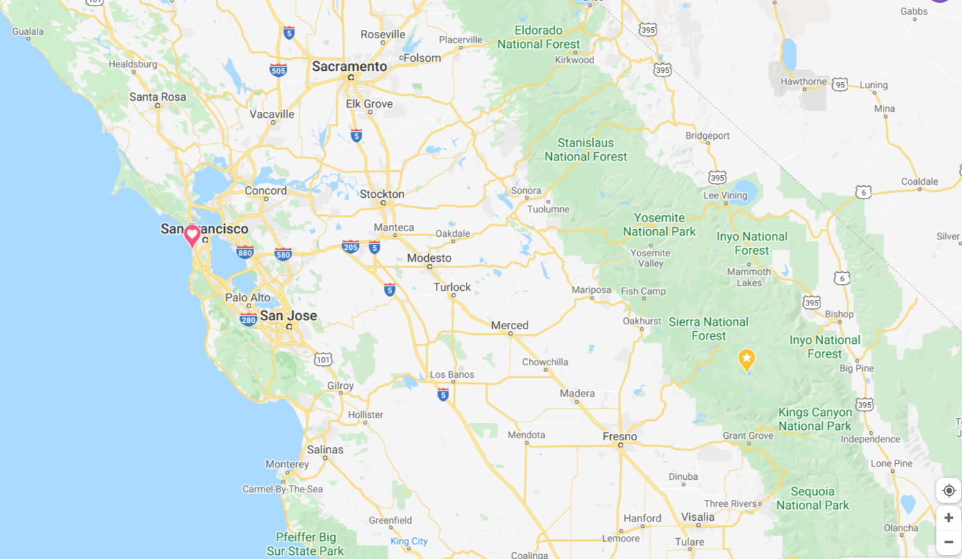
Location (gold pin) of Dinkey Lakes Wilderness in California

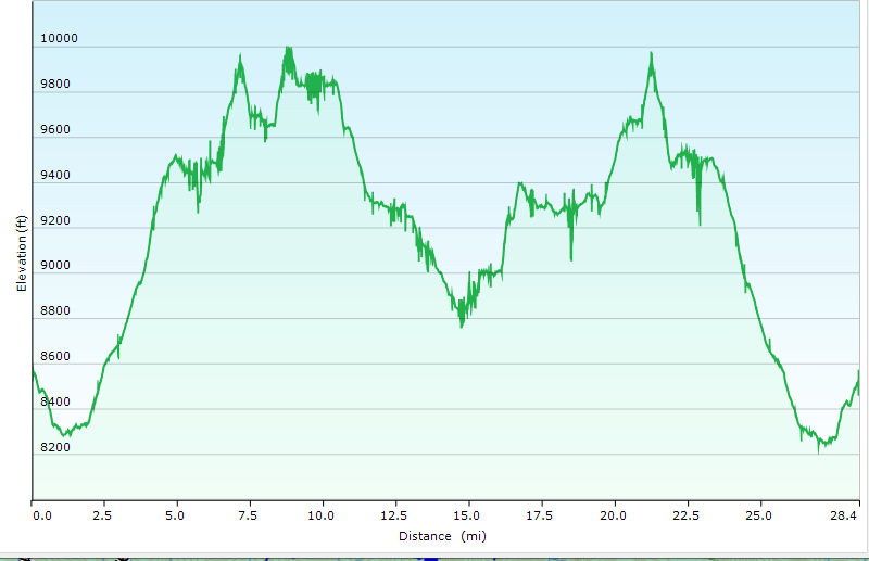
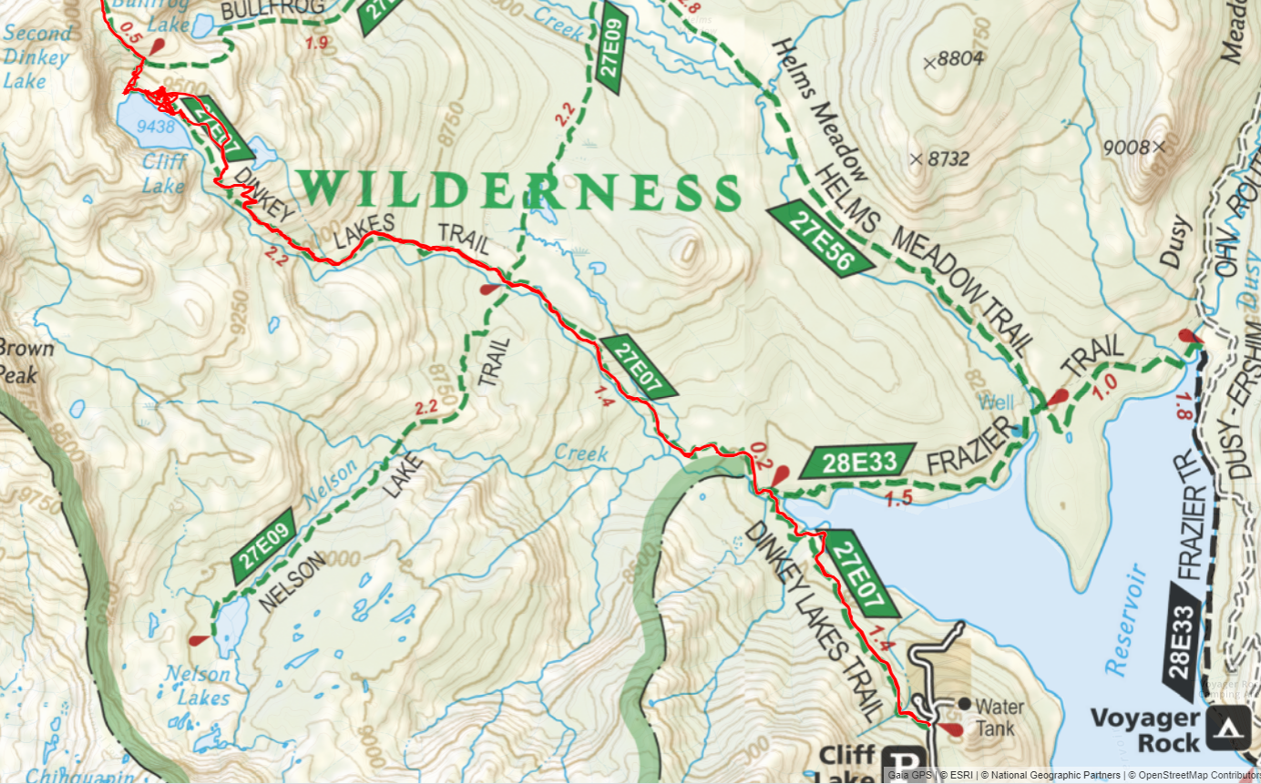
GPS Track of Dinkey Lakes Wilderness Trip; Total Distance ~ 28 mi / 45 km
Day 1 -- Courtright Reservoir Cliff Lake Trailhead to Cliff Lake 5.1 mi: The forecast was favorable with no rain all week, and temperatures were expected to be no lower than 40°F, even at the higher altitude. While there is a quota system for the Dinkey Lakes, I could receive my wilderness permit by calling the Sierra National Forest Service the day before and reserving one. The permit was then left outside the ranger station in Prather, California, for pickup, in order to avoid contact in Covid times. After the long drive from the Bay area, I arrived at the trailhead around 2 p.m. and started up the trail toward Cliff Lake. After I was well underway, some big black clouds rolled over and thunder began to roll. Trying to pack lightly, I hadn't brought rain gear, so I hoped it would blow over. Surprisingly, it did, and blue skies were predominant by the time I arrived at Cliff Lake. I was a bit tired by the time I arrived, and feeling the altitude at 9400 ft. I had plenty of time to set up camp before shooting some photos of Cliff lake at sunset. There were an enormous number of campsites all along the east and north side of the lake, with plenty of opportunity for privacy.


Day 2 -- Cliff Lake to Island Lake 3.4 mi: I had a leisurely breakfast the next morning, with only a short hike to Island Lake. I enjoyed having the extra time to explore the lakes and stop for photos. After a short climb further uphill on the trail, I started back downhill toward Rock Lake and Second Dinkey Lake.
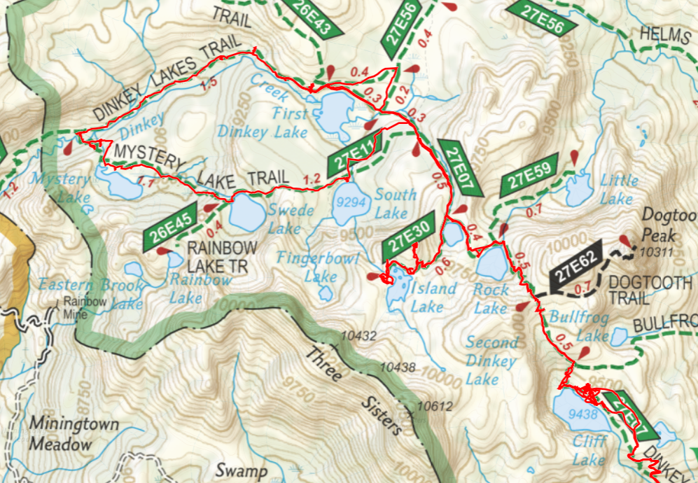


The initial climb to Island Lake was quite steep, and marked "Not maintained for pack use" -- I had to agree! I stopped along the trail and hid my pack to climb a hill that offered a magnificent view, a stealth campsite, and some (missing) geocaches. I spent a bit of time on the hill enjoying the far-ranging views of the entire area: one could see several of the lakes in the lower drainages and the eastern mountain range.
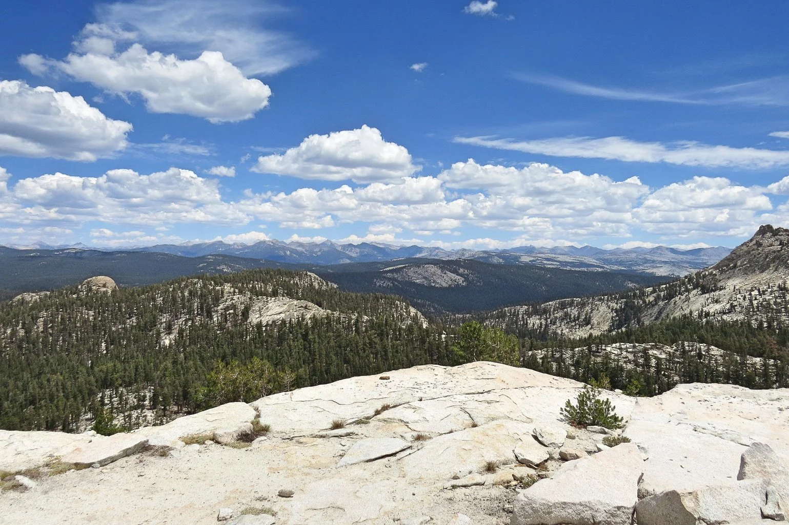


A panorama from atop the hill
I arrived at Island Lake around noon, with plenty of time to set up camp, relax, and explore the lake. There was only one other couple at the lake, and then a group of 7 fishermen arrived around dusk. There was plenty of space and privacy, with each of us spread out at opposite corners of the lake - what a prime location! A family of gadwall ducks paraded around the lake in the evening, and the sun set as a spectacular orange-red fireball in the sky behind the trees. The mosquitoes were few, thanks to a nice breeze.
Island Lake Slideshow


Day 3 - Island Lake to First Dinkey Lake and Loop Trail 8.4 mi: I was up fairly early, although reluctant to leave this beautiful lake behind. I hit the trail before 9 a.m. to hike west past Second Dinkey Lake and then north to First Dinkey Lake, which I had spied from atop the hill. First Dinkey Lake is, as described by an earth cache, a eutrophic lake, slowly filling with sediment from runoff. At a lower elevation, this lake has fewer campsites than other lakes, and they are not nearly as scenic, as I was to discover. Nevertheless, I had wanted to stay at First Dinkey lake as a convenient spot from which to start the loop hike, so I set up camp on the east side of the trail near the lake. After executing a bear hang for the food, I set off on the loop, hiking counterclockwise, to see the sights and learn about the geology of the area from the Earth caches.
DINKEY LAKES LOOP SLIDESHOW


The loop around the lakes is relatively short, downhill to Mystery Lake and back uphill toward First Dinkey Lake. I was surprised to see no one camping at Swede or South Lake, both beautiful spots with nice campsites. I was wishing I had camped at either Swede or South Lake, rather than First Dinkey Lake, as a basecamp for the loop. But I spent most of the day hiking and exploring around the loop, so didn't spend as much time at First Dinkey Lake anyway. The night was clear and much colder than at the other lakes, and I attempted some unsuccessful astrophotography from my campsite at midnight.
Day 4 - First Dinkey Lake to Cliff Lake 4 mi: The next day, I was feeling a bit tired from poor sleep, so decided to hike back to Cliff Lake to make for a shorter hike out the following day with my long drive. The hike back to Second Dinkey Lake and Rock Lake was uneventful, although I initially took a wrong turn and started down Helms Creek trail before correcting. I first set up my site at the northern end of Cliff Lake, which offered great solitude. However, the winds were pretty strong and extensive tree cover made the northernmost site much colder than the sites on the eastern side. I eventually decided to move my tent to the northernmost sites on the east side of the lake, which were much warmer in the afternoon sun. I still had plenty of privacy, with no one camping nearby. Although I arrived in the early afternoon, I had poor luck executing my bear hang, which ate up more time than I expected. I had a bit of time to relax in my tent as another set of dark clouds and thunder rolled over. This time, there were just a few spits of rain drops for 30 minutes or so, before the storm blew over. How lucky is that?
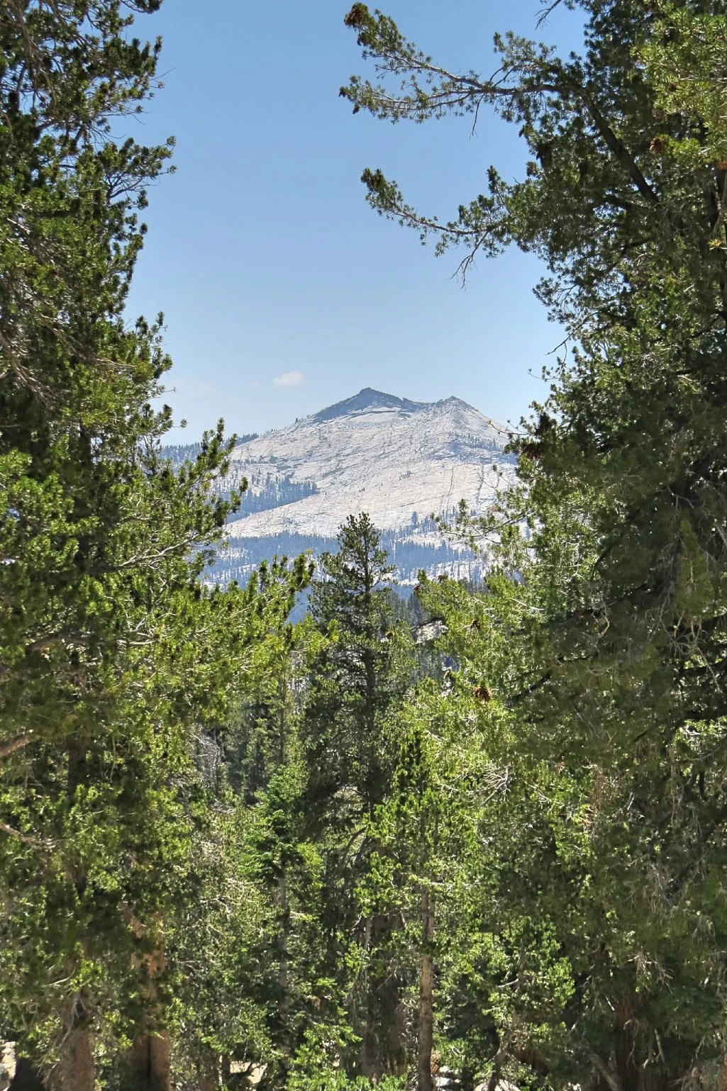
A Peek at Eeagle Peak (10,318 FT / 3145 M) through the trees
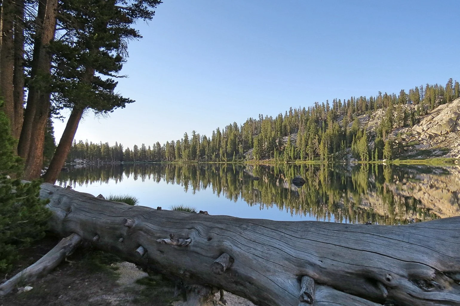
Day 5 -- Cliff Lake to Trailhead 5.5 mi: I was up early on the last day and snapped a few photos of the reflective Cliff Lake at dawn before the wind picked up.

The hike was (mostly) downhill to the trail head, with my food bag now much lighter. I stopped to take a few photos along the way, and passed quite a few folks heading into the Wilderness on this Friday. I was glad to be able to backpack mid-week! On the drive out from the trailhead, I spotted a large badger near the road, but he didn't cooperate for photos. I also stopped at the scenic overlook for the LeConte Divide, offering magnificent vistas of the surrounding Sierra Nevada mountains as far as the eye could see.
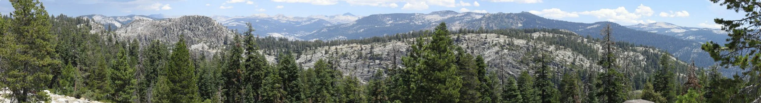
LeConte Divide Panorama
The Dinkey Lakes Wilderness offers a great backpacking option with low mileage and plenty of peaceful lakes to camp beside. In my opinion, the best lakes were Island, Swede, and South Lakes, for offering the best beauty and the most solitude. Cliff Lake is also nice, but is more crowded with weekenders and families given its proximity to the trailhead. Although at higher altitude, the mileage and climbs between the lakes are easy, offering plenty of time for exploring other nearby lakes, swimming, and fishing. If interested in the geology, I recommend exploring the following earthcaches at geocaching.com before and during your trip: First Dinkey Lake Eutrophication, South Lake - a Cirque, Mystery Lake Outfall Potholes, Dinkey Creek Chatter Marks, Dinkey Creek Meanders, and Dinkey Creek Pluton.
LOGISTICAL INFORMATION
Photos by Cris Lewis Canon Powershot SX50 HS
Logistics are easy for this trip, even in pandemic times. There is a quota for the wilderness, but a wilderness permit could be obtained by calling the wilderness office of the Sierra National Forest 24 hours before your trip. A permit was left outside of the Forest Service Office in Prather, which is on the route to the trailhead.
I read and was told that a four-wheel drive vehicle was required / strongly recommended for visiting the Willow Meadow trailhead. On the other hand, the Cliff Lake Trailhead at Courtright reservoir has high-quality paved roads all the way to the trailhead. Campsites managed by Pacific Gas & Electric exist at Courtright reservoir, but may be closed depending on conditions (and were closed due to Covid during this trip in July 2020). Bear canisters are recommended but not required, and I saw no evidence of bears during this trip.
Be prepared for afternoon thunderstorms, independent of whatever the forecast for the Prather / Lakeville / Shaver Lake area may be.
Feel free to download and use my GPX file for this trip.