Prince of Wales Archipelago Alaska 2021

In the summer of 2021 I organized a 3-week kayaking trip to the outer islands west of Prince of Wales Island in Alaska. This was an opportunity for me to re-visit an area that I had paddled in 2013 on a much shorter trip. On this trip, I wanted to take a bit more time to explore different islands in the area, and to introduce two paddling companions to the magic and challenges of sea kayaking in the Alaska coastal wilderness. The trip offered great adventure, extra travel logistics, plenty of rain, and a wealth of birds and wildlife.
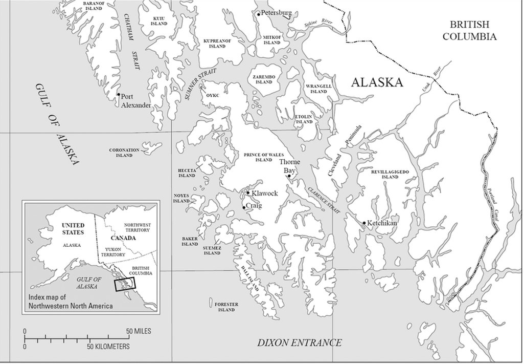
Southeast Alaska (inset) and the Prince of Wales Island Archipelago. Ketchikan and Revillagigedo Island are due east (see Misty Fjords trip 2019).
Route Overview: ~ 185 miles Total, 3 weeks of paddling

Overall GPS track of sea kayaking route from Craig, Alaska to Outer Islands
Traveling to Alaska always requires extra days, and this trip was no exception. The logistics of getting to our paddling destination required an extra ferry and transport, which extended the length of the trip by a week. I began by driving from the San Francisco Bay area to Otis, Oregon, where my friends Ken Sund and his wife Maria live. There, we met up with Denise Harrington, an Oregonian and longtime sea kayaker, and we loaded up all our gear and three kayaks (all Prijon Kodiaks) into Ken's truck. We shared the driving to Bellingham Washington, leaving early in the morning to allow sufficient time to catch the Alaska Marine Highway Ferry that departed for Alaska that evening. We were able to get our gear and boats loaded onto the ferry with time to spare, and Ken parked his truck in the long-term parking lot across the street from the ferry terminal. There followed a full day of ferry travel before we arrived in Ketchikan about 30 hours later.


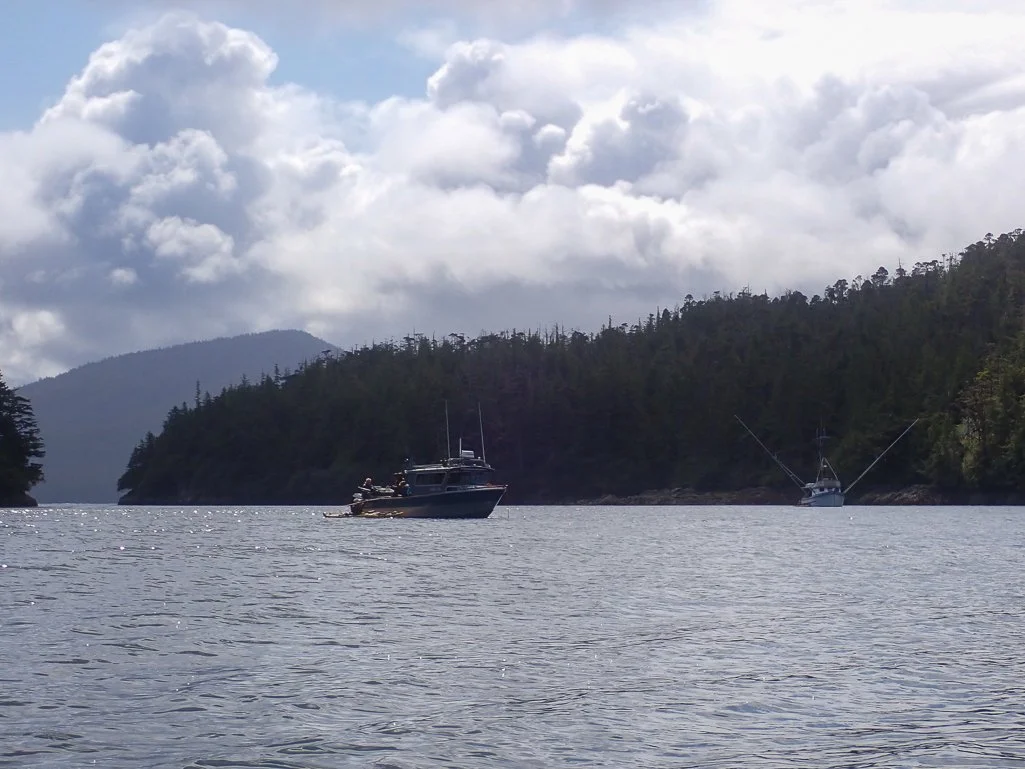
Arriving in Ketchikan at 7:00 a.m., we wheeled our loaded kayaks off the AMHS ferry and into the waiting area for the Inter-Island Ferry that was to transport us from Ketchikan to Hollis, Alaska, on Prince of Wales Island. Although this required extra logistics, it was far preferable to paddling from Ketchikan around to Hollis or Craig, which would have required too much time. Ken and Denise went off to explore Ketchikan for a few hours, while I stayed with the kayaks. The Inter-Island ferry loaded up around 1 p.m. There was a short period of extra drama, when we realized (along with several other kayakers) that we had needed to reserve and pay for a space for our kayaks in addition to our selves! Fortunately, the ferry staff were helpful and they were able to squeeze our kayaks in to the small ferry. Covid masks were required on all ferries and waiting areas, and the ferry was quite full with fishermen, visitors, and 4 other kayakers in addition to us. There was plenty of open air seating and viewing on the several hour ride from Ketchikan to Hollis.


Hollis is a tiny little town, and there is nothing nearby the ferry terminal for food or lodging. The other kayakers had wisely reserved their transport across the island much earlier in the year, so they were picked up by the delightful Katie Rook of Prince of Wales Excursion Outfitter that evening when we arrived. Our transport reservations were not until the next morning, so we camped near the ferry terminal, on a small patch of parking lot at the west side of the lot.
Day 1: Craig to San Fernando Island -- 8.1 mi / 13 km: The next morning, we had time to collect water and pack up our gear before Katie's partner Harlan arrived in the transport van and kayak trailer to take us across Prince of Wales Island to the small town of Craig, on the west coast. POW Excursion Outfitters offered outstanding service, with high-quality kayak trailers and cinches, and expert local knowledge. They were also kind enough to make a quick stop at a local spot that held many old Haida totems from the villages.


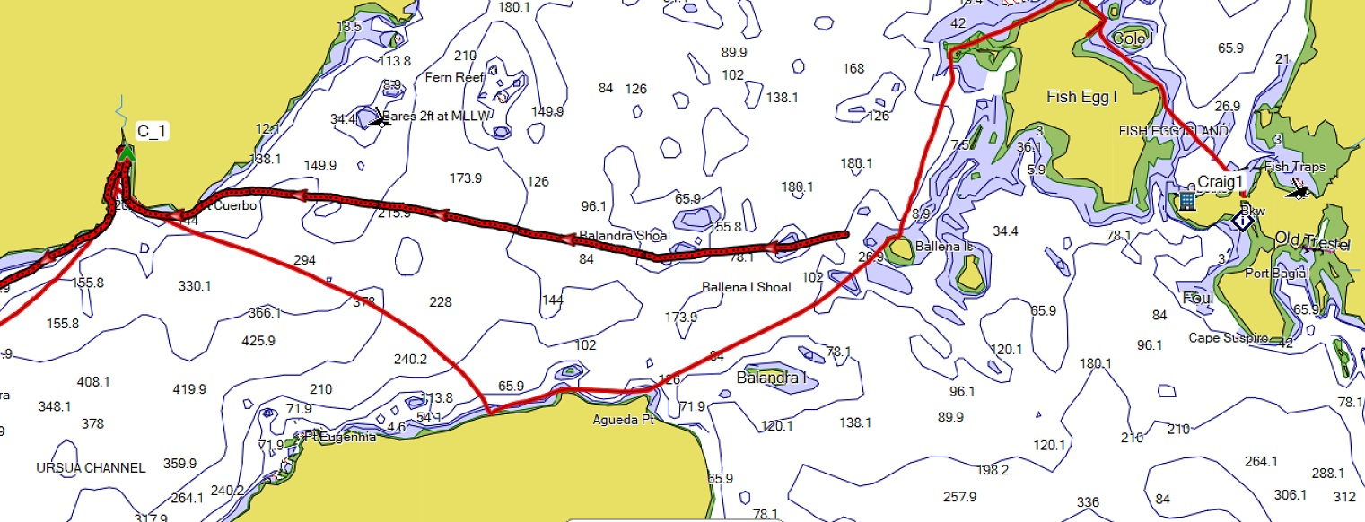
Partial GPS track from Craig to the bay campsite (C_1) just south of Pt. Cuerbo. (In my excitement, I forgot to start tracking after departing from Craig).
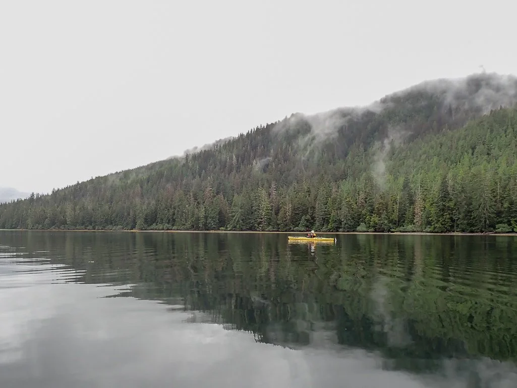
After loading our kayaks and gear at one of the boat launches in Craig, we set off around noon in beautiful weather, paddling west across glassy water. Alas, the water did not remain glassy for long; soon a southwest wind picked up and we had a long slog west toward San Fernando Island. I regretted not paddling next to San Juan Batista Island as we crossed, in order to gain some shelter from the wind. Just one of many lessons learned on this kayak trip! Nevertheless, we were happy to be on the water again after the long trip. Already, the wildlife abounded, with whale spouts in the distance and many sea birds and otters. After a long slog across the windy open bay, we headed in to a little bay on San Fernando Island in search of a campsite. The choices were few, but we finally found a steep beach with enough room for our three tents, and settled in for our first night in the Alaskan wilderness.


Day 2: San Fernando Island Pt Cuerbo to Garcia Cove -- 14.3 mi / 23 km

GPS route (in gold) from the cove near Pt Cuerbo to Garcia Cove on the north west end of San Fernando Island. We found a decent campsite at a location I had identified previously by studying charts and Google Earth.
During the night, I heard crashing in the dark woods outside my tent, and a loud huffing noise, which could have been a bear or a large deer. The woods were too dense to see the critter, even with a headlamp, so I went back to sleep. In the morning, we reviewed charts and discussed paddling plans. We had an apparent 4-day window of decent weather, so we decided to 'book it', paddle north, and see if we could get to Coronation Island, the outermost island in the archipelago, before the weather changed. We weren't in a particular hurry to launch, knowing most of our paddle would be with the prevailing southerly winds, and we'd have protection from neighboring Lulu island. Denise was up early, and made a beautiful watercolor of our campsite.

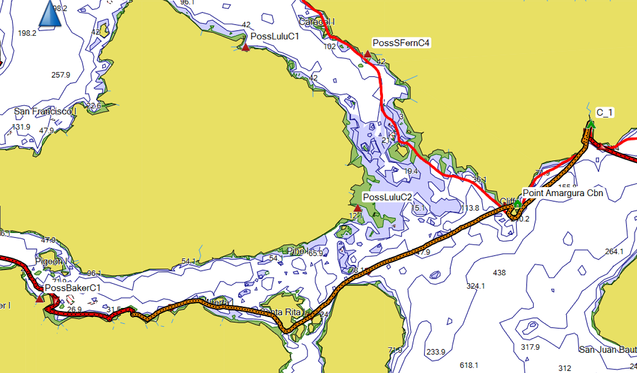
Paddling around Point Amargura, we headed north up Portillo channel under beautiful, calm conditions. We passed lots of sea otters, a small colony of growling harbor seals, and saw two mink bounding across the rocky shore. In the late afternoon, we found a campsite in Garcia Cove. Ken and Denise paddled south to the nearby creek for a bath, while I scrounged for small patch of flat tent space, typically very limited in Alaska!


Day 3: San Fernando Island Garcia Cove to Heceta Island - 20.7 mi / 33 km

GPS track (in gold) of paddling route through the Maurelle Islands, to Heceta Island.
We launched around 8:30 the next morning, continuing our paddle north. Although we had originally planned to paddle on the north side of Anguilla island to ride the south wind, when we saw the benign conditions we changed course so we could paddle between Anguilla and Esquibel Islands. After the 8.5 mile crossing of the Gulf of Esquibel, we stopped for a lunch break on Anguilla Island, just north of Launch Pass. The Maurelles were magical - calm, serene and abundant with wildlife. We saw many marbled murrelets and sea otters, and three river otters scampering out of the water and between the rocks. Passing Anguilla Island, we began the crossing of Bocas de Finas and along the beautiful white cliffs of Heceta Island. As we neared 20 miles, we opted to stop in a small cove with a creek, just north of Dead Tree cove. The cove was not a good camping location, but we made do.


We were happy to see the elusive and beautiful marbled murrelets, but photographing them was a challenge. Although they are endangered in California, they are abundant in Alaska.
Day 4, 5: Heceta Island to Kosciusko Island -- 12.2 mi / 19.6 km

GPS Track (in gold) from Heceta Island to Kosciusko Island, just south of Halibut Harbor.
The VHF weather report the previous night forecasted the arrival of a storm in the late afternoon, with predicted rain and 20 knot winds with gusts to 35. We pushed to get north before the storm hit, knowing there were few campsites until we passed Whale Head Islands. The wind was building in the afternoon, and rain began as we neared Kosciusko. Fortunately, I knew of a kayak campsite from my research, and it turned out to be quite suitable. There was a ramshackle shelter on a point, but the increasing wind made that site too cold. There were several favorable flat spots further into the woods of the peninsula. We stayed an extra day at this location, exploring the woods while we waited out the storm. Ken saw a bear while we were exploring the other side of the small point, but it disappeared too quickly for me to see. According to the ecological atlas, there are only black bears on all of these islands -- good news! Denise went out in the rainy weather to attempt to catch a salmon from her kayak, and found the salmon far less easy to catch than lingcod. We spent some time repairing gear and chatting inside our rain kitchen tent, the Mountain Hardwear Hoop Dreams that I brought along.


This little spit was filled with gulls, mostly short-billed gulls, at low tide.
Day 6: Kosciusko Island to Warren Island 10.1 mi / 16.2 km

GPS Track (in gold) from Kosciusko Island to Warren Island
We were up early the next morning, to pack up in the rain. Once outside the islands of Halibut Harbor, we paddled southwest to avoid the breaking waves on the reef, then took advantage of the current and south wind to head toward Northern Warren Island. Warren was peaceful and foggy, with no other boats in sight. We passed a huge waterfall on the northern side of Warren, which we admired as we paddled past.


There are few campsites on the NW shore of Warren, but we eventually found a beautiful sandy beach well positioned as a starting point for a paddle to Coronation Island the next day. Denise caught some rockfish and was kind enough to share -- very tasty!


Day 7: Warren Island to Egg Harbor, Coronation Island 18.4 mi / 29.6 km
We launched at ~ 8 a.m. the next morning to begin the > 7 mile crossing to Coronation Island. We weren't sorry to leave buggy Warren Island! Conditions were mild for the first few miles of the crossing, before the south wind increased. Unfortunately, we didn't adjust our ferry angle quickly enough for the wind and current, and ended up paddling an extra 1.5 miles south from Spanish Islands.

GPS Track (in gold) of crossing from Warren Island to Coronation Island.
As we neared these islands, we saw hundreds of beautiful little red-necked phalaropes on the water. We stopped for lunch at ~11:30 at a little cove near Cora Point, and checked out the campsite there. Tent spots were few, and we opted to paddle on to see more of Coronation Island. As we had seen from a distance, Coronation remained shrouded in fog and the rain continued intermittently. It was much cooler this far west compared to the inland islands.


Coronation Island felt special as soon as we arrived. Being so much further west than the rest of the Archipelago, it was often shrouded in fog, and subject to much harsher weather patterns. In our entire time on the island, we never saw another boat or human -- it felt like true, unspoiled Alaskan wilderness. We saw several humpback whales on the paddle over, including one that surfaced just yards from my kayak!
Slideshow of Coronation Island


We turned in to Egg Harbor and found a nice campsite on the south east side of the beautiful bay. This was the best campsite so far, with plenty of room and few signs of previous campers.
Days 8, 9, 10, 11: Coronation Island The weather report the next morning was alarming: reports of several days of bad weather, with an approaching atmospheric river, potential for landslides and flash floods, and higher wind conditions of 20-25 knots. We decided to wait out the weather in our safe Egg Harbor, knowing we could not repeat the crossing under poor conditions. Not a bad place to be holed up! Sure enough, the winds and rain increased that afternoon, and we took extra care to move the boats well above the high tide line, stock up on water, and tie down tents. The winds roared all that night, with the tents shaking from the force of the wind. The winds were lower the next day in the harbor, and skies remained grey and overcast. I caught up on sleep, and then went for a hike to the opposite side of the isthmus, into Alikula Bay. There I spotted many humpback whales slowly circling around. When Denise explored this area, she captured incredible, emotionally moving footage of a humpback whale slowly feeding -- see below, and wait for it! This gave me goose bumps!


Video by Denise Harrington
We continued to check the weather forecasts on the VHF, both morning and evening. We didn't hear more about an impending atmospheric river, and we learned later that the worst of the 'river' may have struck landfall further north. The second ridge was forecast to arrive the next day, with south winds to 20 knots and elevated seas. We took advantage of the temporary weather respite to paddle out to the western point of the bay. We all paddled to the mouth of Egg Harbor and then ventured out around Nation Point. From here we were exposed to the full face of the Pacific Ocean, with no intervening islands. The tide was low, and the rollers near the point were very large, enough to make all of us a bit uncomfortable with the idea of proceeding further west. The combination of the wind chop and rollers made it challenging to take photographs, which was disappointing because we soon saw many puffins flying about near the cliffs of Nation Point. I even saw one flying in with the stereotypical fish hanging out of its beak - very memorable. They also flew quite rapidly, which would make for challenging photography even in ideal conditions. Deciding we shouldn't push our luck, we turned around to venture back past the reef and into the safety of Egg Harbor. When I had paddled to Coronation Island in 2013, the conditions were ideal, and allowed us to completely circumnavigate Coronation Island. Fickle Alaska weather...
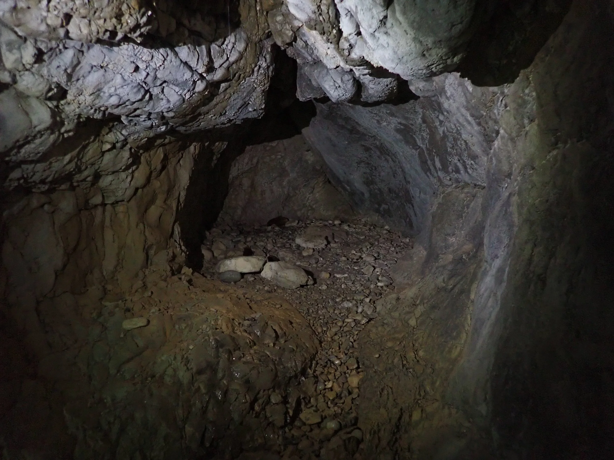
We paddled down the west side of Egg Harbor, and beached our kayaks to explore the caves in the area. As I recalled from my previous trip, the caves were full of discarded ore cylinders left from the lead mine, which was operated by the Coronation Island Mining Company from the early 1900's to the 1960's.
Slideshow of Egg Harbor


The rain began again that afternoon and continued for some time. The forecast for the next day was again poor, with seas 10-15 feet and SW winds of 20 knots. Although we were all ready to paddle back east and explore the other islands, the challenge of knowing we'd be unlikely to have good conditions for a long afternoon crossing to Warren Island, plus the poor quality of the campsite we had seen on the eastern side of Coronation, convinced us to be conservative and wait for a better window. Although there were likely to be suitable campsites within the other northern bays of Coronation, they were relatively nearby and we wouldn't gain much mileage for all the work of changing camp. In addition, I had witnessed the volatility of the Alaskan weather, which can become a safety concern if not respected. We resigned ourselves to another day on the island to be safe.
Day 12: Coronation Island to Warren Island: 19.4 miles / 31.2 km

GPS Track (in gold) of route from Egg Harbor on Coronation Island back to our old campsite on Warren Island.
The weather forecast that next night finally offered conditions suitable for crossing back to Warren Island the next day. I set my alarm for 4:40 a.m. and we all got an early start the next morning. Ken's early morning photo of the Harbor indeed showed beautiful conditions, at least as viewed within the harbor. However, after we launched and paddled through the reef, we were faced with quite high swell again, with the big rollers pushing our kayaks eastward in a manner that focused our attention. The air felt cold and the conditions very much "post-storm". We were surrounded by dozens of circling sooty shearwaters, including some floating in a dazed manner on the water, not even scooting away at our presence. They were likely blown in from the storm and were recuperating. These beautiful birds were also challenging to photograph under the conditions! The big rollers were breaking as we passed each point on Coronation, requiring us to pay extra attention in reading the water.

Egg Harbor at sunrise after the storms. Photo by Ken Sund


This poor little sooty shearwater must have been battered by the storm.
The west swell continued its push, and we cut inland near Cora Point to avoid the active tide rip that was going off. We arrived at 11:30 a.m. and had lunch at the same beach as before, tucked into a little bay just north of Cora Point. We were feeling good enough to continue the push toward Warren, and conditions were favorable. The first half of the 8 mile crossing went well, but as we continued east, the west swell diminished and the SE headwind increased. As before, we were getting pushed quite a bit north and had to keep adjusting our ferry angle. The last two miles into Warren Island seemed endless, as I was dehydrated and getting very tired. As seen from our GPS track, I again mis-judged the ferry angle, and we were pushed so far north by the wind and current that we had to paddle due south, directly into the wind, to reach the beach. We were happy to be back in our old, buggy beachside camp on Warren, feeling victorious about being able to visit Coronation island, in spite of being tired after the long paddle. I was relieved to have safely accomplished the journey over to Coronation and back. We learned later that very few kayakers or fishermen ever venture out to that outermost Island, and I can appreciate why.
Day 13, 14: Warren Island to Kosciusko Island: 12.4 miles / 20 km

GPS Track (in gold) of our route back to Kosciusko Island. We did a better job of avoiding the breaking reef this time, and enjoyed our blind navigation in the fog.
The 4 mile crossing from Warren Island back to Halibut Harbor required that we pay close attention to the currents, as they were as high as 2.3 knots the next day, and they could push us north into the breakers on the reef if we weren't careful. We timed our departure from camp the next day to avoid max flood, which was at noon. Fortunately, this allowed more time for sleep, which I needed after two nights in a row of poor sleep. We launched around 11 a.m., and had an enjoyable paddle east in easy conditions, with a slightly favorable current until we turned south. Conditions were calm on the east side of Warren as we paddled amongst the kelp. A misty fog persisted as we stopped for lunch inside False Cove.

The fog was such that visibility was only 50-100 yards, so we couldn't see our destination once we began our crossing. We chose a heading that would keep us south of the breakers, and headed into the thick fog. Eventually, we could barely make out a faint outline of the islets near Quartz Island outside the harbor - I love it when pure compass navigation works well!


Because we hadn't paddled a long distance, we considered looking for a different campsite near Cosmos Pass or Survey Cove, but ultimately decided a sure thing, our known campsite on Kosciusko Island, was preferable to an unknown that could turn into a long hunt for a suitable beach. So we turned north and returned to our now well-known campsite on the southern peninsula of Halibut Harbor.
Our timing was good: the evening forecast predicted yet another front the next day, with high 25 knot winds and rain. Although we were frustrated at being stuck in camp again, we were relieved to have completed the crossings and be at a comfortable site. The next morning seemed milder than predicted, with the continuation of a light rain that began during the night. This had me second-guessing my decision to stay in camp instead of paddling south. I decided to trust the forecast, and indeed the winds and rain increased in the early afternoon, about the time we would have been stuck on the water, with minimal landing sites. It seems Alaska forecasts for bad weather are accurate, but those for good weather can change in a few hours to bad weather! The rain and wind eased near 8 p.m. that evening, and we had plans to continue south in the morning.
Day 15: Kosciusko Island to Tonina Island: 20.6 miles / 33 km

GPS Track (in gold) from Kosciusko Island to Tonina Island.
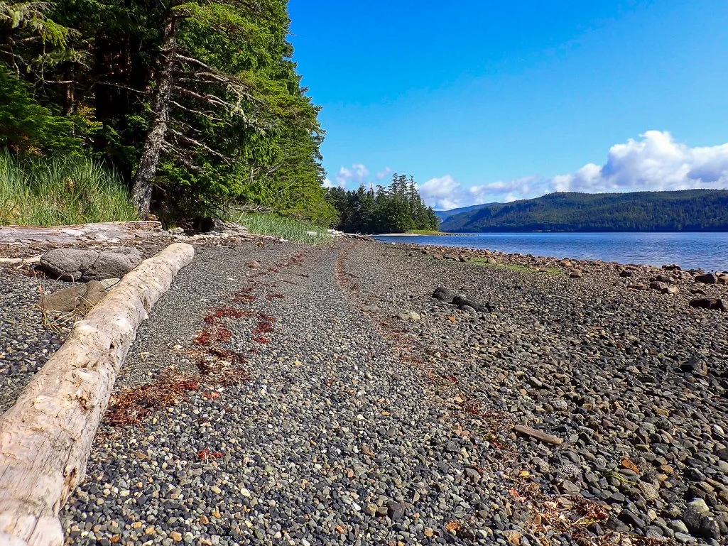
Hoping to gain some mileage, we headed straight for Heceta Island rather than paddling close to the Whale Head Islands. We stopped for a lunch break in a small cove south of Cape Lynch, backtracked to meet up when we got temporarily separated, then headed south again for the tip of the Maurelles. The winds were light, but the west swell was higher, requiring us to pay attention if we paddled closer to the cliffs. There were dozens of pigeon guillemots flying around their cliffside homes. Finally, we pulled in to a small campsite on Tonino Island, barely suitable for the three of us, but we made do. A light rain began as we were setting up our tents, so we had a brief dinner before retiring for the night.

Looking southeast down Boca de Finas passage toward the Maurelles.
Day 16: Tonina Island to Noyes Island : 14.8 miles / 23.8 km

GPS Track (in gold) from Tonino Island, through the Maurelles and across Arriaga Passage to Point San Francisco on Noyes Island
After the long paddle the previous day, we slept better, and were up the next day to launch around 9 a.m. The rain had stopped overnight and a hint of sun was peeking through the clouds, which lifted our spirits. We had an enjoyable and peaceful paddle south through the Maurelles. There was a significant west wind and swell, which made the more open parts of the Maurelles west of Esquibel Island quite choppy, with the occasional roller. We paddled along the east side of Turtle island and then west of Escurial Island to stop at the floating platform on San Lorenzo Island for lunch. In these more inland waters, we saw more fishing boats, and after lunch Ken paddled over to an old wooden-hulled boat to see if he could purchase some salmon. The kind fisherman gave him an entire Coho! Ken was grinning as if he had won the lottery -- "Wait 'til you see it!" Denise spoke to another fishing boat and got some local advice on campsites on Noyes Island, and help with her fishing hand-line. We poked our kayaks out past San Lorenzo and into Arriaga Passage and decided that conditions looked reasonable for the ~ 3 mile crossing. We chose a ferry angle and had an enjoyable, bouncy and choppy ride across the channel. The wind and swell was enough to give us a couple facefuls of spray, but we enjoyed it as it gave us a nice push. After we passed Point Incarnation conditions were much calmer, and we had a nice cruise down the east coast of Noyes Island. There were quite a few fishing boats in the Saint Nicholas Channel, and quite a few whale spouts as well. We arrived at the beautiful beach on San Francisco Point in the early afternoon and set up camp. The sun was out and the beachside campsite brought big smiles to our faces. Ken and Denise cooked up the huge salmon, and we gorged ourselves so that none went to waste, saving some for breakfast the next day.
San Francisco Point Slideshow


Day 17: Noyes Island to Baker Island: 14.8 miles / 23.8 km

GPS Track (in gold) from Point San Francisco to North Baker Island
Our elation at the sunshine was to be short-lived, but we enjoyed it while it lasted. The forecast for 2 days hence was again poor, with the arrival of another front. We had been hoping to camp on the south side of Noyes Island and then do a day paddle out to the very exposed Cape Addington, where there was apparently a puffin grotto. However, the exposure at this location and the upcoming storm made us change our plans, to our disappointment. Nevertheless, the weather was ideal this day, and we thoroughly enjoyed the paddle south along Noyes Island, spotting lots of sea otters, jumping salmon, rhinoceros auklets and marbled murrelets, short-billed gulls, harbor seals and a mink.
Noyes Island Slideshow


We paddled all the way to the mouth of the channel at Saint Nicholas Point, to view the south east coastline of Noyes Island. The conditions were much less placid outside the point, with western rollers combining with a fairly strong ebb to make for more bouncy conditions that we noticed when we paddled back into the channel. The coastline of Noyes looked quite foreboding, with high cliffs and few visible beaches. It would have been fun to explore in more suitable conditions, but we risked getting pinned down there if the storm persisted. We paddled back east, stopping for lunch on Cone Island, before beginning our search for a decent campsite on the north shore of Baker Island in Port Real Marina channel. Suitable campsites were few and far between here, but Denise eventually found a great one further east in the channel.

Day 18: Baker Island There was intermittent rain the next day, and we could hear the south wind roaring over the trees, but we were quite protected by Baker Island. I took the opportunity to catch up on sleep, and to help Denise with her first field self-repair of the neck gasket on her drysuit. I always bring spare gaskets and aquaseal on these trips, but the challenge is finding a suitable form to hold the new gasket in place. We came up with the perfect solution: the Garcia bear canister. It's slightly conical shape worked well to keep the gasket in place overnight, and we were relieved to have Denise in safer attire. Denise is the new MacGyver!

Day 19: Baker Island to San Fernando Island 8.2 mi / 13 km
GPS Track (in gold) from Baker Island to our original campsite on San Fernando Island
As we neared the end of our trip, some of us were ready for a break from the rain and hopeful of returning a day or so early to sightsee in Ketchikan and get a hot shower. We were also a bit limited in further exploration of other islands, which could hamper our ability to return to Craig in time for our transport and scheduled ferry ride. We certainly didn't want to miss the transport, the Interisland ferry, or the AMHS ferry back to Bellingham, as we'd likely be stuck an extra week if that happened. (And Denise would miss her return to work schedule!) We compromised by exploring our options for getting return transport early, and booking a hotel room in Ketchikan. But it was to take another couple days to resolve dates and times, due to limited cell reception.
The next morning there was still some light rain as we packed up. We launched around 9 a.m. in grey, cool mist, and paddled in the bay to see the salmon run: the nearby creek outlet was so full of salmon that they bumped against the bottom of the kayaks and roiled the water. I've never seen so many live salmon! No wonder the bears and seals are well fed. Ken captured some great photos of the shallow area thick with salmon.
Salmon Spawn Slideshow
Photos by Ken Sund


We noodled along the shoreline of Baker Island and explored the islets east of Triste Point, before turning north and paddling along St. Ignace Island. This was a very leisurely paddle as we knew we had plenty of time to reach our destination.


The three mile crossing to Point Amargura on San Fernando Island was relaxing, under serene conditions, with only a mild 1-2 foot wind chop in the middle of Portillo Channel. There was still a light rain, and we spotted many sea otters, rhinoceros auklets and common murres. It was quite cool, and we had hopes that the cabin at Point Amargura might be unoccupied, so we could stay in a warm cozy shelter. Not surprisingly, it was occupied, so we made our way in the rain around Point Amargura and back to our first campsite of the trip. By paddling back out to the mouth of the cove, I got enough cell reception to confirm that transport from Katie was only possible one day early, not two, so I made arrangements for one night in Ketchikan. I was quite chilled by the time I made it back to camp.
Day 20, 21: San Fernando Island to Fish Egg Island 9.9 mi / 15.9 km

GPS Track (in gold) from San Fernando Island to San Juan Batista Island and Fish Egg Island.
At her home in Oregon, Denise worked with Ryan Hamilton, a Haida native who was originally from the Prince of Wales area. His family owned property on Fish Egg Island, and she had permission from him to camp at a location of his childhood adventures on the northeast side of the Island. He described the seine nets that were strung in the trees that they used to play on. We leisurely made our way over to Fish Egg, paddling in much calmer conditions than we had on the first day of our trip. The skies were overcast, the water glassy, and we were surrounded by whale spouts in all directions as we paddled across San Alberto Bay. We stopped briefly on San Juan Batista Island, and then for lunch on Balena Island, before making our way around the north side of Fish Egg to a beautiful campsite. We felt privileged to be able to stay at this campsite that is not open to the public - Thank you Ryan!


We spent the next day relaxing on beautiful Fish Egg Island, each in our own way. I sorted gear, hiked on the beach, and sunbathed. Denise went for a paddle near Crab Bay in Klawock Inlet, and Ken paddled to Craig for a shower and laundry. He returned with beer to share and a happy smile. The sun was out, the skies were blue, and it was a beautiful day - a great way to end the trip. After dinner, we cleaned up all the residual trash and cans on the beach, and left the site cleaner than we found it.
The next morning, we paddled to Craig to unload boats, take showers, do laundry and share a delicious hot pizza, before being picked up by Katie of POW Excursion Outfitters at 2 pm. She transported us back to Hollis, where we camped overnight near the ferry terminal again. The rain began again on the ride back to Hollis, so we set up our tents in the rain one last time. We heard the news that the delta variant of Covid-19 had surged across the U.S. in the month we were gone, and hospitals were again struggling with capacity. We were happy to be in the remote wilderness, and even on Prince of Wales Island with only 4 new Covid cases. The next morning, we caught the Inter-island ferry and began our long journey back home, with some feasting and toasting along the way.

“Downtown” Craig
The Prince of Wales Islands offers an excellent kayaking destination, albeit one that requires extra transport logistics. The inland waters are quite placid and relaxing, and the archipelago offers a vast area of waters to explore. The abundance of wildlife throughout the islands is truly astounding and unique, from birds to humpback whales, otters, seals and sea lions, black bears, and other mammals. There are no grizzly bears on these islands, and bugs were few at most locations, except for Warren Island. For experienced ocean kayakers, Coronation Island is a unique destination that offers a true wilderness experience, but Katie Rooks and others stated that few kayakers or fishing boats ever venture out there. As you read, exploration of this area requires either steady good weather, and/or the ability to wait out poor conditions, in addition to confidence in paddling in ocean swell, tide rips, occasional breakers, and > 7 mile crossings, possibly in fog.
We were all thrilled at the abundance of wildlife and magnificent coastal scenery on every day of the trip! The weather played a significant role, however: In our 22 days of paddling, 16 included rain. Although it can be wearing to camp so many days in a row in cold rain, I kept telling myself that this is to be expected in a coastal rainforest. We certainly enjoyed our few days of sunshine! We were thrilled to be able to get safely to Coronation Island and back, but with that accomplishment came several lost days of travel that we couldn't use to explore more of the southern islands. We fared better than a fellow kayaker who paddled at the same time out of Sitka - the atmospheric river had him pinned down so that he ultimately had to abandon his trip. It is possible that climate change will only cause the percentage of inclement weather days to increase in the coming years. I personally found this trip more physically taxing than others, partially due to insufficient calories packed, and to poor sleep patterns. I expect to remedy this on my next trip. I can't say enough what great paddling companions I had on this trip: Ken Sund and Denise Harrington are the ideal expedition companions - strong and highly experienced paddlers, with sunny dispositions that never flagged. I hope we may have many more adventures together!
Photos by Cris Lewis, Olympus TG-6, as well as Ken Sund and Denise Harrington
Logistics and Reference Information
Like much of coastal Alaska, the weather is volatile, changing rapidly. It is not uncommon to hear a promising morning forecast of 4 days of good weather, only to have a new storm front forecasted 8 hours later. With the volatility of the weather, paddling to Coronation Island is for experienced, expert sea kayakers only. Nevertheless, there is a wealth of quality paddling venues in the more interior passages of the archipelago that may not experience the swell and storm surges of the outer islands. Sea Otter Sound, for example, was highly recommended by Katie Rooks of POW Excursion Outfitters and local kayakers she knew. Wind and rain, however, can be expected in a temperate rainforest.
The currents can be significant in narrow passages (up to 6 knots), and are not inconsequential even in wider straits. As you can see from our GPS tracks, we frequently were pushed off-course by winds and tide, even when we corrected our paddling at a significant ferry angle.
Long-term parking is available across the street from the Bellingham AMHS Ferry terminal, and is now payable by credit card.
The Alaska Marine Highway Ferry System faced budget cuts in recent years. The Matanuska ferry, unlike the larger Columbia ferry of previous years, has no laundry, no movies and is quite a bit smaller. It does offer a cafeteria, showers, lockers for valuables, and sufficient space in the solarium for sleeping.
The Inter-Island Ferry travels from Hollis to Ketchikan daily (at present writing), and is a fairly small ferry. It does offer food service on board that is quite tasty. Be aware that reservations must be made for BOTH individuals AND their kayaks. This isn't obvious on the website. Kayak reservations cost an additional ~$100. Upon arrival in Ketchikan on the AMHS ferry, one cannot store kayaks or gear unattended in the terminal area, due to Coast Guard regulations. Someone must be present to remain with kayaks and/or equipment while waiting for the afternoon Inter-island ferry.
Within a short walking distance from the Ketchikan ferry terminal, there is lodging (My Place hotel, for example), a laundromat, the U.S. Forest Service office, a sporting goods store, a private, well-stocked food market (a few blocks northwest of the terminal) and a large Safeway and mall (about 1 mile southeast). We found a place to stash our kayaks in a grassy area behind the My Place hotel, where they were undisturbed for our one night stay there.
Lodging in Hollis is extremely limited, and not convenient to the Inter-island Ferry Terminal. I would recommend booking lodging reservations at least six months in advance. The ferry terminal staff is friendly, and the terminal has a clean and well-maintained bathroom, water fountain and snack machine, but no other food is nearby. There is also a large and well-maintained portable toilet that is accessible after hours. There is camping below the rocky rip-rap on the west side of the parking lot, or in the forest surrounding the parking lot. We simply set up our tents on the corner of the parking lot in the non-parking zone.
Lodging in Craig is very limited. I would recommend booking lodging reservations, including the U.S. Forest Service cabin at Point Amargura, at least six months in advance.
I highly recommend POW Excursion Outfitters for transport from Hollis to Craig, round-trip. They are a highly professional organization, and very knowledgeable, friendly and accommodating. There are few transportation options across the island for kayaks, but you can't go wrong with Katie Rooks. With the high indigenous population on POW Island, I particularly appreciated that she was very careful about Covid precautions.
Reference links on Coronation Islands can be found here and here. This file describes a cave on Coronation Island, and radiocarbon dating of the animal remains found there, which I found fascinating.
Recommended reading: "Rare Bird: Pursuing the Mystery of the Marbled Murrelet" by Maria Mudd Ruth. A fascinating description of the Marbled Murrelet and the mystery of its breeding location.
In interests of safety for fellow kayakers, and of reducing impact by minimizing the number of campsites on the Alaska coastal shores, I have included below GPS coordinates of the campsites where we stayed, with brief comments, and a few coordinates of sites we passed by that looked promising. If you desire a GPX file of these waypoints, please don't hesitate to contact me at oceansandforestsadventures@gmail.com or via the Comments below.
