CHICHAGOF ISLAND & GLACIER BAY SUMMER 2018
In the summer of 2018 I had the long-awaited opportunity to take a longer paddling journey from Sitka Alaska, along the open coast of Chichagof Island, around Yakobi Island, and into Glacier Bay. I had planned the trip for some time, but few had the desire or the time commitment for such an expedition. I was joined by Mike Higgins in what turned out to be an outstanding kayaking trip, one that I highly recommend for experienced paddlers. I've included a few logistical details for those who might be planning for this trip, indicated by asterisks.
The trip began inauspiciously. I had packed up my car for the 4-7 week trip (including long ferry rides), and was just about to cross the Golden Gate bridge heading north, when I received a call from Mike, telling me that he was unable to make reservations on the Alaska Marine Highway ferry for our planned transport from Bellingham, Washington to Sitka. It turned out the MV Columbia ferry had experienced a fire in the hold, and was out of commission for several weeks. I turned around and went home, but took comfort in knowing we could afford to start the trip later.
We were able to book a different ferry one day later, so the next morning I departed again, headed for Washington state. Mike and I met up in Port Townsend, WA, where I left my car at a friend's house before we departed for Bellingham. At Bellingham, we were able to walk our boats on the ferry, park Mike's truck, and load all our gear for the trip with plenty of time. The 2-day ferry ride was relaxing after all the trip preparations, and we were able to catch a connecting ferry from Juneau to Sitka. I had examined the Sitka ferry landing on Google Earth, and saw a potential launch spot just a short walk from the ferry. We shared a pair of kayak wheels, which turned out to be essential for all the ferry loading and unloading. Mike was gracious enough to carry the folding wheels during the trip, while I carried a large hoop tent that we shared for cooking in the rain.
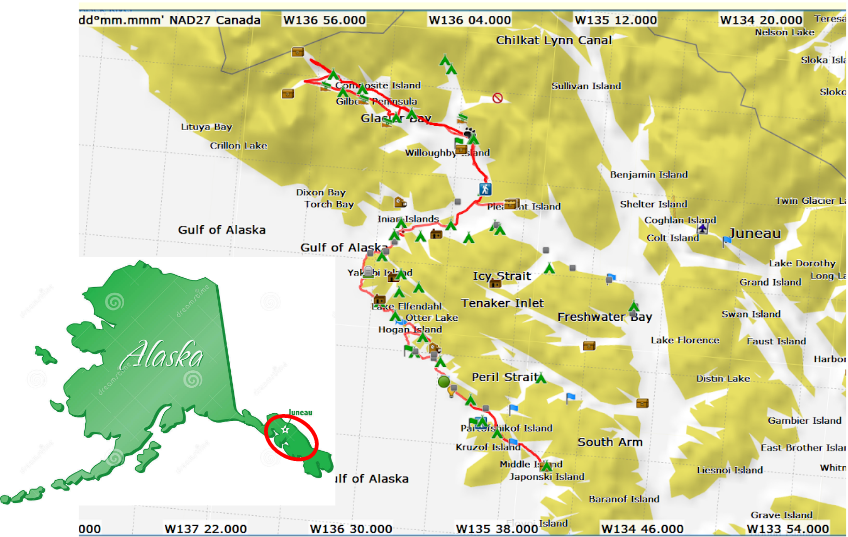
Route Overview: ~ 360 miles Total, ~ 1 month
After arriving on the ferry in the afternoon, we stayed at Starrigavan Campground that evening, in the light rain. *Travelers beware that Starrigavan is unusual in that it receives no cell signal, as well as no GPS signal for Spot or Inreach devices!
Day 1: The next morning we headed north. I had read in a guidebook that the western route to Salibury Sound through Sukoi Inlet was passable at high tide, so we chose that route to avoid boat traffic. However, I didn't read carefully enough: *Sukoi Inlet is only passable at the highEST tides, so we faced a difficult portage with loaded boats over a hillock of barnacles. Oops! While eating lunch after the portage we saw a black bear on a neighboring island, but it scooted into the bushes in short order.

Day 1: Starrigavan Campground to Sukoi Inlet
17.7 mi / 28.4 km

Day 2: A peaceful paddle north up Sukoi Inlet brought us Salibury Sound, where we started paddling west. Unfortunately, a west wind began building that slowed my pace considerably. By the time we finally reached Point Leo on Chichagof Island, the wind waves had swamped my sprayskirt several times and I was tired. I discovered on finally landing at Leo Anchorage that I had taken on several gallons of water (sprayskirt since replaced).


Peaceful Sukoi Inlet, heading toward Salisbury Sound
Day 2: Sukoi Inlet to Leo Anchorage
15 miles / 24 km
Day 3: Before proceeding north up the Khaz peninsula, we took a rest day at Leo Anchorage to wait out a forecast for high winds.

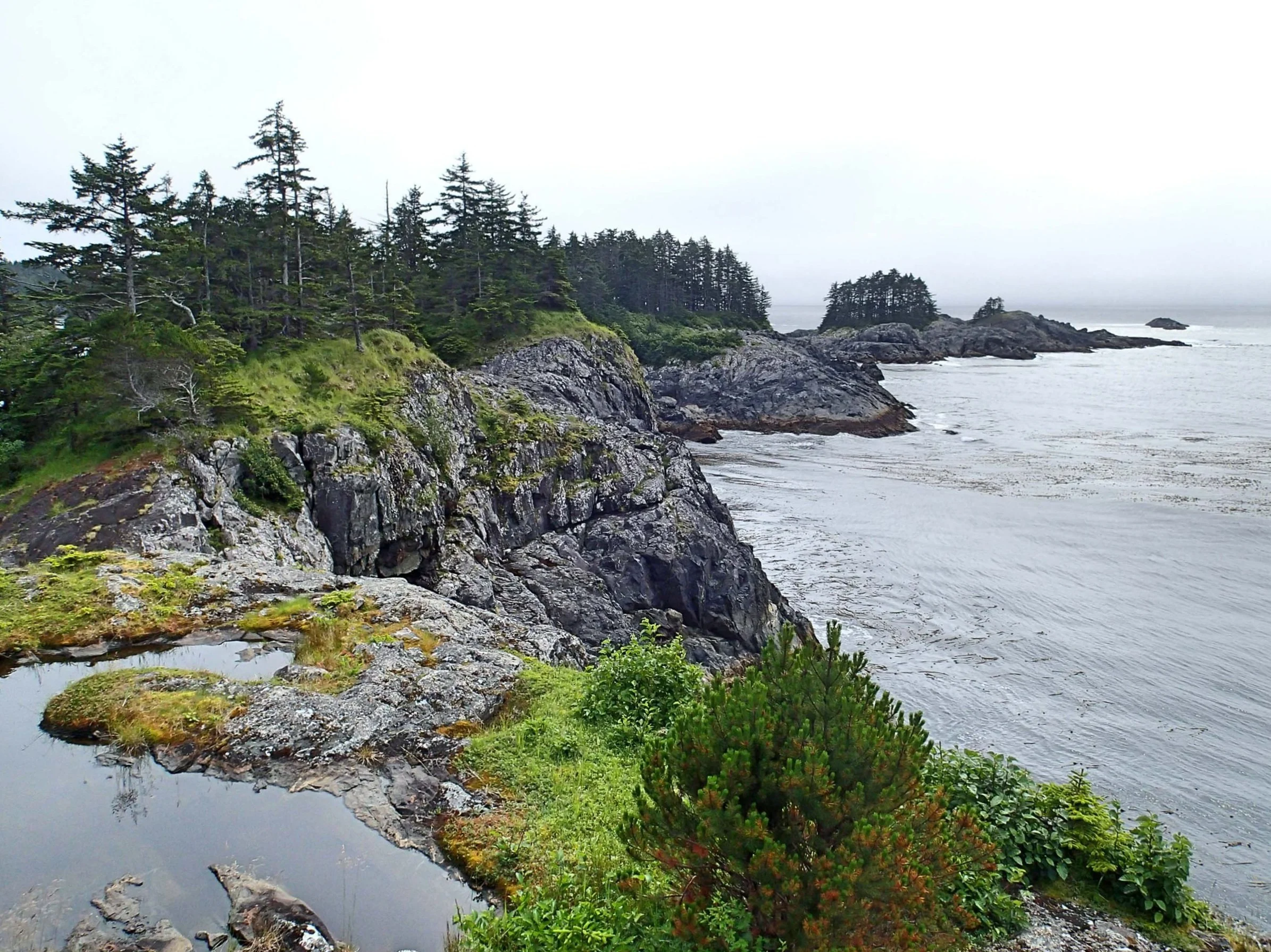
Day 4: I was full of excitement to head northwest to the outer coast, up Khaz Peninsula and through Piehle Passage into Slocum Arm. Although the guidebook described no places to land, we could see a few possible spots if necessary. Conditions were calm, and the outer coast was spectacularly wild and scenic compared to the inner passages. We were able to paddle past a very calm Piehle passage and around Baird, Ramp, and Deuce Islands before turning north into Slocum Arm. This long-awaited stretch of coast was everything I had hoped for!

Day 4: Leo Anchorage to Khaz Peninsula coastline, to Double Cove on Talkeena Peninsula
19 mi / 30.6 km
The Outer Coast Slideshow: Khaz Peninsula


Day 5: After setting up camp in Double Cove, we had a forecast of high wind and rain for the next day, so we waited out the rain in our tents. During a break in the rain, I took a short hike to look for the "Portage" to Sister Lake marked at the north end of Double Cove on several maps. Although I found a short trail into the brush, it petered out and became very overgrown. If it still exists, I couldn't find it, but I would have paddled instead of portaging anyway!
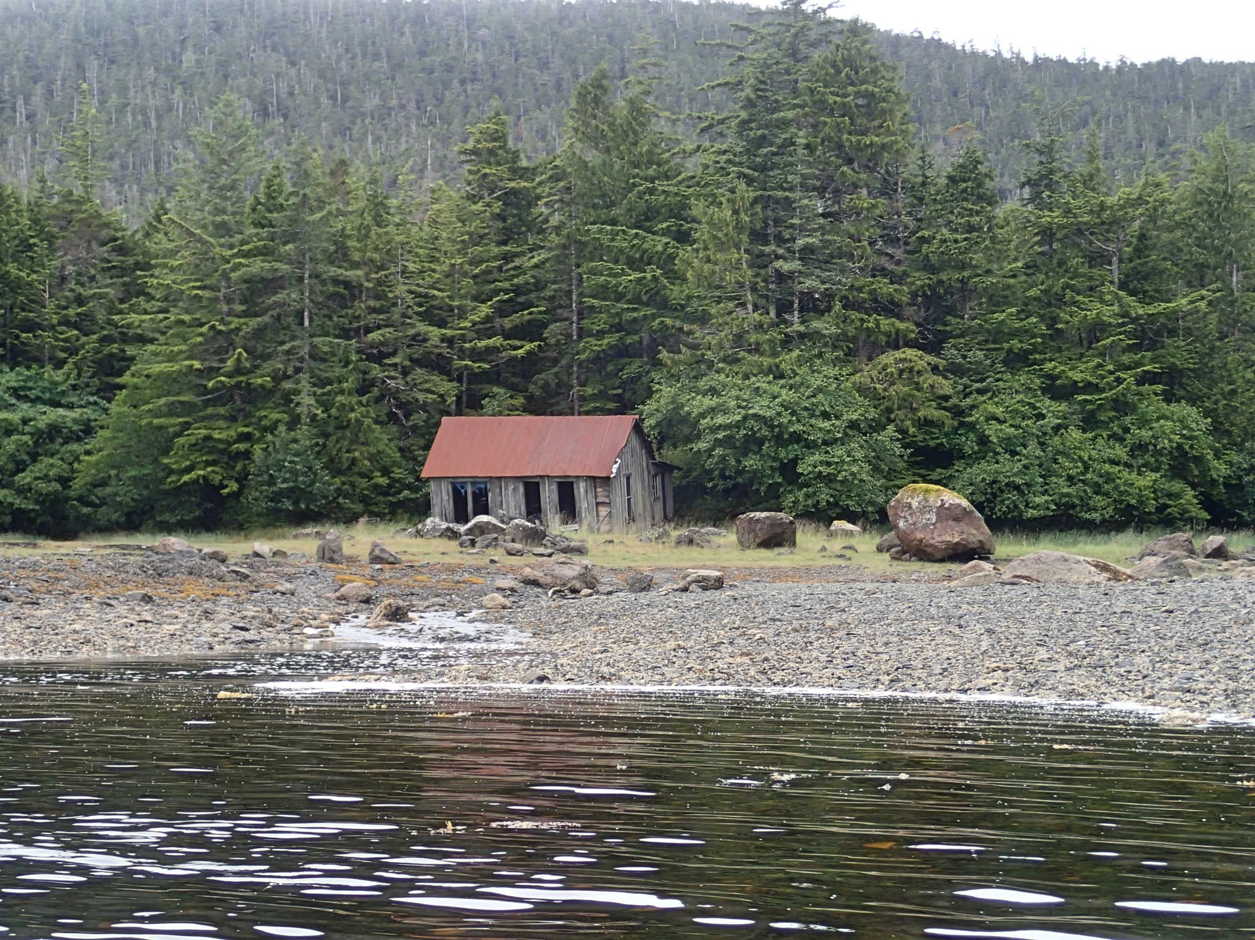
Day 6: With a break in the wind and rain, we paddled into Klag Bay with plans to explore the abandoned Native village and abandoned mining town. We enjoyed poking around in the ruins before island-hopping our way north, headed for the Myriad Islands. We finally found a buggy campsite on one of the Myriad Islands, after some searching. After seeing a small boat in Double Cove that was also waiting out the storm, we saw no other paddlers or boats all day.
Double Cove to Klag Bay and Myriad Islands
18 mi / 29 km

Abandoned Village and Mining Equipment at Klag Bay


Outer Coast, Myriad and Granite Islands
Day 7: We made an early start the next day to avoid forecasted building winds. We were able to explore more of the outer coast, past Herbert Graves and Hogan Island, where we saw hundreds of otters! We realized we had been making good time and could afford some extra sightseeing, so we headed inland to explore more there. Lydonia Island was loaded with bear scat, but fortunately we saw no bears.

Myriad Islands to Lydonia Island
14.5 mi / 23 km
Day 8 - 10: We paddled east from Lydonia Island to Kimshan Cove, where a sailboat was anchored peacefully, then turned back west to paddle along Black and Didrickson Bay. We filled up on water at a rushing waterfall at Didrickson Bay, then continued further west around Hill Island, and through Dry Pass back out to the open coast. Our final destination was White Sulfur Hot Springs, apparently a popular coastal stopover. When we arrived, there was another party at the campsite, but they were graciously willing to share some open tent sites. We met some very kind local folks who offered sightseeing advice and bug repellant. The forecast for the next several days was stormy, but we didn't mind waiting out the weather in this nice location!

Lydonia Island to White Sulfur Hot Springs
19 mi / 30.6 km
White Sulfur Hot Springs and Hiking Trails Slideshow


Day 11-12: The forecasted high winds were later than predicted, and not as high as predicted. We set off after 2 days at the Hot Springs to cross Lisianski Strait and see if we could stay at Greentop Cabin on Yakobi Island. The coastline north of White Sulfur was just as spectacular, and Greentop Harbor was peaceful and lush. The Forest Service cabin wasn't occupied, so we stayed without reservations and paid upon our return. We met two local artists who had a cabin nearby - Eric Bealer and his wife Pam. They were happy to see kayakers at the cabin, and they were incredibly gracious hosts, showing us around their delightful garden and cabin, and advising on sights to see on the Yakobi coastline. Although Pam suffered from MS and wasn't up for a boat ride, Eric took us out in his skiff with his dog to show us his favorite spot along the coast, and point out some features along the way. These were two marvelous people that were both talented artists and wonderful, warm human beings!

White Sulfur Hot Springs to Greentop Harbor Forest Service Cabin
12 mi / 19 km


Day 13: Eric had pointed out a nice beach with petroglyphs, which we decided to make our next day's destination. We paddled in nearly every nook and cranny along the coast, exploring the rocks and beautiful scenery.
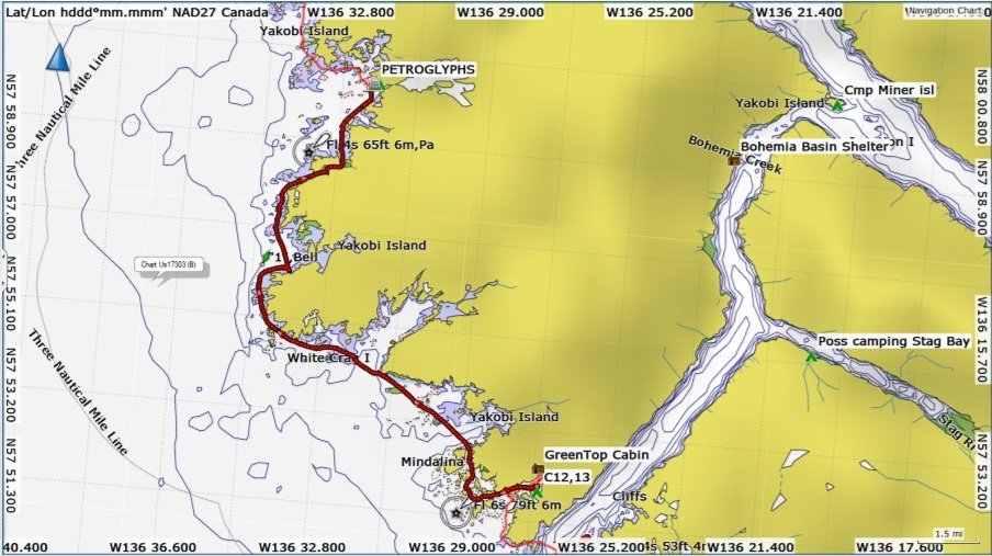
Greentop Harbor to Yakobi Island Cove
~ 15 mi / 24 km


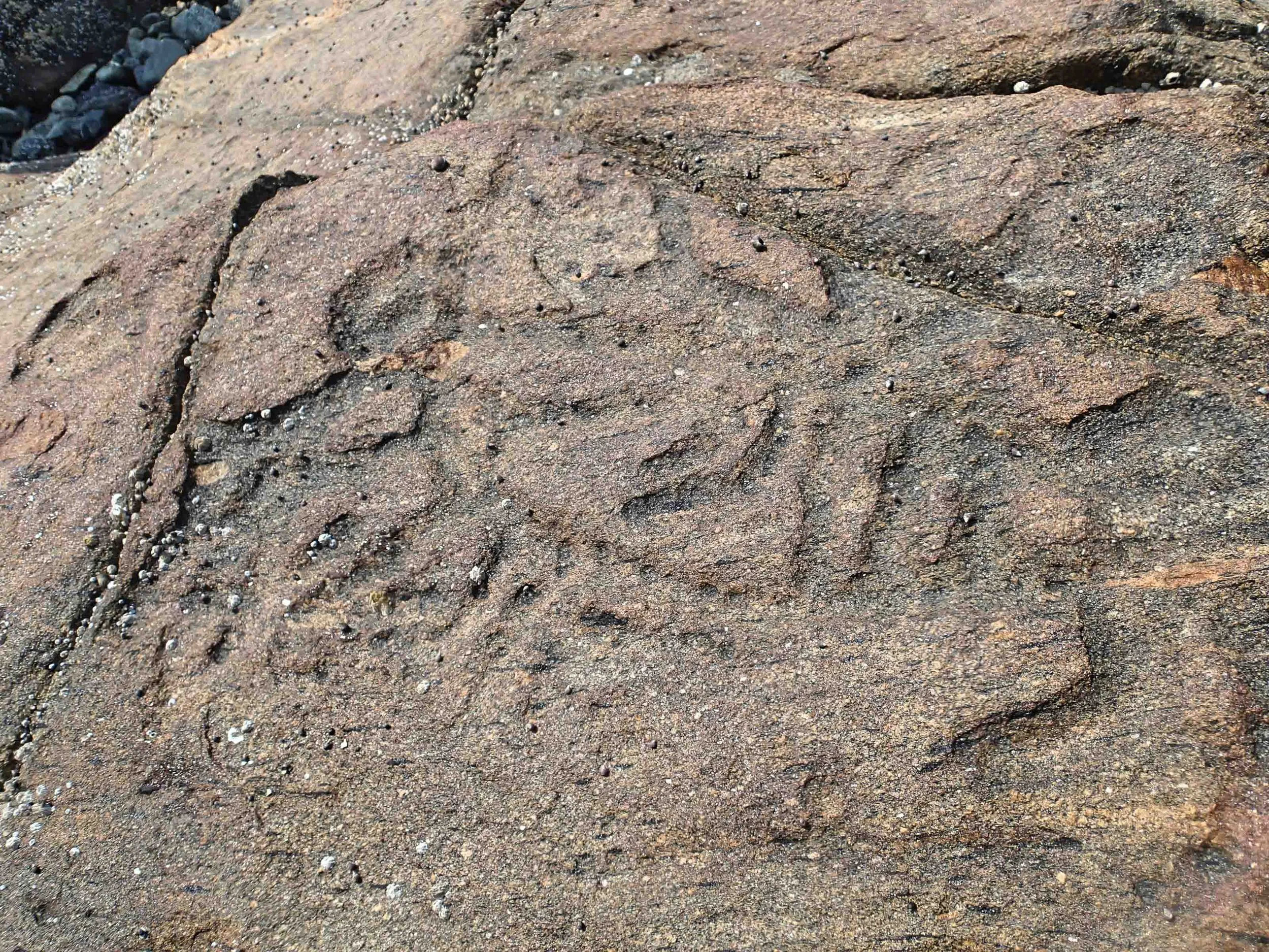
Researching petroglyphs after the trip, I learned that the oldest rock carvings are believed to have been carved over 10,000 years ago, and are usually associated with salmon streams, rather than primitive village sites; they apparently always face the sea. Archaeologists have found similar abstract symbols along the coast of Siberia. These were believed to have been carved by the Tlingit, but a report from late 1880’s indicated that oldest Tlingit elders had no knowledge of their meaning or purpose.1
American Anthropologist Vol 10, 1908 George T. Emmons
Day 14: Conditions were perfect for 12 more delightful miles of rock garden paddling. We rounded the northern tip of Yakobi Island seeking a fishing scow that was rumored to have ice cream, anchored in a cove in Lisianski inlet . (No ice cream, but the folks on the fish-buying barge were incredibly friendly.)

Yakobi Island Cove to Lisianski Inlet 12 mi / 19 km
Yakobi Island Outer Coast


Day 15: There was thick fog in the morning when we needed to cross Lisianski inlet, with visibility only about 100 ft. So we set our compasses and kept an air horn on hand for boat traffic en route to the small town of Pelican, which was further south on Lisianski inlet. The crossing was uneventful, and the fog lent a mystical quality to the many sea stacks and columns as we rounded Column Point on the SW corner of Althorp Peninsula. This day offered the most scenic and geologically interesting views of the trip, with many stacks, caves, and cliffs. If there had been more places to land I could have explored this area all day.

Lisianski Inlet to George Island
12 mi / 19 km
Column Point and Three Hill Island in Cross Sound


Along the way, we came across a herd of Steller sea lions, who were quite active and vocal.

Day 16: This day was dedicated to paddling from George Island to Elfin Cove to pick up our re-supply boxes of food, extra books, etc., from the Elfin Cove Post Office. The entire town of Elfin Cove is accessed by the water, so we were able to tie up to docks while we took hot showers and did laundry. We parked ourselves in a local eatery and re-packed our bear cans, and sorted gear to ship home or discard. *There was no cell reception in Elfin Cove, but there was on George Island, so we had to paddle back in a light drizzle to take care of any business requiring emails or phone calls.
Day 17: The next day, we were able to paddle through South Inian pass close to slack current, seeing only a few whirlpools and eddies in the notorious passage. We stopped for a break north of Earl Cove on the Inian Islands before beginning the ~ 4.9 mi / 7.9 km crossing to Lemesurier Island. There were some stately houses on Lemsurier island that overlooked Cross Sound, and we also spotted a large wolf print when we stopped for water. We had a bit of difficulty finding a campsite, but ultimately settled in the afternoon near Willoughby Cove.

George Island to Lemesurier Island
18 mi / 29 km

Campsite on Lemesurier Island looking south toward Chichagof Island
Day 18: Although *the guidebook recommends crossing North Inian Passage at slack, our plan was to cross the Passage into Glacier Bay about an hour from max flood. With a ~15 knot west wind, we figured this would make for a lively ride into Glacier Bay. Indeed! Conditions were quite calm proceeding north along the east coast of Lemesurier island, where we saw huge rafts of sea otters. As we began the crossing, we could see some white chop in the middle of the passage, and conditions became much livelier, but quite manageable even in loaded kayaks. Mike was delighted to be able to use his Pacific Action Sail, and our progress northeasterly became so swift we soon had to change our ferry angle to due north. There were quite a few places of switching currents, whirlpools and eddies before we reached the mainland shoreline just north of Point Gustavus. A fun paddle that kept me focused! It was then a leisurely paddle along the shore to Bartlett Cove. *We learned a bit late that Bartlett Cove has a special rack for kayak storage just south of the Ranger Station and information center, with handy double-wheeled wheelbarrows to haul gear to campsites. Campsites are free, but I learned to choose more carefully as the locals can have noisy parties on the beach until the wee hours on weekend nights.

Lemesurier Island to Bartlett Cove campground in Glacier Bay 17 mi / 27 km

Large rafts of sea otters along Lemesurier Island


Sunset along Glacier Bay
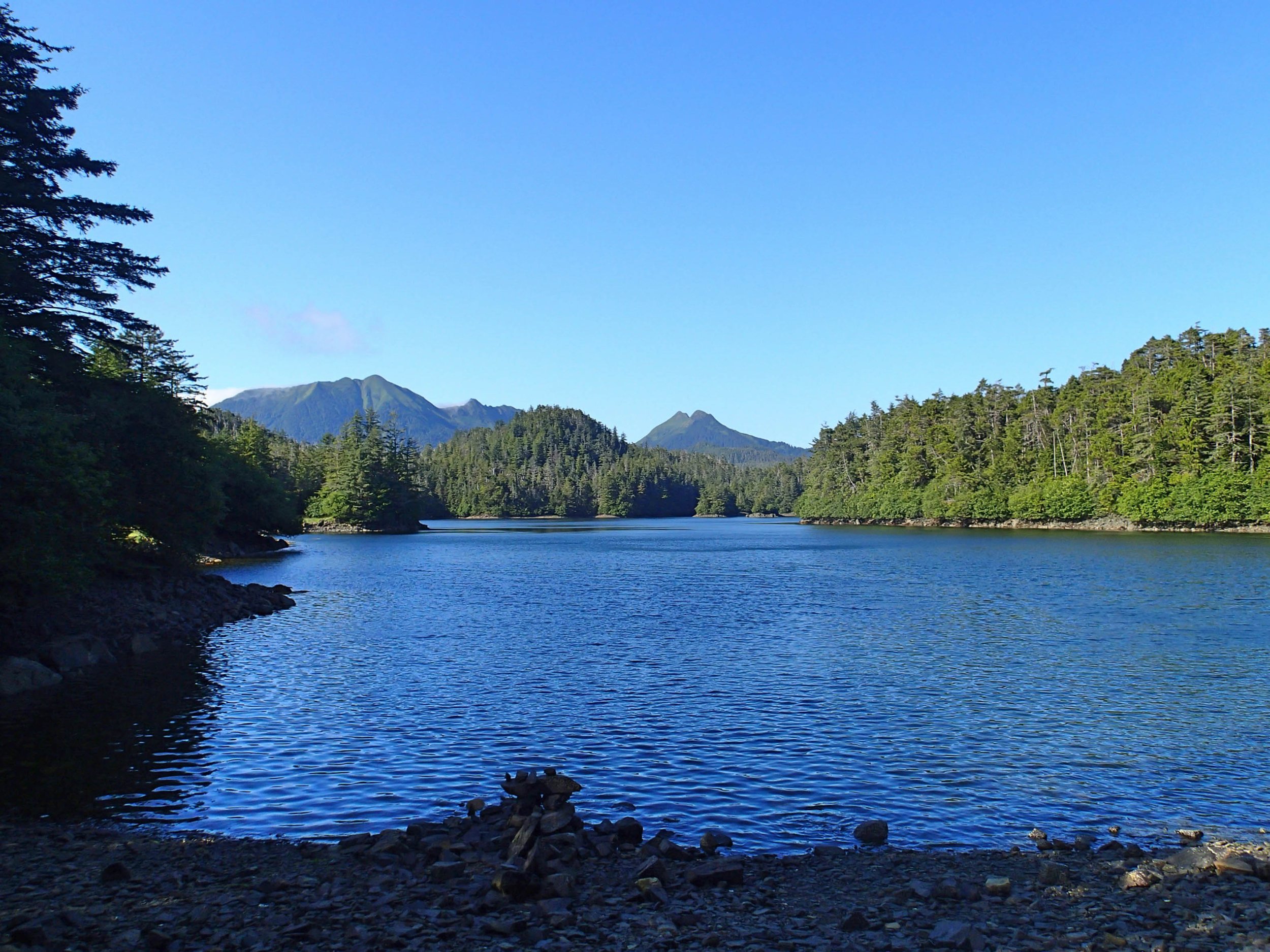
Day 19-29: After a day to relax a bit and take the mandatory orientation at the Bartlett Cove ranger station, we paddled north into Glacier Bay with a rising tide. Another kayaker in the orientation told us that the East arm had more silt from the glaciers, and "much less biomass" and wildlife, so we chose to focus on the west arm, even though that is where the cruise ships also go. Afterward, we heard of folks who saw plenty of wildlife in the east arm, leading us to wonder if the other kayaker simply wanted to paddle the east arm himself with fewer kayakers! Because many have paddled in Glacier Bay, I have abbreviated the paddling routes and descriptions. We found a good campsite across from Russell Island in the west arm, and used that as a base camp to wait out weather and paddle to the Tarr Inlet and Johns Hopkins Inlet on different days. On the way back, we faced a 2-day gale, with pelting rain and winds greater than 40 knots. The wind was howling outside our tents near Tidal Inlet where we hunkered down, emerging only for quick meals and bio-breaks. The waterfalls were quite active after the storm!
Although we saw only one bear on the shoreline, was saw plenty of bear scat everywhere. The bears in Glacier Bay seemed to be completely unafraid of humans, unlike the bears outside of Glacier Bay where hunting occurs. We were relieved not to have had any negative interactions with these big predators.

Glacier Bay West Arm Tour
158 mi / 254 km
Glacier Bay Slideshow


After returning back to Bartlett cove, we had an extra day to do laundry and clean up with nice hot showers. We treated ourselves to a couple hot meals in the lodge as well. I took advantage of the hiking trails at Bartlett Cove to stretch my legs, and also visited the Huna Tribal house on display there.


On the last paddling day of the trip, we left Bartlett cove at mid-morning to take advantage of the flood current out in North Inian Passage. Remembering our experience paddling from Lemesurier Island, we figured the flood tide, coupled with a 15 kn west wind, would make the paddle to Gustavus a breeze. Unfortunately, as we rounded Point Gustavus, we faced a very strong current, which baffled us. We had to hold on to kelp to avoid being pushed west at an alarming rate. We also saw a fishing boat a bit further out drifting west in the flood current as well. I had checked my GPS current stations with printed tide charts, and *we were indeed on a flood current, it was simply flowing west where we were! The current was easily strong enough to tip our boats if we weren't careful. We were forced to head for shore and work our way along east very close to shore. Given the long flat tidal area on this stretch, this made for much slower paddling than we had hoped for! Nevertheless, we reached Gustavus and camped out in the rain near the ferry terminal bridge, so that we'd be prepared to load our boats and gear on the shuttle ferry from Gustavus the next day.

Bartlett Cove to Gustavus 15.3 mi / 24.6 km

Fickle tide rips and currents -- no free rides! After returning home I found a diagram (right panel) of the tide cycle pattern into Glacier Bay, as determined with flow markers. This provides a partial explanation for the opposing current we experienced at Point Gustavus.
Catching the ferry from Gustavus was straightforward, and we headed for Juneau and civilization. The ferry schedule required a short overnight stay in Juneau, as the larger ferry departed for Bellingham early the next morning. *Although there is no lodging near the ferry terminal, camping on the terminal grounds is possible, but less desirable. We chose to store our kayaks and most gear out of the way on the terminal grounds before heading for a Youth Hostel in town that offered inexpensive lodging. The ferry back to Bellingham was relaxing, giving us a chance to dry out our gear on the sun deck.
This is so far the best kayaking expedition I have experienced in 9 years, and I highly recommend this trip. Patience in waiting out conditions can permit enjoying some of the most beautiful and remote stretches of the Alaskan coastline.
Photographs by Cris Lewis and Mike Higgins ---a highly experienced and very fun paddling companion!
REFERENCES AND INFORMATION
Logistics Links:
Alaska Marine Highway Ferry System (Note that impending budget cuts may significantly limit ferry travel in Alaska beyond the summer of 2019.)
Guidebooks:
Jim Howard, "Guide to Sea Kayaking in Southeast Alaska: The Best Day Trips from Misty Fjords to Glacier Bay" Globe Pequot, 1999. ISBN-10: 0762704098
Feel free to download and share this GPX file of Campsites and Waypoints.